TopoQuest Logo
Do you find TopoQuest useful?
Help keep TopoQuest running and adding new maps/features by donating!
Bitcoin:  19c7KJd3qBynnjoSw5npx9KScwjBe4ifkT
Litecoin:  LXs6TkuXGGXo1vDsWCkWVdjQX94eUKd6ui
Home View Maps Find Maps Find Places Resources & Links


Wellston NE, Michigan Topographic Map

USGS Map Title: Wellston NE, MI
USGS Map MRC: 44085B7
DRG (GeoTIFF) Download: o44085b7.tif


Neighboring USGS Topographic Map Quads:


  Marilla, MI  
44085C8
 

  Yuma, MI  
44085C7
 

  Harrietta, MI  
44085C6
 

  Wellston, MI  
44085B8
 

  Wellston NE, MI  
44085B7
 

  Hoxeyville, MI  
44085B6
 

  Peacock, MI  
44085A8
 

  Stewart Lake, MI  
44085A7
 

  Luther, MI  
44085A6


Map MRC Location:

N45°
W86°
N45°
W85°
H8 H7 H6 H5 H4 H3 H2 H1
G8 G7 G6 G5 G4 G3 G2 G1
F8 F7 F6 F5 F4 F3 F2 F1
E8 E7 E6 E5 E4 E3 E2 E1
D8 D7 D6 D5 D4 D3 D2 D1
C8 C7 C6 C5 C4 C3 C2 C1
B8 B7 B6 B5 B4 B3 B2 B1
A8 A7 A6 A5 A4 A3 A2 A1
N44°
W86°
N44°
W85°

Wellston NE, MI USGS 1:24K Topographic Map Preview:
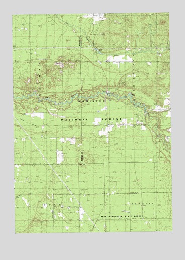
Wellston NE, MI USGS Topographic Map
Click on map above to begin viewing in our Map Viewer.

This topographic map contains these locations and features:
Feature Name Type Latitude Longitude GNIS ID View Map
Chalker CemeteryCemeteryN44.1725°W85.8403°1619502View Map
Coolwater Camp GroundsLocaleN44.1865°W85.7692°2509265View Map
Dobson Bridge Canoe AccessLocaleN44.1792°W85.7598°1622641View Map
Garlett PondReservoirN44.2297°W85.8092°1622667View Map
Garletts CornerPopulated PlaceN44.2222°W85.8042°1622669View Map
High School BridgeBridgeN44.1933°W85.7701°1622640View Map
Hoxeyville BridgeBridgeN44.1792°W85.7598°1622639View Map
Hoxeyville SchoolSchoolN44.1936°W85.7503°1620264View Map
Johnson CreekStreamN44.2283°W85.7515°1618976View Map
Kestelwoods CampgroundsLocaleN44.1864°W85.8000°2509266View Map
Lincoln Mills Snowmobile TrailTrailN44.1331°W85.7523°1622783View Map
Peterson BridgeBridgeN44.2042°W85.8006°1621217View Map
Peterson Bridge CampgroundLocaleN44.2020°W85.7981°1622642View Map
Peterson Bridge CampgroundLocaleN44.2036°W85.7989°2509096View Map
Peterson Bridge Canoe AccessLocaleN44.2042°W85.7995°1622638View Map
Pine River Experimental ForestParkN44.2195°W85.7559°1624219View Map
Pine River Experimental ForestForestN44.2197°W85.7553°1622817View Map
Pine River Paddlesport Center and CampgroundLocaleN44.2019°W85.7978°2509095View Map
South Branch Township Volunteer Fire DepartmentBuildingN44.2229°W85.7906°2626763View Map
Township of South BranchCivilN44.2078°W85.7606°1627094View Map
Wildcat SwampSwampN44.1897°W85.8645°1622162View Map

Note: Coordinates in the location and feature list above are referenced to NAD83 datum.


Copyright (C) 2008-2025 Ryan Niemi / Sunset Dynamics ... All Rights Reserved