TopoQuest Logo
Do you find TopoQuest useful?
Help keep TopoQuest running and adding new maps/features by donating!
Bitcoin:  19c7KJd3qBynnjoSw5npx9KScwjBe4ifkT
Litecoin:  LXs6TkuXGGXo1vDsWCkWVdjQX94eUKd6ui
Home View Maps Find Maps Find Places Resources & Links


Marilla, Michigan Topographic Map

USGS Map Title: Marilla, MI
USGS Map MRC: 44085C8
DRG (GeoTIFF) Download: o44085c8.tif


Neighboring USGS Topographic Map Quads:


  Copemish, MI  
44085D8
 

  Harlan, MI  
44085D7


  Marilla, MI  
44085C8
 

  Yuma, MI  
44085C7
 

  Udell, MI  
44086B1
 

  Wellston, MI  
44085B8
 

  Wellston NE, MI  
44085B7


Map MRC Location:

N45°
W86°
N45°
W85°
H8 H7 H6 H5 H4 H3 H2 H1
G8 G7 G6 G5 G4 G3 G2 G1
F8 F7 F6 F5 F4 F3 F2 F1
E8 E7 E6 E5 E4 E3 E2 E1
D8 D7 D6 D5 D4 D3 D2 D1
C8 C7 C6 C5 C4 C3 C2 C1
B8 B7 B6 B5 B4 B3 B2 B1
A8 A7 A6 A5 A4 A3 A2 A1
N44°
W86°
N44°
W85°

Marilla, MI USGS 1:24K Topographic Map Preview:
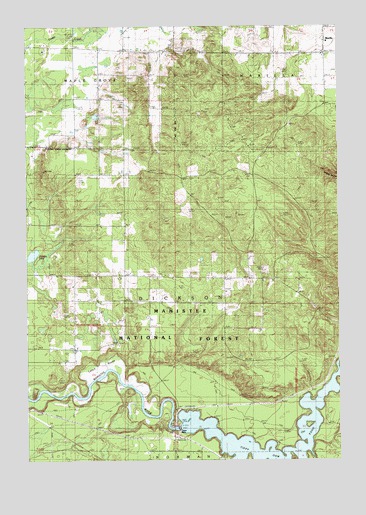
Marilla, MI USGS Topographic Map
Click on map above to begin viewing in our Map Viewer.

This topographic map contains these locations and features:
Feature Name Type Latitude Longitude GNIS ID View Map
Birch IslandIslandN44.2578°W85.8906°1622420View Map
Cedar IslandIslandN44.2528°W85.9037°1622423View Map
Cedar SwampSwampN44.2543°W85.9999°1617381View Map
Dam IslandIslandN44.2617°W85.9356°1622427View Map
Dickson LakeLakeN44.3092°W85.9976°1619717View Map
Fitch IslandIslandN44.2553°W85.9117°1622426View Map
Government IslandIslandN44.2600°W85.8876°1622421View Map
Leitch BayouSwampN44.2780°W85.9654°1620507View Map
MarillaPopulated PlaceN44.3708°W85.8809°1620707View Map
Marilla Post Office (historical)Post OfficeN44.3708°W85.8808°2499328View Map
Marilla Township HallBuildingN44.3533°W85.8794°2500340View Map
Oak Grove SchoolLocaleN44.3019°W85.9259°1621083View Map
Tippy DamReservoirN44.2505°W85.9076°1622424View Map
Tippy Dam North Recreation AreaLocaleN44.2647°W85.9351°1622425View Map
Tippy Dam PondReservoirN44.2593°W85.9397°1621916View Map
Tippy Dam Road CampgroundsLocaleN44.2525°W85.9411°2499846View Map
Township of DicksonCivilN44.2962°W85.9414°1626185View Map

Note: Coordinates in the location and feature list above are referenced to NAD83 datum.


Copyright (C) 2008-2025 Ryan Niemi / Sunset Dynamics ... All Rights Reserved