TopoQuest Logo
Do you find TopoQuest useful?
Help keep TopoQuest running and adding new maps/features by donating!
Bitcoin:  19c7KJd3qBynnjoSw5npx9KScwjBe4ifkT
Litecoin:  LXs6TkuXGGXo1vDsWCkWVdjQX94eUKd6ui
Home View Maps Find Maps Find Places Resources & Links


Luther, Michigan Topographic Map

USGS Map Title: Luther, MI
USGS Map MRC: 44085A6
DRG (GeoTIFF) Download: o44085a6.tif


Neighboring USGS Topographic Map Quads:


  Wellston NE, MI  
44085B7
 

  Hoxeyville, MI  
44085B6
 

  Axin, MI  
44085B5
 

  Stewart Lake, MI  
44085A7
 

  Luther, MI  
44085A6
 

  Bristol, MI  
44085A5
 

  Baldwin, MI  
43085H7
 

  Chase, MI  
43085H6
 

  Reed City North, MI  
43085H5


Map MRC Location:

N45°
W86°
N45°
W85°
H8 H7 H6 H5 H4 H3 H2 H1
G8 G7 G6 G5 G4 G3 G2 G1
F8 F7 F6 F5 F4 F3 F2 F1
E8 E7 E6 E5 E4 E3 E2 E1
D8 D7 D6 D5 D4 D3 D2 D1
C8 C7 C6 C5 C4 C3 C2 C1
B8 B7 B6 B5 B4 B3 B2 B1
A8 A7 A6 A5 A4 A3 A2 A1
N44°
W86°
N44°
W85°

Luther, MI USGS 1:24K Topographic Map Preview:
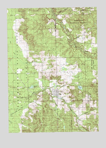
Luther, MI USGS Topographic Map
Click on map above to begin viewing in our Map Viewer.

This topographic map contains these locations and features:
Feature Name Type Latitude Longitude GNIS ID View Map
Ahmikwam LakeLakeN44.0471°W85.7168°1618998View Map
Baldwin Luther SwampSwampN44.0142°W85.7489°1622645View Map
Baylor SwampSwampN44.0857°W85.7414°1619118View Map
Big Spring LakeLakeN44.0544°W85.6530°1622374View Map
Carey Station (historical)LocaleN44.0431°W85.7422°2513380View Map
Carrieville Recreation SiteLocaleN44.0361°W85.7234°1622378View Map
Church of ChristChurchN44.0375°W85.6836°2513280View Map
Coe CreekStreamN44.0764°W85.6301°1619546View Map
Evad Enterprises LLC AirportAirportN44.0874°W85.7316°2650916View Map
Fellowship Baptist ChurchChurchN44.0375°W85.6819°2513281View Map
Hillsdale College Biological StationSchoolN44.0422°W85.6431°2513285View Map
Lincoln CreekStreamN44.0356°W85.6892°1622375View Map
LutherPopulated PlaceN44.0403°W85.6826°1620648View Map
Luther Area Public LibraryBuildingN44.0361°W85.6825°2513275View Map
Luther Elementary SchoolSchoolN44.0433°W85.6814°2513283View Map
Luther Fire District 1BuildingN44.0418°W85.6817°2626895View Map
Luther Post OfficePost OfficeN44.0369°W85.6825°2513276View Map
Luther Station (historical)LocaleN44.0456°W85.6819°2513287View Map
Luther United Methodist ChurchChurchN44.0381°W85.6828°2513282View Map
Manistee CreekStreamN44.0161°W85.6559°1620681View Map
Newkirk Township HallBuildingN44.0378°W85.6825°2513274View Map
North Park CemeteryCemeteryN44.0478°W85.6828°1621052View Map
Pleasant Hill CemeteryCemeteryN44.0405°W85.6758°2513386View Map
Rockwell LakeLakeN44.0445°W85.6502°1621422View Map
Saint Ignatius Catholic ChurchChurchN44.0414°W85.6825°2513278View Map
Sellers CreekStreamN44.0933°W85.6595°1621561View Map
Silver CreekStreamN44.1195°W85.6853°1621607View Map
Silver Creek State Forest CampgroundLocaleN44.1167°W85.6839°2513270View Map
SkookumPopulated PlaceN44.0806°W85.6437°1621636View Map
Skookum BridgeBridgeN44.0792°W85.6434°1622373View Map
Totten Post Office (historical)Post OfficeN44.0011°W85.6417°2513360View Map
Township of NewkirkCivilN44.0762°W85.7428°1626803View Map
Valley CemeteryCemeteryN44.0325°W85.6594°2513385View Map
Village of LutherCivilN44.0388°W85.6826°2399204View Map

Note: Coordinates in the location and feature list above are referenced to NAD83 datum.


Copyright (C) 2008-2025 Ryan Niemi / Sunset Dynamics ... All Rights Reserved