TopoQuest Logo
Do you find TopoQuest useful?
Help keep TopoQuest running and adding new maps/features by donating!
Bitcoin:  19c7KJd3qBynnjoSw5npx9KScwjBe4ifkT
Litecoin:  LXs6TkuXGGXo1vDsWCkWVdjQX94eUKd6ui
Home View Maps Find Maps Find Places Resources & Links


West Salem, Wisconsin Topographic Map

USGS Map Title: West Salem, WI
USGS Map MRC: 43091H1
DRG (GeoTIFF) Download: o43091h1.tif


Neighboring USGS Topographic Map Quads:


  Stevenstown, WI  
44091A2
 

  North Bend, WI  
44091A1
 

  Four Corners, WI  
44090A8
 

  Onalaska, WI  
43091H2
 

  West Salem, WI  
43091H1
 

  Bangor, WI  
43090H8
 

  La Crosse, WI  
43091G2
 

  Saint Joseph, WI  
43091G1
 

  Middle Ridge, WI  
43090G8


Map MRC Location:

N44°
W92°
N44°
W91°
H8 H7 H6 H5 H4 H3 H2 H1
G8 G7 G6 G5 G4 G3 G2 G1
F8 F7 F6 F5 F4 F3 F2 F1
E8 E7 E6 E5 E4 E3 E2 E1
D8 D7 D6 D5 D4 D3 D2 D1
C8 C7 C6 C5 C4 C3 C2 C1
B8 B7 B6 B5 B4 B3 B2 B1
A8 A7 A6 A5 A4 A3 A2 A1
N43°
W92°
N43°
W91°

West Salem, WI USGS 1:24K Topographic Map Preview:
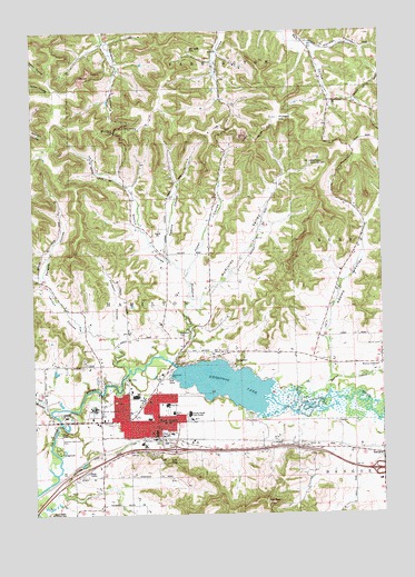
West Salem, WI USGS Topographic Map
Click on map above to begin viewing in our Map Viewer.

This topographic map contains these locations and features:
Feature Name Type Latitude Longitude GNIS ID View Map
Adams CreekStreamN43.9103°W91.0185°2760856View Map
Adams ValleyValleyN43.9176°W91.0187°1560690View Map
Adams Valley School (historical)SchoolN43.9208°W91.0235°1843208View Map
Bell Coulee ChurchChurchN43.9816°W91.0171°1561523View Map
Bell Coulee SchoolSchoolN43.9861°W91.0215°1578748View Map
Bergum CouleeValleyN43.9365°W91.1210°1561598View Map
Brookside SchoolSchoolN43.9236°W91.1062°1562249View Map
Burns CemeteryCemeteryN43.9187°W91.0010°1562439View Map
Burns CornersLocaleN43.9136°W91.0004°1562440View Map
Burns CreekStreamN43.9050°W91.0310°1562443View Map
Christ - Saint John's Lutheran SchoolSchoolN43.9013°W91.0872°2715680View Map
Christ Lutheran ChurchChurchN43.8964°W91.0829°1843232View Map
Coulee Christian SchoolSchoolN43.8999°W91.0837°2715801View Map
Eggens CouleeValleyN43.9446°W91.0774°1564462View Map
Gill CouleeValleyN43.9015°W91.1204°1565524View Map
Hamilton CemeteryCemeteryN43.8986°W91.0965°1566011View Map
Herman CouleeValleyN43.9952°W91.0220°1566317View Map
Hoyer CouleeValleyN43.9381°W91.0694°1566780View Map
Jordson CouleeValleyN43.9229°W91.0965°1567292View Map
Krueger HillSummitN43.9775°W91.0368°1567653View Map
La Crosse CountyCivilN43.9066°W91.1152°1581091View Map
Larson CouleeValleyN43.9134°W91.0919°1567859View Map
McKinley ValleyValleyN43.9306°W91.0653°1569258View Map
Mindoro CutGapN43.9739°W91.0951°1843338View Map
Neshonoc 2WP44239 DamDamN43.9136°W91.0749°1791948View Map
Neshonoc CemeteryCemeteryN43.9215°W91.0736°1570186View Map
Neshonoc CreekStreamN43.9150°W91.0785°1570187View Map
Neshonoc LakeReservoirN43.9087°W91.0566°1570188View Map
Neshonoc School (historical)SchoolN43.9172°W91.0732°1843347View Map
Our Saviours Lutheran ChurchChurchN43.9005°W91.0810°1843367View Map
Phillips Ridge School (historical)SchoolN43.9794°W91.0804°1843373View Map
Pleasant ValleyValleyN43.8816°W91.0961°1571642View Map
Saint Leo the Great ChurchChurchN43.9044°W91.0837°1843397View Map
Scotch CouleeValleyN43.9377°W91.0702°1573832View Map
Swarthout ParkParkN43.9108°W91.0771°1575167View Map
Town of HamiltonCivilN43.9241°W91.0978°1583340View Map
Village of West SalemCivilN43.8989°W91.0881°1584416View Map
Walker SchoolSchoolN43.9422°W91.0624°1576160View Map
West SalemPopulated PlaceN43.8991°W91.0812°1576552View Map
West Salem Baptist ChurchChurchN43.8936°W91.0790°1843451View Map
West Salem Elementary SchoolSchoolN43.9023°W91.0735°1843452View Map
West Salem Fire DepartmentBuildingN43.8968°W91.0802°2698077View Map
West Salem High SchoolSchoolN43.9034°W91.0773°1843453View Map
West Salem Middle SchoolSchoolN43.9013°W91.0753°1843454View Map
West Salem Police DepartmentBuildingN43.8954°W91.0809°2759543View Map
West Salem Post OfficePost OfficeN43.8975°W91.0810°1843455View Map
West Salem Rod and Gun ClubLocaleN43.9658°W91.0251°1843456View Map
West Salem Wastewater Treatment FacilityLocaleN43.9094°W91.0919°2646882View Map
Wet Coulee CemeteryCemeteryN43.9955°W91.0678°1843459View Map

Note: Coordinates in the location and feature list above are referenced to NAD83 datum.


Copyright (C) 2008-2025 Ryan Niemi / Sunset Dynamics ... All Rights Reserved