TopoQuest Logo
Do you find TopoQuest useful?
Help keep TopoQuest running and adding new maps/features by donating!
Bitcoin:  19c7KJd3qBynnjoSw5npx9KScwjBe4ifkT
Litecoin:  LXs6TkuXGGXo1vDsWCkWVdjQX94eUKd6ui
Home View Maps Find Maps Find Places Resources & Links


Four Corners, Wisconsin Topographic Map

USGS Map Title: Four Corners, WI
USGS Map MRC: 44090A8
DRG (GeoTIFF) Download: o44090a8.tif


Neighboring USGS Topographic Map Quads:


  North Bend NE, WI  
44091B1
 

  Melrose, WI  
44090B8
 

  Shamrock, WI  
44090B7
 

  North Bend, WI  
44091A1
 

  Four Corners, WI  
44090A8
 

  Cataract, WI  
44090A7
 

  West Salem, WI  
43091H1
 

  Bangor, WI  
43090H8
 

  Sparta, WI  
43090H7


Map MRC Location:

N45°
W91°
N45°
W90°
H8 H7 H6 H5 H4 H3 H2 H1
G8 G7 G6 G5 G4 G3 G2 G1
F8 F7 F6 F5 F4 F3 F2 F1
E8 E7 E6 E5 E4 E3 E2 E1
D8 D7 D6 D5 D4 D3 D2 D1
C8 C7 C6 C5 C4 C3 C2 C1
B8 B7 B6 B5 B4 B3 B2 B1
A8 A7 A6 A5 A4 A3 A2 A1
N44°
W91°
N44°
W90°

Four Corners, WI USGS 1:24K Topographic Map Preview:
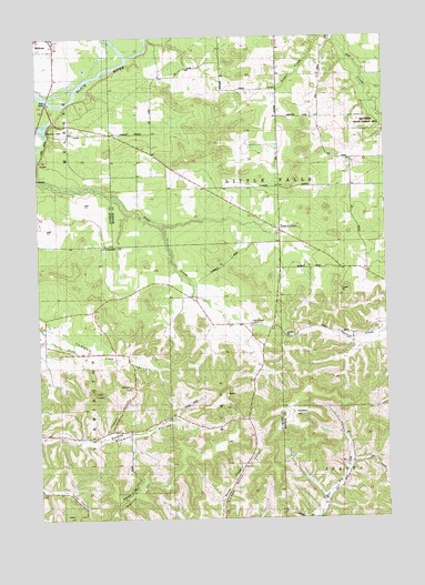
Four Corners, WI USGS Topographic Map
Click on map above to begin viewing in our Map Viewer.

This topographic map contains these locations and features:
Feature Name Type Latitude Longitude GNIS ID View Map
Browns Valley SchoolSchoolN44.0211°W90.9885°1562275View Map
Four CornersPopulated PlaceN44.0750°W90.9137°1572605View Map
Hippler HillSummitN44.0339°W90.9671°1843293View Map
Pleasant ValleyValleyN44.0230°W90.9748°1571640View Map
Printz CreekStreamN44.1250°W90.8924°1571942View Map
Sand Creek CemeteryCemeteryN44.0508°W90.9235°1843411View Map
Sand Creek Pines State Natural AreaParkN44.0794°W90.9657°2059242View Map
Sand Creek SchoolSchoolN44.0502°W90.9301°1573666View Map
Stevens LakeReservoirN44.1017°W90.9974°1574877View Map
Twin PeaksSummitN44.0327°W90.9818°1575818View Map
Upper Big Creek SchoolSchoolN44.0075°W90.8937°1575953View Map
Upper Burns School (historical)SchoolN44.0027°W90.9343°1575955View Map
Wadels HillSummitN44.0258°W90.9110°1576134View Map
Wanless HillSummitN44.0052°W90.9699°1576174View Map
West Prairie SchoolSchoolN44.1044°W90.8979°1576549View Map
Yeske SchoolSchoolN44.1183°W90.9346°1577098View Map

Note: Coordinates in the location and feature list above are referenced to NAD83 datum.


Copyright (C) 2008-2025 Ryan Niemi / Sunset Dynamics ... All Rights Reserved