TopoQuest Logo
Do you find TopoQuest useful?
Help keep TopoQuest running and adding new maps/features by donating!
Bitcoin:  19c7KJd3qBynnjoSw5npx9KScwjBe4ifkT
Litecoin:  LXs6TkuXGGXo1vDsWCkWVdjQX94eUKd6ui
Home View Maps Find Maps Find Places Resources & Links


North Bend, Wisconsin Topographic Map

USGS Map Title: North Bend, WI
USGS Map MRC: 44091A1
DRG (GeoTIFF) Download: o44091a1.tif


Neighboring USGS Topographic Map Quads:


  Hegg, WI  
44091B2
 

  North Bend NE, WI  
44091B1
 

  Melrose, WI  
44090B8
 

  Stevenstown, WI  
44091A2
 

  North Bend, WI  
44091A1
 

  Four Corners, WI  
44090A8
 

  Onalaska, WI  
43091H2
 

  West Salem, WI  
43091H1
 

  Bangor, WI  
43090H8


Map MRC Location:

N45°
W92°
N45°
W91°
H8 H7 H6 H5 H4 H3 H2 H1
G8 G7 G6 G5 G4 G3 G2 G1
F8 F7 F6 F5 F4 F3 F2 F1
E8 E7 E6 E5 E4 E3 E2 E1
D8 D7 D6 D5 D4 D3 D2 D1
C8 C7 C6 C5 C4 C3 C2 C1
B8 B7 B6 B5 B4 B3 B2 B1
A8 A7 A6 A5 A4 A3 A2 A1
N44°
W92°
N44°
W91°

North Bend, WI USGS 1:24K Topographic Map Preview:
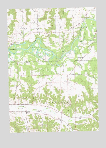
North Bend, WI USGS Topographic Map
Click on map above to begin viewing in our Map Viewer.

This topographic map contains these locations and features:
Feature Name Type Latitude Longitude GNIS ID View Map
Bell CouleeValleyN44.0089°W91.0454°1561522View Map
Black Oak CemeteryCemeteryN44.0541°W91.1176°1561872View Map
Black Oak RidgeRidgeN44.0402°W91.0976°1561874View Map
Black Oak School (historical)SchoolN44.0564°W91.1176°1843218View Map
Browns ValleyValleyN44.0112°W91.0417°1562274View Map
Burr OakPopulated PlaceN44.0572°W91.0546°1562448View Map
Burr Oak SchoolSchoolN44.0508°W91.0429°1562452View Map
Camp EhaweeLocaleN44.0689°W91.1232°1562602View Map
Davis CreekStreamN44.0775°W91.0451°1563732View Map
Farmington CemeteryCemeteryN44.0208°W91.1219°1564869View Map
Farmington Volunteer Fire DepartmentBuildingN44.0214°W91.1024°2697738View Map
German ValleyValleyN44.0730°W91.0383°1565487View Map
Heller CouleeValleyN44.0146°W91.0094°1566279View Map
Little Red School (historical)SchoolN44.1002°W91.0526°1845479View Map
Maiden RockSummitN44.0808°W91.0490°1568901View Map
Melrose - Mindoro High SchoolSchoolN44.0745°W91.0208°1569328View Map
Mill CreekStreamN44.0891°W91.1151°1569475View Map
Mill Creek School (historical)SchoolN44.1089°W91.0829°1845484View Map
MindoroPopulated PlaceN44.0211°W91.1018°1569547View Map
Mindoro Elementary SchoolSchoolN44.0190°W91.1013°2715695View Map
North BendPopulated PlaceN44.0914°W91.1168°1570359View Map
Oxbow CemeteryCemeteryN44.0852°W91.0096°1570975View Map
Oxbow School (historical)SchoolN44.0894°W91.0037°1845491View Map
Pfaff School (historical)SchoolN44.0466°W91.0032°1843372View Map
Red School ValleyValleyN44.0816°W91.0482°1572159View Map
Rhyme School (historical)SchoolN44.0172°W91.0526°1843381View Map
Sand CreekStreamN44.0930°W91.0274°1573662View Map
Sandberg ValleyValleyN44.0932°W91.1146°1573703View Map
Severson CouleeValleyN44.0209°W91.1053°1573929View Map
Sullivan CouleeValleyN44.0178°W91.0777°1575044View Map
Town of FarmingtonCivilN44.0309°W91.0840°1583191View Map
Town of MelroseCivilN44.1184°W91.0082°1583690View Map
Town of North BendCivilN44.1148°W91.1049°1583825View Map
Wet CouleeValleyN44.0087°W91.0534°1576589View Map
Wilson CreekStreamN44.0844°W91.1232°1576810View Map

Note: Coordinates in the location and feature list above are referenced to NAD83 datum.


Copyright (C) 2008-2025 Ryan Niemi / Sunset Dynamics ... All Rights Reserved