TopoQuest Logo
Do you find TopoQuest useful?
Help keep TopoQuest running and adding new maps/features by donating!
Bitcoin:  19c7KJd3qBynnjoSw5npx9KScwjBe4ifkT
Litecoin:  LXs6TkuXGGXo1vDsWCkWVdjQX94eUKd6ui
Home View Maps Find Maps Find Places Resources & Links


Weston, Ohio Topographic Map

USGS Map Title: Weston, OH
USGS Map MRC: 41083C7
DRG (GeoTIFF) Download: o41083c7.tif


Neighboring USGS Topographic Map Quads:


  Colton, OH  
41083D8
 

  Grand Rapids, OH  
41083D7
 

  Bowling Green North, OH  
41083D6
 

  McClure, OH  
41083C8
 

  Weston, OH  
41083C7
 

  Bowling Green South, OH  
41083C6
 

  Deshler, OH  
41083B8
 

  Hoytville, OH  
41083B7
 

  North Baltimore, OH  
41083B6


Map MRC Location:

N42°
W84°
N42°
W83°
H8 H7 H6 H5 H4 H3 H2 H1
G8 G7 G6 G5 G4 G3 G2 G1
F8 F7 F6 F5 F4 F3 F2 F1
E8 E7 E6 E5 E4 E3 E2 E1
D8 D7 D6 D5 D4 D3 D2 D1
C8 C7 C6 C5 C4 C3 C2 C1
B8 B7 B6 B5 B4 B3 B2 B1
A8 A7 A6 A5 A4 A3 A2 A1
N41°
W84°
N41°
W83°

Weston, OH USGS 1:24K Topographic Map Preview:
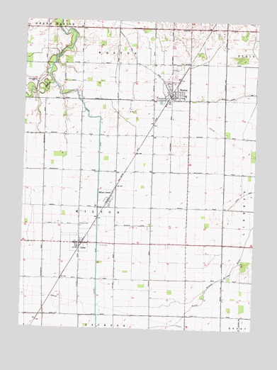
Weston, OH USGS Topographic Map
Click on map above to begin viewing in our Map Viewer.

This topographic map contains these locations and features:
Feature Name Type Latitude Longitude GNIS ID View Map
Antioch ChurchChurchN41.3720°W83.7883°1037450View Map
Baldwin Woods PreserveParkN41.3598°W83.7616°1952118View Map
CustarPopulated PlaceN41.2848°W83.8444°1056856View Map
Custar Post OfficePost OfficeN41.2834°W83.8438°1951678View Map
Cutoff DitchCanalN41.2926°W83.8352°1066670View Map
Grace Evangelical Lutheran ChurchChurchN41.3428°W83.7949°1952119View Map
Haney (historical)Populated PlaceN41.2556°W83.7660°1050448View Map
Lawndale Mobile Home PlazaPopulated PlaceN41.3520°W83.7935°1951841View Map
Manders DairyLocaleN41.3158°W83.7642°2547153View Map
Milton CenterPopulated PlaceN41.3026°W83.8288°1080513View Map
Milton Center Post OfficePost OfficeN41.2992°W83.8308°1951855View Map
Milton Elementary SchoolSchoolN41.2998°W83.8355°1050446View Map
Milton Township CemeteryCemeteryN41.2923°W83.8416°1731434View Map
Milton Township Fire DistrictBuildingN41.2996°W83.8383°2549357View Map
New Weston CemeteryCemeteryN41.3578°W83.7908°1731437View Map
Old Weston CemeteryCemeteryN41.3559°W83.7930°1731440View Map
Pottertown CemeteryCemeteryN41.3501°W83.8696°1044724View Map
Saint Louis CemeteryCemeteryN41.2839°W83.8333°1045608View Map
Saint Louis Elementary SchoolSchoolN41.2851°W83.8385°1951962View Map
Sonlight Christian Assembly of God ChurchChurchN41.3439°W83.7894°1952120View Map
Township of MiltonCivilN41.2988°W83.8250°1087189View Map
Township of WestonCivilN41.3616°W83.8148°1087201View Map
Village of CustarCivilN41.2846°W83.8438°2398662View Map
Village of Milton CenterCivilN41.3007°W83.8297°2399367View Map
Village of WestonCivilN41.3464°W83.7947°2400154View Map
WestonPopulated PlaceN41.3448°W83.7972°1061765View Map
Weston Church of ChristChurchN41.3478°W83.7966°1952121View Map
Weston Elementary SchoolSchoolN41.3451°W83.7885°1050447View Map
Weston Emergency Medical ServicesBuildingN41.3424°W83.8003°2550815View Map
Weston Fire DepartmentBuildingN41.3424°W83.8003°2549348View Map
Weston Post OfficePost OfficeN41.3444°W83.7956°1952022View Map
Weston Public LibraryBuildingN41.3439°W83.7960°1952099View Map
Weston Sewage Treatment PlantLocaleN41.3517°W83.7903°2678309View Map
Weston Trailer CourtPopulated PlaceN41.3534°W83.7952°1952100View Map
Weston United Methodist ChurchChurchN41.3451°W83.7947°1952122View Map
Weston Water Treatment PlantLocaleN41.3422°W83.8008°2678308View Map

Note: Coordinates in the location and feature list above are referenced to NAD83 datum.


Copyright (C) 2008-2024 Ryan Niemi / Sunset Dynamics ... All Rights Reserved