TopoQuest Logo
Do you find TopoQuest useful?
Help keep TopoQuest running and adding new maps/features by donating!
Bitcoin:  19c7KJd3qBynnjoSw5npx9KScwjBe4ifkT
Litecoin:  LXs6TkuXGGXo1vDsWCkWVdjQX94eUKd6ui
Home View Maps Find Maps Find Places Resources & Links


Whitcomb, Indiana Topographic Map

USGS Map Title: Whitcomb, IN
USGS Map MRC: 39084D8
DRG (GeoTIFF) Download: o39084d8.tif


Neighboring USGS Topographic Map Quads:


  Everton, IN  
39085E1
 

  New Fairfield, IN  
39084E8
 

  College Corner, OH  
39084E7
 

  Brookville, IN  
39085D1
 

  Whitcomb, IN  
39084D8
 

  Reily, OH  
39084D7
 

  Spades, IN  
39085C1
 

  Cedar Grove, IN  
39084C8
 

  Harrison, OH  
39084C7


Map MRC Location:

N40°
W85°
N40°
W84°
H8 H7 H6 H5 H4 H3 H2 H1
G8 G7 G6 G5 G4 G3 G2 G1
F8 F7 F6 F5 F4 F3 F2 F1
E8 E7 E6 E5 E4 E3 E2 E1
D8 D7 D6 D5 D4 D3 D2 D1
C8 C7 C6 C5 C4 C3 C2 C1
B8 B7 B6 B5 B4 B3 B2 B1
A8 A7 A6 A5 A4 A3 A2 A1
N39°
W85°
N39°
W84°

Whitcomb, IN USGS 1:24K Topographic Map Preview:
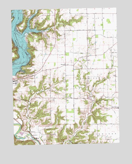
Whitcomb, IN USGS Topographic Map
Click on map above to begin viewing in our Map Viewer.

This topographic map contains these locations and features:
Feature Name Type Latitude Longitude GNIS ID View Map
Battle PointSummitN39.4645°W84.9958°430583View Map
Big Cedar ChurchChurchN39.4514°W84.9113°431019View Map
Bon Well HillSummitN39.4401°W84.9897°431312View Map
Brookville High SchoolSchoolN39.4337°W84.9986°446505View Map
Brookville Junior High SchoolSchoolN39.4337°W84.9986°446504View Map
Brookville Lake DamDamN39.4403°W84.9997°448702View Map
Cobbs HillSummitN39.3787°W84.9008°431931View Map
East Fork Big Cedar CreekStreamN39.4206°W84.9061°433882View Map
Garr HillSummitN39.4742°W84.9586°434966View Map
Harrison Sand and Gravel PitMineN39.3856°W84.9900°2649433View Map
Holland School (historical)SchoolN39.4176°W84.9558°449783View Map
James CemeteryCemeteryN39.4184°W84.9072°436918View Map
Little Cedar CreekStreamN39.3845°W84.9838°438006View Map
Little Cedar Creek School (historical)SchoolN39.3876°W84.9747°449784View Map
Little Cedar Grove ChurchChurchN39.3873°W84.9816°438007View Map
Mound HavenPopulated PlaceN39.3839°W84.9783°439513View Map
Mounds State Recreation AreaParkN39.4926°W84.9666°446860View Map
Mount Carmel CemeteryCemeteryN39.4073°W84.8863°439539View Map
Orschell OverlookLocaleN39.4709°W84.9783°449609View Map
Owl HollowValleyN39.4023°W84.9711°440811View Map
PalestinePopulated PlaceN39.4173°W84.9277°440836View Map
Possum HollowValleyN39.3775°W84.9367°441485View Map
Sleepy HollowValleyN39.4133°W84.9034°443600View Map
Springfield School (historical)SchoolN39.4367°W84.8775°449782View Map
Templeton CreekStreamN39.4842°W84.9802°444631View Map
The MoundsSummitN39.4864°W84.9875°444674View Map
Town of Mount CarmelCivilN39.4076°W84.8755°2396788View Map
WhitcombPopulated PlaceN39.4484°W84.9369°445916View Map

Note: Coordinates in the location and feature list above are referenced to NAD83 datum.


Copyright (C) 2008-2025 Ryan Niemi / Sunset Dynamics ... All Rights Reserved