TopoQuest Logo
Do you find TopoQuest useful?
Help keep TopoQuest running and adding new maps/features by donating!
Bitcoin:  19c7KJd3qBynnjoSw5npx9KScwjBe4ifkT
Litecoin:  LXs6TkuXGGXo1vDsWCkWVdjQX94eUKd6ui
Home View Maps Find Maps Find Places Resources & Links


Whitesburg, Pennsylvania Topographic Map

USGS Map Title: Whitesburg, PA
USGS Map MRC: 40079F4
DRG (GeoTIFF) Download: o40079f4.tif


Neighboring USGS Topographic Map Quads:


  Kittanning, PA  
40079G5
 

  Mosgrove, PA  
40079G4
 

  Rural Valley, PA  
40079G3
 

  Leechburg, PA  
40079F5
 

  Whitesburg, PA  
40079F4
 

  Elderton, PA  
40079F3
 

  Vandergrift, PA  
40079E5
 

  Avonmore, PA  
40079E4
 

  McIntyre, PA  
40079E3


Map MRC Location:

N41°
W80°
N41°
W79°
H8 H7 H6 H5 H4 H3 H2 H1
G8 G7 G6 G5 G4 G3 G2 G1
F8 F7 F6 F5 F4 F3 F2 F1
E8 E7 E6 E5 E4 E3 E2 E1
D8 D7 D6 D5 D4 D3 D2 D1
C8 C7 C6 C5 C4 C3 C2 C1
B8 B7 B6 B5 B4 B3 B2 B1
A8 A7 A6 A5 A4 A3 A2 A1
N40°
W80°
N40°
W79°

Whitesburg, PA USGS 1:24K Topographic Map Preview:
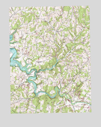
Whitesburg, PA USGS Topographic Map
Click on map above to begin viewing in our Map Viewer.

This topographic map contains these locations and features:
Feature Name Type Latitude Longitude GNIS ID View Map
Baker HollowValleyN40.6456°W79.4602°1168602View Map
Brick ChurchPopulated PlaceN40.6862°W79.4553°1170224View Map
Burrell Township Volunteer Fire Department Station 290BuildingN40.6704°W79.4721°2644893View Map
Cherry RunStreamN40.6737°W79.4589°1171665View Map
Cochrans Mill United Methodist Church CemeteryCemeteryN40.6706°W79.4701°2775891View Map
Cochrans MillsPopulated PlaceN40.6701°W79.4581°1203296View Map
Cochrans Mills ChurchChurchN40.6706°W79.4692°1172114View Map
Craig RunStreamN40.6356°W79.4000°1172603View Map
Crooked Creek LakeReservoirN40.6626°W79.4682°1198223View Map
Crooked Creek Lake Recreation AreaParkN40.7045°W79.4873°1212200View Map
Dunkard Baptist Christian Bretheren CemeteryCemeteryN40.6701°W79.4728°2775902View Map
Elbow RunStreamN40.7181°W79.4953°1174074View Map
Fagley RunStreamN40.6520°W79.4234°1174406View Map
GirtyPopulated PlaceN40.6473°W79.4109°1175645View Map
Horney Camp RunStreamN40.7084°W79.4998°1177430View Map
Lindsay RunStreamN40.6348°W79.4020°1179416View Map
Long RunStreamN40.6540°W79.4206°1179884View Map
MateerPopulated PlaceN40.6420°W79.4731°1204118View Map
McDonalds CemeteryCemeteryN40.6603°W79.4462°1180695View Map
Mount Union Lutheran Church CemeteryCemeteryN40.6880°W79.3783°2775940View Map
North Branch Cherry RunStreamN40.6856°W79.4259°1182530View Map
Paradise BeachBeachN40.7142°W79.4989°1193087View Map
Pine RunStreamN40.6876°W79.4745°1183877View Map
PyrraPopulated PlaceN40.7209°W79.4256°1204454View Map
RockvillePopulated PlaceN40.7331°W79.4417°1185331View Map
Rowley CemeteryCemeteryN40.6890°W79.4027°2775960View Map
Rupert CemeteryCemeteryN40.6597°W79.4021°2775961View Map
Saint Johns ChurchChurchN40.7215°W79.4595°1186136View Map
Saint Johns Lutheran Church CemeteryCemeteryN40.7197°W79.4611°2775965View Map
Saint Mathews ChurchChurchN40.7303°W79.4373°1186446View Map
Saint Michaels ChurchChurchN40.6845°W79.4553°1186492View Map
Saint Michaels Lutheran Church CemeteryCemeteryN40.6837°W79.4559°2775884View Map
Shaeffer CemeteryCemeteryN40.6928°W79.4439°1187315View Map
ShayPopulated PlaceN40.7365°W79.4548°1187413View Map
Shellhammer - Beck CemeteryCemeteryN40.6395°W79.4799°2775974View Map
Shellhammer CemeteryCemeteryN40.6420°W79.4892°1187446View Map
Shotts CemeteryCemeteryN40.7187°W79.4750°1187607View Map
Sugar RunStreamN40.6376°W79.4050°1188965View Map
TopPopulated PlaceN40.7101°W79.4456°1204819View Map
Township of BurrellCivilN40.6706°W79.4647°1215841View Map
Township of South BendCivilN40.6313°W79.3967°1215859View Map
United Rockville Lutheran CemeteryCemeteryN40.7309°W79.4385°2775959View Map
WhitesburgPopulated PlaceN40.7431°W79.3975°1191341View Map
Whitesburg Presbyterian CemeteryCemeteryN40.7372°W79.3959°2775985View Map
Whitesburg United Methodist Church CemeteryCemeteryN40.7384°W79.3965°2775984View Map

Note: Coordinates in the location and feature list above are referenced to NAD83 datum.


Copyright (C) 2008-2025 Ryan Niemi / Sunset Dynamics ... All Rights Reserved