TopoQuest Logo
Do you find TopoQuest useful?
Help keep TopoQuest running and adding new maps/features by donating!
Bitcoin:  19c7KJd3qBynnjoSw5npx9KScwjBe4ifkT
Litecoin:  LXs6TkuXGGXo1vDsWCkWVdjQX94eUKd6ui
Home View Maps Find Maps Find Places Resources & Links


McIntyre, Pennsylvania Topographic Map

USGS Map Title: McIntyre, PA
USGS Map MRC: 40079E3
DRG (GeoTIFF) Download: o40079e3.tif


Neighboring USGS Topographic Map Quads:


  Whitesburg, PA  
40079F4
 

  Elderton, PA  
40079F3
 

  Ernest, PA  
40079F2
 

  Avonmore, PA  
40079E4
 

  McIntyre, PA  
40079E3
 

  Indiana, PA  
40079E2
 

  Saltsburg, PA  
40079D4
 

  Blairsville, PA  
40079D3
 

  Bolivar, PA  
40079D2


Map MRC Location:

N41°
W80°
N41°
W79°
H8 H7 H6 H5 H4 H3 H2 H1
G8 G7 G6 G5 G4 G3 G2 G1
F8 F7 F6 F5 F4 F3 F2 F1
E8 E7 E6 E5 E4 E3 E2 E1
D8 D7 D6 D5 D4 D3 D2 D1
C8 C7 C6 C5 C4 C3 C2 C1
B8 B7 B6 B5 B4 B3 B2 B1
A8 A7 A6 A5 A4 A3 A2 A1
N40°
W80°
N40°
W79°

McIntyre, PA USGS 1:24K Topographic Map Preview:
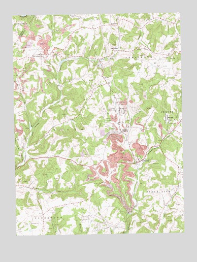
McIntyre, PA USGS Topographic Map
Click on map above to begin viewing in our Map Viewer.

This topographic map contains these locations and features:
Feature Name Type Latitude Longitude GNIS ID View Map
AultmanPopulated PlaceN40.5640°W79.2609°1168514View Map
Aultman Volunteer Fire Department Station 270BuildingN40.5635°W79.2608°2645189View Map
Borough of Jacksonville (historical)CivilN40.5395°W79.2992°1215291View Map
Clune Post OfficePost OfficeN40.5578°W79.3041°1782050View Map
Coal RunPopulated PlaceN40.5573°W79.2948°1172062View Map
Coal RunStreamN40.5142°W79.2873°1172066View Map
Coal Run - McIntyre Volunteer Fire Department Station 290BuildingN40.5580°W79.3037°2645386View Map
Conemaugh CemeteryCemeteryN40.5065°W79.3643°1172298View Map
Conemaugh Church (historical)ChurchN40.5070°W79.3648°1201026View Map
Ebenezer ChurchChurchN40.5087°W79.3203°1173951View Map
Green Valley LakeReservoirN40.5958°W79.3099°1176127View Map
Hooper RunStreamN40.5501°W79.3650°1177363View Map
J M JunctionPopulated PlaceN40.6042°W79.2956°1203881View Map
JacksonvillePopulated PlaceN40.5409°W79.2817°1177938View Map
Jacksonville Census Designated PlaceCensusN40.5652°W79.2952°2389976View Map
Kent Post OfficePost OfficeN40.5416°W79.2814°1782049View Map
LewisvillePopulated PlaceN40.5106°W79.3211°1204022View Map
McIntire CemeteryCemeteryN40.5403°W79.2731°1180727View Map
McIntyrePopulated PlaceN40.5698°W79.2956°1180730View Map
McIntyre Post OfficePost OfficeN40.5659°W79.2962°2772812View Map
Neal RunStreamN40.5551°W79.2903°1182193View Map
Nesbit RunStreamN40.5431°W79.3678°1182251View Map
ParkwoodPopulated PlaceN40.6190°W79.3011°1183341View Map
Reeds RunStreamN40.5392°W79.2798°1217371View Map
Saint Anthonys ChurchChurchN40.5620°W79.2592°1185791View Map
StewardsvilleLocaleN40.6034°W79.2873°1206873View Map
Township of YoungCivilN40.5634°W79.3436°1216554View Map
Union CemeteryCemeteryN40.5952°W79.2685°1190102View Map
Watts HillSummitN40.6006°W79.2778°1190702View Map
West LebanonPopulated PlaceN40.6026°W79.3537°1191055View Map
West Lebanon CemeteryCemeteryN40.6012°W79.3459°1191056View Map
West Lebanon StationLocaleN40.5848°W79.3400°1212069View Map
West Union ChurchChurchN40.6167°W79.3414°1191123View Map
Whisky RunStreamN40.5615°W79.3612°1191240View Map

Note: Coordinates in the location and feature list above are referenced to NAD83 datum.


Copyright (C) 2008-2025 Ryan Niemi / Sunset Dynamics ... All Rights Reserved