TopoQuest Logo
Do you find TopoQuest useful?
Help keep TopoQuest running and adding new maps/features by donating!
Bitcoin:  19c7KJd3qBynnjoSw5npx9KScwjBe4ifkT
Litecoin:  LXs6TkuXGGXo1vDsWCkWVdjQX94eUKd6ui
Home View Maps Find Maps Find Places Resources & Links


Elderton, Pennsylvania Topographic Map

USGS Map Title: Elderton, PA
USGS Map MRC: 40079F3
DRG (GeoTIFF) Download: o40079f3.tif


Neighboring USGS Topographic Map Quads:


  Mosgrove, PA  
40079G4
 

  Rural Valley, PA  
40079G3
 

  Plumville, PA  
40079G2
 

  Whitesburg, PA  
40079F4
 

  Elderton, PA  
40079F3
 

  Ernest, PA  
40079F2
 

  Avonmore, PA  
40079E4
 

  McIntyre, PA  
40079E3
 

  Indiana, PA  
40079E2


Map MRC Location:

N41°
W80°
N41°
W79°
H8 H7 H6 H5 H4 H3 H2 H1
G8 G7 G6 G5 G4 G3 G2 G1
F8 F7 F6 F5 F4 F3 F2 F1
E8 E7 E6 E5 E4 E3 E2 E1
D8 D7 D6 D5 D4 D3 D2 D1
C8 C7 C6 C5 C4 C3 C2 C1
B8 B7 B6 B5 B4 B3 B2 B1
A8 A7 A6 A5 A4 A3 A2 A1
N40°
W80°
N40°
W79°

Elderton, PA USGS 1:24K Topographic Map Preview:
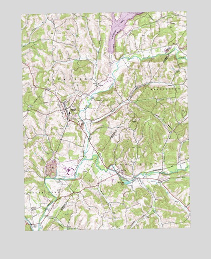
Elderton, PA USGS Topographic Map
Click on map above to begin viewing in our Map Viewer.

This topographic map contains these locations and features:
Feature Name Type Latitude Longitude GNIS ID View Map
AdvancePopulated PlaceN40.7087°W79.2620°1202950View Map
Anthony RunStreamN40.6551°W79.2895°1168334View Map
Borough of EldertonCivilN40.6945°W79.3421°1214848View Map
Borough of SheloctaCivilN40.6573°W79.3017°1215295View Map
Cessna RunStreamN40.7040°W79.3192°1171520View Map
Cheese RunStreamN40.6512°W79.2711°1171617View Map
Citizens Ambulance Service Elderton Station 81BuildingN40.6924°W79.3449°2719574View Map
Curry RunStreamN40.6562°W79.2820°1172847View Map
Curry Run ChurchChurchN40.6520°W79.2711°1172850View Map
Dark Hollow RunStreamN40.6590°W79.2553°1172943View Map
Dutch RunStreamN40.6867°W79.3281°1173662View Map
EldertonPopulated PlaceN40.6951°W79.3414°1174082View Map
Elderton Borough Police DepartmentBuildingN40.6946°W79.3412°2781065View Map
Elderton CemeteryCemeteryN40.6922°W79.3435°2775905View Map
Elderton District Volunteer Fire Company Station 50BuildingN40.6960°W79.3418°2645920View Map
Elderton Elementary SchoolSchoolN40.6917°W79.3395°1205552View Map
Elderton High SchoolSchoolN40.6928°W79.3395°1205553View Map
Elderton Post OfficePost OfficeN40.6950°W79.3431°2777479View Map
Elderton Presbyterian Church CemeteryCemeteryN40.6972°W79.3430°2775906View Map
Elderton United Methodist Church CemeteryCemeteryN40.6943°W79.3455°2775907View Map
Fishers SidingLocaleN40.6598°W79.2659°1214209View Map
Flying O Airport (historical)AirportN40.7084°W79.3439°1194075View Map
GastownPopulated PlaceN40.7092°W79.3156°1175482View Map
Gastown CemeteryCemeteryN40.7080°W79.3181°2775915View Map
Gobblers RunStreamN40.6342°W79.3603°1175768View Map
IdahoPopulated PlaceN40.6537°W79.3470°1177681View Map
Keystone Station DamDamN40.7284°W79.2898°1195005View Map
MillerLocaleN40.6881°W79.2906°1212074View Map
Mitchell RunStreamN40.6573°W79.2703°1192951View Map
Montgomery Family CemeteryCemeteryN40.6597°W79.3715°2775936View Map
North Branch Plum CreekStreamN40.7203°W79.3025°1182548View Map
Plum CreekStreamN40.6656°W79.3292°1184106View Map
Russell HillSummitN40.6878°W79.2906°1185649View Map
Saint Jacobs ChurchChurchN40.6378°W79.3695°1186002View Map
Saint Thomas ChurchChurchN40.7090°W79.3173°1186754View Map
Salem ChurchChurchN40.7153°W79.2581°1186841View Map
Sample ReservoirReservoirN40.6667°W79.3348°1194960View Map
Sample Run DamDamN40.6667°W79.3348°1194961View Map
Shady Side LakeReservoirN40.6516°W79.2969°1187311View Map
Sharon Oil and Gas FieldChurchN40.6528°W79.2928°1187455View Map
SheloctaPopulated PlaceN40.6559°W79.3020°1187454View Map
Shelocta Post OfficePost OfficeN40.6545°W79.2990°2772976View Map
Shelocta StationLocaleN40.6576°W79.2809°1214208View Map
South BendPopulated PlaceN40.6278°W79.3695°1188012View Map
South Bend CemeteryCemeteryN40.6374°W79.3702°2775964View Map
South Branch Plum CreekStreamN40.7203°W79.3025°1188036View Map
Township of ArmstrongCivilN40.6319°W79.2793°1216531View Map
Township of PlumcreekCivilN40.7131°W79.3469°1215856View Map
Walker RunStreamN40.6606°W79.3178°1190504View Map

Note: Coordinates in the location and feature list above are referenced to NAD83 datum.


Copyright (C) 2008-2025 Ryan Niemi / Sunset Dynamics ... All Rights Reserved