TopoQuest Logo
Do you find TopoQuest useful?
Help keep TopoQuest running and adding new maps/features by donating!
Bitcoin:  19c7KJd3qBynnjoSw5npx9KScwjBe4ifkT
Litecoin:  LXs6TkuXGGXo1vDsWCkWVdjQX94eUKd6ui
Home View Maps Find Maps Find Places Resources & Links


Whitesville, West Virginia Topographic Map

USGS Map Title: Whitesville, WV
USGS Map MRC: 37081H5
DRG (GeoTIFF) Download: o37081h5.tif


Neighboring USGS Topographic Map Quads:


  Williams Mountain, WV  
38081A6
 

  Sylvester, WV  
38081A5
 

  Eskdale, WV  
38081A4
 

  Wharton, WV  
37081H6
 

  Whitesville, WV  
37081H5
 

  Dorothy, WV  
37081H4
 

  Lorado, WV  
37081G6
 

  Pilot Knob, WV  
37081G5
 

  Arnett, WV  
37081G4


Map MRC Location:

N38°
W82°
N38°
W81°
H8 H7 H6 H5 H4 H3 H2 H1
G8 G7 G6 G5 G4 G3 G2 G1
F8 F7 F6 F5 F4 F3 F2 F1
E8 E7 E6 E5 E4 E3 E2 E1
D8 D7 D6 D5 D4 D3 D2 D1
C8 C7 C6 C5 C4 C3 C2 C1
B8 B7 B6 B5 B4 B3 B2 B1
A8 A7 A6 A5 A4 A3 A2 A1
N37°
W82°
N37°
W81°

Whitesville, WV USGS 1:24K Topographic Map Preview:
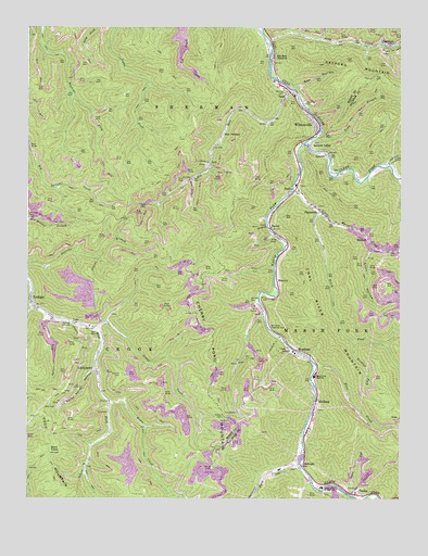
Whitesville, WV USGS Topographic Map
Click on map above to begin viewing in our Map Viewer.

This topographic map contains these locations and features:
Feature Name Type Latitude Longitude GNIS ID View Map
Asbury CemeteryCemeteryN37.8968°W81.5596°1535037View Map
Bailey CemeteryCemeteryN37.8832°W81.5632°1535124View Map
Bald KnobSummitN37.8876°W81.6173°1553784View Map
Bear HollowValleyN37.9837°W81.5359°1535370View Map
Birch ForkStreamN37.9518°W81.5276°1536023View Map
BirchtonPopulated PlaceN37.9329°W81.5415°1553907View Map
Blue PennantPopulated PlaceN37.9709°W81.5596°1553933View Map
Bradley ForkStreamN37.9171°W81.5154°1536284View Map
Clear ForkStreamN37.9696°W81.5323°1537393View Map
Coon HollowValleyN37.9432°W81.5098°1537631View Map
Ducky Ferrell HollowValleyN37.9084°W81.6015°1538403View Map
EdwightPopulated PlaceN37.8846°W81.5323°1538565View Map
Elk RunStreamN37.9837°W81.5368°1538635View Map
Elk Run JunctionPopulated PlaceN37.9921°W81.5429°1538638View Map
Ellis CreekStreamN37.9107°W81.5279°1538676View Map
EunicePopulated PlaceN37.9465°W81.5434°1538748View Map
GarrisonPopulated PlaceN37.9962°W81.5068°1554533View Map
Hazy CreekStreamN37.8843°W81.5337°1540101View Map
James CreekStreamN37.9198°W81.6032°1540812View Map
JaniePopulated PlaceN37.9823°W81.5384°1554796View Map
Jarrells CemeteryCemeteryN37.9079°W81.5940°1540829View Map
Jarrells CemeteryCemeteryN37.9273°W81.5498°1540830View Map
Jarrolds ValleyPopulated PlaceN37.9751°W81.5290°1554798View Map
LeevalePopulated PlaceN37.9662°W81.5251°1541614View Map
LindytownPopulated PlaceN37.9098°W81.6023°1554957View Map
Little Marsh ForkStreamN37.9568°W81.5362°1542169View Map
Little Ugly BranchStreamN37.9262°W81.6223°1542248View Map
Low Gap BranchStreamN37.9409°W81.5007°1542502View Map
Lower Big Branch Refuse ImpoundmentReservoirN37.9268°W81.5465°1559281View Map
MarforkPopulated PlaceN37.9443°W81.5109°1555045View Map
Marsh ForkStreamN37.9696°W81.5323°1542786View Map
Marsh Fork Elementary SchoolSchoolN37.8781°W81.5262°1542790View Map
Marsh Fork High School (historical)SchoolN37.9073°W81.5290°1542788View Map
Marsh Fork Public LibraryBuildingN37.9067°W81.5283°2727370View Map
Matts CreekStreamN37.9009°W81.5973°1542874View Map
MontcoalPopulated PlaceN37.9140°W81.5357°1555151View Map
Montcoal Post OfficePost OfficeN37.9132°W81.5321°1742864View Map
Mooney School (historical)SchoolN37.9237°W81.6207°1534773View Map
Mordue CemeteryCemeteryN37.9829°W81.5396°1543526View Map
PacksvillePopulated PlaceN37.9521°W81.5282°1555290View Map
Packsville Post OfficePost OfficeN37.9501°W81.5254°1742887View Map
PettusPopulated PlaceN37.9565°W81.5376°1544762View Map
Pettus Elementary School (historical)SchoolN37.9582°W81.5351°1742895View Map
Raleigh - Boone Technical CenterSchoolN37.9584°W81.5350°1742918View Map
Robinhood ImpoundmentReservoirN37.9201°W81.6198°1557389View Map
Rockhouse CreekStreamN37.9634°W81.5037°1545980View Map
Seng CreekStreamN37.9973°W81.5448°1546569View Map
Shumate ChapelChurchN37.8765°W81.5226°1546758View Map
Shumate CreekStreamN37.8782°W81.5207°1546759View Map
Spruce Lick ForkStreamN37.9246°W81.6190°1547261View Map
StickneyPopulated PlaceN37.9015°W81.5276°1555712View Map
Stink RunStreamN37.8757°W81.5162°1547426View Map
SundialPopulated PlaceN37.8762°W81.5146°1555753View Map
Sundial Post OfficePost OfficeN37.8765°W81.5151°1742985View Map
Toms BranchStreamN37.9712°W81.5287°1548134View Map
Town of WhitesvilleCivilN37.9825°W81.5367°2391485View Map
TwilightPopulated PlaceN37.9273°W81.6234°1548396View Map
Twilight Census Designated PlaceCensusN37.9252°W81.6176°2586891View Map
Twilight Post OfficePost OfficeN37.9250°W81.6220°1741814View Map
Walhonde Roadside ParkParkN37.9207°W81.5440°1548712View Map
West Virginia State Police Troop 6 - Whitesville DetachmentBuildingN37.9586°W81.5349°2728151View Map
WhitesvillePopulated PlaceN37.9748°W81.5290°1555976View Map
Whitesville Elementary SchoolSchoolN37.9822°W81.5358°1741825View Map
Whitesville Police DepartmentBuildingN37.9816°W81.5353°2727874View Map
Whitesville Post OfficePost OfficeN37.9853°W81.5427°1741826View Map
Whitesville Public LibraryBuildingN37.9806°W81.5347°2727193View Map
Whitesville Volunteer Fire DepartmentBuildingN37.9734°W81.5271°2577982View Map
Whitesville Volunteer Fire Department Pettus SubstationBuildingN37.9624°W81.5341°2577903View Map

Note: Coordinates in the location and feature list above are referenced to NAD83 datum.


Copyright (C) 2008-2024 Ryan Niemi / Sunset Dynamics ... All Rights Reserved