TopoQuest Logo
Do you find TopoQuest useful?
Help keep TopoQuest running and adding new maps/features by donating!
Bitcoin:  19c7KJd3qBynnjoSw5npx9KScwjBe4ifkT
Litecoin:  LXs6TkuXGGXo1vDsWCkWVdjQX94eUKd6ui
Home View Maps Find Maps Find Places Resources & Links


Sylvester, West Virginia Topographic Map

USGS Map Title: Sylvester, WV
USGS Map MRC: 38081A5
DRG (GeoTIFF) Download: o38081a5.tif


Neighboring USGS Topographic Map Quads:


  Racine, WV  
38081B6
 

  Belle, WV  
38081B5
 

  Cedar Grove, WV  
38081B4
 

  Williams Mountain, WV  
38081A6
 

  Sylvester, WV  
38081A5
 

  Eskdale, WV  
38081A4
 

  Wharton, WV  
37081H6
 

  Whitesville, WV  
37081H5
 

  Dorothy, WV  
37081H4


Map MRC Location:

N39°
W82°
N39°
W81°
H8 H7 H6 H5 H4 H3 H2 H1
G8 G7 G6 G5 G4 G3 G2 G1
F8 F7 F6 F5 F4 F3 F2 F1
E8 E7 E6 E5 E4 E3 E2 E1
D8 D7 D6 D5 D4 D3 D2 D1
C8 C7 C6 C5 C4 C3 C2 C1
B8 B7 B6 B5 B4 B3 B2 B1
A8 A7 A6 A5 A4 A3 A2 A1
N38°
W82°
N38°
W81°

Sylvester, WV USGS 1:24K Topographic Map Preview:
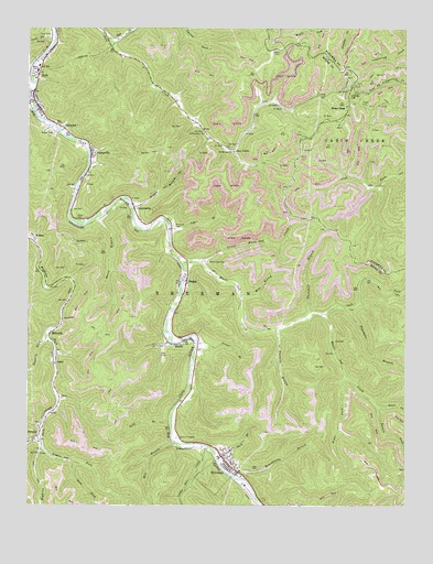
Sylvester, WV USGS Topographic Map
Click on map above to begin viewing in our Map Viewer.

This topographic map contains these locations and features:
Feature Name Type Latitude Longitude GNIS ID View Map
Big Jarrells CreekStreamN38.0184°W81.6201°1535872View Map
Bowen CemeteryCemeteryN38.0970°W81.6165°1536253View Map
CabotPopulated PlaceN38.0365°W81.6151°1554045View Map
Coon CemeteryCemeteryN38.1226°W81.6185°1537617View Map
Coon ForkStreamN38.1215°W81.6162°1537627View Map
CoopertownPopulated PlaceN38.0782°W81.5898°1554188View Map
Foster CemeteryCemeteryN38.1054°W81.5146°1539164View Map
FostervillePopulated PlaceN38.0920°W81.6040°1539170View Map
Fourmile BranchStreamN38.0523°W81.5187°1539176View Map
Gidd BranchStreamN38.0218°W81.5773°1539387View Map
Haggle BranchStreamN38.0779°W81.5907°1539840View Map
Horse BranchStreamN38.0754°W81.6021°1540473View Map
Jakes BranchStreamN38.0723°W81.5779°1540798View Map
Joes CreekPopulated PlaceN38.0934°W81.5571°1554815View Map
KeithPopulated PlaceN38.0429°W81.5737°1541116View Map
KirbytonPopulated PlaceN38.0987°W81.6132°1554887View Map
Laurel CreekStreamN38.1037°W81.6232°1541419View Map
Lavinia ForkStreamN38.0443°W81.6182°1541553View Map
Left Fork Joes CreekStreamN38.1220°W81.5987°1541668View Map
Left Fork White Oak CreekStreamN38.0501°W81.5279°1541745View Map
Little Elk CreekStreamN38.0157°W81.5662°1542093View Map
Little White Oak CreekStreamN38.0632°W81.5676°1542257View Map
Logan ForkStreamN38.0148°W81.6196°1542312View Map
Mile BranchStreamN38.0554°W81.5546°1543266View Map
Mill BranchStreamN38.0162°W81.5762°1543299View Map
MilltownPopulated PlaceN38.0448°W81.6173°1555129View Map
Mount Herman ChurchChurchN38.0926°W81.5571°1543649View Map
Mount HopePopulated PlaceN38.1051°W81.5182°1549836View Map
Mount Hope CemeteryCemeteryN38.1079°W81.5184°1543657View Map
NelsonPopulated PlaceN38.0690°W81.6226°1555197View Map
OrgasPopulated PlaceN38.0584°W81.5723°1555271View Map
Orgas Post OfficePost OfficeN38.0556°W81.5736°1741778View Map
Oxley CemeteryCemeteryN38.0754°W81.6090°1544499View Map
Pack BranchStreamN38.0121°W81.5618°1544501View Map
Pettry CemeteryCemeteryN38.1190°W81.5415°1544761View Map
Pineview CemeteryCemeteryN38.0732°W81.5765°1544913View Map
Right Fork White Oak CreekStreamN38.0340°W81.5193°1545724View Map
Road ForkStreamN38.0262°W81.5093°1545816View Map
Roundbottom BranchStreamN38.0076°W81.5565°1546112View Map
Seng ForkStreamN38.0112°W81.6101°1546570View Map
SethPopulated PlaceN38.1082°W81.6232°1546581View Map
Seth BridgeBridgeN38.1059°W81.6233°2635288View Map
Seth Post OfficePost OfficeN38.1134°W81.6212°1741802View Map
Sherman High SchoolSchoolN38.1144°W81.6218°1741804View Map
Sherman Junior High SchoolSchoolN38.1151°W81.6215°1741805View Map
Spruce ForkStreamN38.0265°W81.5090°1547241View Map
Stover BranchStreamN38.0432°W81.5687°1547527View Map
SylvesterPopulated PlaceN38.0104°W81.5576°1555775View Map
Sylvester Elementary School (historical)SchoolN38.0109°W81.5607°1741810View Map
Sylvester Police DepartmentBuildingN38.0117°W81.5598°2727873View Map
Sylvester Post OfficePost OfficeN38.0117°W81.5599°1741811View Map
Threemile BranchStreamN38.0498°W81.5329°1548075View Map
Town of SylvesterCivilN38.0080°W81.5623°2391437View Map
Twomile BranchStreamN38.0468°W81.5421°1548425View Map
White Oak CemeteryCemeteryN38.0634°W81.5657°1549044View Map
White Oak CreekStreamN38.0629°W81.5740°1549052View Map

Note: Coordinates in the location and feature list above are referenced to NAD83 datum.


Copyright (C) 2008-2025 Ryan Niemi / Sunset Dynamics ... All Rights Reserved