TopoQuest Logo
Do you find TopoQuest useful?
Help keep TopoQuest running and adding new maps/features by donating!
Bitcoin:  19c7KJd3qBynnjoSw5npx9KScwjBe4ifkT
Litecoin:  LXs6TkuXGGXo1vDsWCkWVdjQX94eUKd6ui
Home View Maps Find Maps Find Places Resources & Links


Firman Canyon, New Mexico Topographic Map

USGS Map Title: Firman Canyon, NM
USGS Map MRC: 33105A6
DRG (GeoTIFF) Download: o33105a6.tif


Neighboring USGS Topographic Map Quads:


  Mescalero, NM  
33105B7
 

  Apache Summit, NM  
33105B6
 

  Whitetail, NM  
33105B5
 

  Domingo Peak, NM  
33105A7
 

  Firman Canyon, NM  
33105A6
 

  Elk-Silver, NM  
33105A5
 

  High Rolls, NM  
32105H7
 

  Cloudcroft, NM  
32105H6
 

  Harvey Ranch, NM  
32105H5


Map MRC Location:

N34°
W106°
N34°
W105°
H8 H7 H6 H5 H4 H3 H2 H1
G8 G7 G6 G5 G4 G3 G2 G1
F8 F7 F6 F5 F4 F3 F2 F1
E8 E7 E6 E5 E4 E3 E2 E1
D8 D7 D6 D5 D4 D3 D2 D1
C8 C7 C6 C5 C4 C3 C2 C1
B8 B7 B6 B5 B4 B3 B2 B1
A8 A7 A6 A5 A4 A3 A2 A1
N33°
W106°
N33°
W105°

Firman Canyon, NM USGS 1:24K Topographic Map Preview:
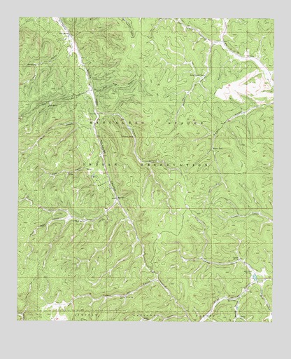
Firman Canyon, NM USGS Topographic Map
Click on map above to begin viewing in our Map Viewer.

This topographic map contains these locations and features:
Feature Name Type Latitude Longitude GNIS ID View Map
Baird CanyonValleyN33.0156°W105.6300°903502View Map
Breece WellLocaleN33.1165°W105.6586°904074View Map
Burnt CanyonValleyN33.1143°W105.6558°904215View Map
Burnt Canyon TankReservoirN33.1015°W105.6596°904219View Map
Cienega CanyonValleyN33.0198°W105.6344°905149View Map
Cienega SpringSpringN33.0256°W105.6425°905156View Map
Deer Flats SpringSpringN33.0207°W105.6360°905692View Map
East Five CanyonValleyN33.0948°W105.7144°905954View Map
East Telephone CanyonValleyN33.1140°W105.6497°905993View Map
Eight CanyonValleyN33.0687°W105.7094°906022View Map
Fireman LakeLakeN33.0770°W105.6975°929317View Map
Firman CanyonValleyN33.0854°W105.7122°906275View Map
Firman SpringSpringN33.0762°W105.6940°906276View Map
Five CanyonValleyN33.0962°W105.7155°906287View Map
Five SpringSpringN33.0886°W105.7358°906289View Map
George CanyonValleyN33.0093°W105.6417°906517View Map
Head SpringsSpringN33.1182°W105.7262°906893View Map
Headwater Picnic GroundsLocaleN33.1159°W105.7280°906895View Map
Horse SpringSpringN33.0416°W105.7179°907107View Map
Morgan TankReservoirN33.0724°W105.6552°908906View Map
Peso CanyonValleyN33.1170°W105.7261°909581View Map
Peso SpringSpringN33.1056°W105.7422°909582View Map
Potato Patch CanyonValleyN33.0429°W105.7233°909813View Map
Red CabinLocaleN33.0506°W105.7019°910043View Map
Seven CanyonValleyN33.0809°W105.7136°910956View Map
Shields DamDamN33.0854°W105.7122°911014View Map
Silver LakeReservoirN33.0188°W105.6344°924227View Map
Silver Springs DamDamN33.0184°W105.6339°923932View Map
Turkey Pen SpringSpringN33.0106°W105.7001°911886View Map
Water CanyonValleyN33.0493°W105.7019°912169View Map
Zinker CanyonValleyN33.0026°W105.6678°912551View Map

Note: Coordinates in the location and feature list above are referenced to NAD83 datum.


Copyright (C) 2008-2025 Ryan Niemi / Sunset Dynamics ... All Rights Reserved