TopoQuest Logo
Do you find TopoQuest useful?
Help keep TopoQuest running and adding new maps/features by donating!
Bitcoin:  19c7KJd3qBynnjoSw5npx9KScwjBe4ifkT
Litecoin:  LXs6TkuXGGXo1vDsWCkWVdjQX94eUKd6ui
Home View Maps Find Maps Find Places Resources & Links


Whiting Bayou, Mississippi Topographic Map

USGS Map Title: Whiting Bayou, MS
USGS Map MRC: 32091G1
DRG (GeoTIFF) Download: o32091g1.tif


Neighboring USGS Topographic Map Quads:


  Millikin, LA  
32091H2
 

  Mayersville, MS  
32091H1
 

  Rolling Fork West, MS  
32090H8
 

  Lake Providence, LA  
32091G2
 

  Whiting Bayou, MS  
32091G1
 

  Cary, MS  
32090G8
 

  Transylvania, LA  
32091F2
 

  Fitler, MS  
32091F1
 

  Onward, MS  
32090F8


Map MRC Location:

N33°
W92°
N33°
W91°
H8 H7 H6 H5 H4 H3 H2 H1
G8 G7 G6 G5 G4 G3 G2 G1
F8 F7 F6 F5 F4 F3 F2 F1
E8 E7 E6 E5 E4 E3 E2 E1
D8 D7 D6 D5 D4 D3 D2 D1
C8 C7 C6 C5 C4 C3 C2 C1
B8 B7 B6 B5 B4 B3 B2 B1
A8 A7 A6 A5 A4 A3 A2 A1
N32°
W92°
N32°
W91°

Whiting Bayou, MS USGS 1:24K Topographic Map Preview:
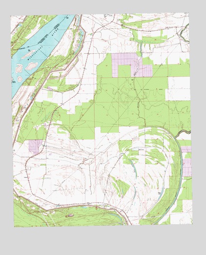
Whiting Bayou, MS USGS Topographic Map
Click on map above to begin viewing in our Map Viewer.

This topographic map contains these locations and features:
Feature Name Type Latitude Longitude GNIS ID View Map
Alexander (historical)Populated PlaceN32.8676°W91.0829°687577View Map
Anderson-Tully State Wildlife Management AreaParkN32.8126°W91.0584°687601View Map
Baleshed LandingLocaleN32.8429°W91.1054°711144View Map
Bear LakeLakeN32.7951°W91.0389°666654View Map
Benham (historical)Populated PlaceN32.8682°W91.1043°549553View Map
Carlisle LakeLakeN32.8349°W91.0778°668061View Map
Christian Home ChurchChurchN32.7518°W91.0448°668429View Map
Christmas Plantation (historical)LocaleN32.8724°W91.0668°687587View Map
Duncannon Plantation (historical)LocaleN32.8296°W91.1107°687590View Map
EllesliePopulated PlaceN32.8732°W91.0515°709489View Map
Evergreen Church (historical)ChurchN32.8287°W91.0893°687592View Map
Goose LakeLakeN32.7837°W91.0400°670520View Map
Holly Ridge LandingLocaleN32.8540°W91.0948°711150View Map
Holly Ridge Plantation (historical)LocaleN32.8535°W91.0690°687597View Map
Homochitto (historical)Populated PlaceN32.8676°W91.0601°687598View Map
Langwood Landing (historical)LocaleN32.8740°W91.0996°549558View Map
Longwood PlantationLocaleN32.8635°W91.1182°549559View Map
Moon LakeLakeN32.7687°W91.0215°673762View Map
Mount Sinai ChurchChurchN32.8710°W91.0498°674272View Map
Saint James ChurchChurchN32.7632°W91.0732°677037View Map
Saint Peters ChurchChurchN32.8662°W91.0154°677240View Map
Supervisor District 2CivilN32.8260°W91.0414°711891View Map
TallulaPopulated PlaceN32.7796°W91.1146°678549View Map
Whiting BayouStreamN32.8018°W91.0118°679646View Map
Whiting LakeLakeN32.7840°W91.0070°692342View Map
Woodland ChurchChurchN32.7921°W91.0501°679844View Map

Note: Coordinates in the location and feature list above are referenced to NAD83 datum.


Copyright (C) 2008-2024 Ryan Niemi / Sunset Dynamics ... All Rights Reserved