TopoQuest Logo
Do you find TopoQuest useful?
Help keep TopoQuest running and adding new maps/features by donating!
Bitcoin:  19c7KJd3qBynnjoSw5npx9KScwjBe4ifkT
Litecoin:  LXs6TkuXGGXo1vDsWCkWVdjQX94eUKd6ui
Home View Maps Find Maps Find Places Resources & Links


Mayersville, Mississippi Topographic Map

USGS Map Title: Mayersville, MS
USGS Map MRC: 32091H1
DRG (GeoTIFF) Download: o32091h1.tif


Neighboring USGS Topographic Map Quads:


  Readland, AR  
33091A2
 

  Glen Allan, MS  
33091A1
 

  Percy, MS  
33090A8
 

  Millikin, LA  
32091H2
 

  Mayersville, MS  
32091H1
 

  Rolling Fork West, MS  
32090H8
 

  Lake Providence, LA  
32091G2
 

  Whiting Bayou, MS  
32091G1
 

  Cary, MS  
32090G8


Map MRC Location:

N33°
W92°
N33°
W91°
H8 H7 H6 H5 H4 H3 H2 H1
G8 G7 G6 G5 G4 G3 G2 G1
F8 F7 F6 F5 F4 F3 F2 F1
E8 E7 E6 E5 E4 E3 E2 E1
D8 D7 D6 D5 D4 D3 D2 D1
C8 C7 C6 C5 C4 C3 C2 C1
B8 B7 B6 B5 B4 B3 B2 B1
A8 A7 A6 A5 A4 A3 A2 A1
N32°
W92°
N32°
W91°

Mayersville, MS USGS 1:24K Topographic Map Preview:
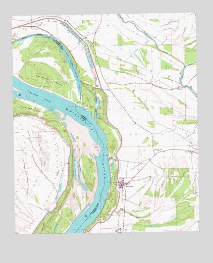
Mayersville, MS USGS Topographic Map
Click on map above to begin viewing in our Map Viewer.

This topographic map contains these locations and features:
Feature Name Type Latitude Longitude GNIS ID View Map
AddiePopulated PlaceN32.9873°W91.0759°691659View Map
AshlandPopulated PlaceN32.8876°W91.0512°709487View Map
Blue HoleLakeN32.9477°W91.0680°667294View Map
Browns LandingLocaleN32.9673°W91.0843°1631267View Map
Browns LandingLocaleN32.9676°W91.0807°687581View Map
CottonwoodPopulated PlaceN32.8885°W91.1018°541077View Map
Cottonwood Landing (historical)LocaleN32.8932°W91.0876°549554View Map
Duncansby LandingLocaleN32.9643°W91.0798°687591View Map
Duncansby TowheadIslandN32.9454°W91.1007°534655View Map
Heigle Field Airport (historical)AirportN32.9209°W91.0220°2676432View Map
HopedalePopulated PlaceN32.9571°W91.0126°671405View Map
Island Number NinetythreeAreaN32.8915°W91.0607°671737View Map
Issaquena County Correctional FacilityBuildingN32.9001°W91.0488°2739801View Map
Issaquena County CourthouseBuildingN32.9023°W91.0526°709492View Map
Issaquena County Sheriff's OfficeBuildingN32.9025°W91.0526°2754143View Map
Issaquena SchoolSchoolN32.9207°W91.0051°671745View Map
Lakeside Ferry (historical)CrossingN32.9579°W91.0076°687603View Map
MayersvillePopulated PlaceN32.9021°W91.0512°673260View Map
Mayersville Fire DepartmentBuildingN32.9031°W91.0520°2665785View Map
Mayersville Post OfficePost OfficeN32.9023°W91.0538°2768585View Map
Millers LandingPopulated PlaceN32.9171°W91.0609°692075View Map
Mills BayouGutN32.8843°W91.0443°673652View Map
Morning Star Church (historical)ChurchN32.8937°W91.0926°549560View Map
New Bethel ChurchChurchN32.9218°W91.0259°674578View Map
New Valewood DitchCanalN32.9821°W91.0462°674859View Map
Old River ChuteLakeN32.9735°W91.0862°555550View Map
Old River ChuteGutN32.9798°W91.0893°675233View Map
Opossum ChuteChannelN32.9532°W91.1062°537889View Map
Rose Hill ChurchChurchN32.8882°W91.0512°676862View Map
Skipwith LandingLocaleN32.9487°W91.0815°711156View Map
Supervisor District 3CivilN32.8889°W91.0249°711892View Map
Town of MayersvilleCivilN32.8964°W91.0467°2406112View Map
Valewood LandingLocaleN32.9876°W91.1154°549564View Map
Washington BayouStreamN32.9698°W91.0079°679359View Map
Wilderness Plantation (historical)LocaleN32.8848°W91.0543°687611View Map
Wilson PointCapeN32.9240°W91.0871°540487View Map
Wilson Point (historical)Populated PlaceN32.9243°W91.0871°549566View Map
Wilson Point Lake (historical)LakeN32.9215°W91.1046°549567View Map
Wilson Point Landing (historical)LocaleN32.9187°W91.0807°549568View Map

Note: Coordinates in the location and feature list above are referenced to NAD83 datum.


Copyright (C) 2008-2025 Ryan Niemi / Sunset Dynamics ... All Rights Reserved