TopoQuest Logo
Do you find TopoQuest useful?
Help keep TopoQuest running and adding new maps/features by donating!
Bitcoin:  19c7KJd3qBynnjoSw5npx9KScwjBe4ifkT
Litecoin:  LXs6TkuXGGXo1vDsWCkWVdjQX94eUKd6ui
Home View Maps Find Maps Find Places Resources & Links


Whitney Point, New York Topographic Map

USGS Map Title: Whitney Point, NY
USGS Map MRC: 42075C8
DRG (GeoTIFF) Download: o42075c8.tif


Neighboring USGS Topographic Map Quads:


  Marathon, NY  
42076D1
 

  Willet, NY  
42075D8
 

  Smithville Flats, NY  
42075D7
 

  Lisle, NY  
42076C1
 

  Whitney Point, NY  
42075C8
 

  Greene, NY  
42075C7
 

  Maine, NY  
42076B1
 

  Castle Creek, NY  
42075B8
 

  Chenango Forks, NY  
42075B7


Map MRC Location:

N43°
W76°
N43°
W75°
H8 H7 H6 H5 H4 H3 H2 H1
G8 G7 G6 G5 G4 G3 G2 G1
F8 F7 F6 F5 F4 F3 F2 F1
E8 E7 E6 E5 E4 E3 E2 E1
D8 D7 D6 D5 D4 D3 D2 D1
C8 C7 C6 C5 C4 C3 C2 C1
B8 B7 B6 B5 B4 B3 B2 B1
A8 A7 A6 A5 A4 A3 A2 A1
N42°
W76°
N42°
W75°

Whitney Point, NY USGS 1:24K Topographic Map Preview:
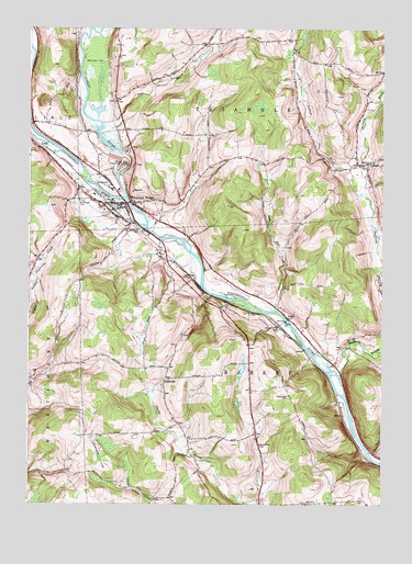
Whitney Point, NY USGS Topographic Map
Click on map above to begin viewing in our Map Viewer.

This topographic map contains these locations and features:
Feature Name Type Latitude Longitude GNIS ID View Map
Adams Street CemeteryCemeteryN42.2653°W75.9177°942170View Map
Bull CreekStreamN42.3009°W75.9135°945121View Map
Caryl E Adams Primary SchoolSchoolN42.3401°W75.9745°2597275View Map
Countryside Christian ChapelChurchN42.3031°W75.9101°2597307View Map
Dorchester CemeteryCemeteryN42.3558°W75.9698°2542956View Map
Dorchester EstatesPopulated PlaceN42.3450°W75.9658°2490758View Map
Ford Hill Country ClubLocaleN42.3166°W75.9856°2598424View Map
Grace Episcopal ChurchChurchN42.3293°W75.9696°2597321View Map
Green CemeteryCemeteryN42.3558°W75.9696°2542957View Map
Halfway BrookStreamN42.2784°W75.8871°952034View Map
Hyde Street CemeteryCemeteryN42.2920°W75.9477°2542960View Map
HydevillePopulated PlaceN42.2829°W75.9513°953565View Map
ItaskaPopulated PlaceN42.2990°W75.9080°953853View Map
Itaska CemeteryCemeteryN42.2967°W75.9115°953854View Map
King Street CemeteryCemeteryN42.2784°W75.9075°954639View Map
Lisle CemeteryCemeteryN42.3446°W75.9996°2542953View Map
Mary Wilcox Memorial LibraryBuildingN42.3292°W75.9697°2598432View Map
Meadowbrooke EstatesPopulated PlaceN42.3247°W75.9731°2490720View Map
Otselic RiverStreamN42.3306°W75.9655°959555View Map
Page BrookStreamN42.3498°W75.9744°959750View Map
Page Brook CemeteryCemeteryN42.3670°W75.9430°2542958View Map
Riverside CemeteryCemeteryN42.3226°W75.9610°962579View Map
Saint Patrick CemeteryCemeteryN42.3299°W75.9808°964057View Map
Saint Patrick's Catholic ChurchChurchN42.3405°W75.9765°2597353View Map
Strawberry Valley PitMineN42.3089°W75.9353°2712440View Map
Taft CemeteryCemeteryN42.3538°W75.8799°2542959View Map
Ticknor BrookStreamN42.3309°W75.8808°967509View Map
Tioughnioga River BridgeBridgeN42.3293°W75.9648°2598405View Map
Town of BarkerCivilN42.2802°W75.9127°978709View Map
Town of TriangleCivilN42.3678°W75.9206°979557View Map
TrianglePopulated PlaceN42.3398°W75.8802°967799View Map
Triangle Volunteer Fire CompanyBuildingN42.3390°W75.8873°2718293View Map
Valley Chapel ChurchChurchN42.3387°W75.8798°2597364View Map
Village of Whitney PointCivilN42.3303°W75.9679°2391217View Map
Whitney PointPopulated PlaceN42.3290°W75.9677°971191View Map
Whitney Point Fire DepartmentBuildingN42.3289°W75.9674°2735020View Map
Whitney Point Flood Control DamDamN42.3390°W75.9650°971192View Map
Whitney Point Intermediate SchoolSchoolN42.3326°W75.9709°2597285View Map
Whitney Point LakeReservoirN42.3390°W75.9649°1829073View Map
Whitney Point Post OfficePost OfficeN42.3289°W75.9690°2598388View Map
Whitney Point Rest AreaLocaleN42.3749°W75.9951°2598409View Map
Whitney Point Senior High SchoolSchoolN42.3387°W75.9744°2597287View Map
Whitney Point United Methodist ChurchChurchN42.3279°W75.9660°2597372View Map

Note: Coordinates in the location and feature list above are referenced to NAD83 datum.


Copyright (C) 2008-2024 Ryan Niemi / Sunset Dynamics ... All Rights Reserved