TopoQuest Logo
Do you find TopoQuest useful?
Help keep TopoQuest running and adding new maps/features by donating!
Bitcoin:  19c7KJd3qBynnjoSw5npx9KScwjBe4ifkT
Litecoin:  LXs6TkuXGGXo1vDsWCkWVdjQX94eUKd6ui
Home View Maps Find Maps Find Places Resources & Links


Willet, New York Topographic Map

USGS Map Title: Willet, NY
USGS Map MRC: 42075D8
DRG (GeoTIFF) Download: o42075d8.tif


Neighboring USGS Topographic Map Quads:


  McGraw, NY  
42076E1
 

  Cincinnatus, NY  
42075E8
 

  Pitcher, NY  
42075E7
 

  Marathon, NY  
42076D1
 

  Willet, NY  
42075D8
 

  Smithville Flats, NY  
42075D7
 

  Lisle, NY  
42076C1
 

  Whitney Point, NY  
42075C8
 

  Greene, NY  
42075C7


Map MRC Location:

N43°
W76°
N43°
W75°
H8 H7 H6 H5 H4 H3 H2 H1
G8 G7 G6 G5 G4 G3 G2 G1
F8 F7 F6 F5 F4 F3 F2 F1
E8 E7 E6 E5 E4 E3 E2 E1
D8 D7 D6 D5 D4 D3 D2 D1
C8 C7 C6 C5 C4 C3 C2 C1
B8 B7 B6 B5 B4 B3 B2 B1
A8 A7 A6 A5 A4 A3 A2 A1
N42°
W76°
N42°
W75°

Willet, NY USGS 1:24K Topographic Map Preview:
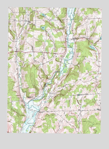
Willet, NY USGS Topographic Map
Click on map above to begin viewing in our Map Viewer.

This topographic map contains these locations and features:
Feature Name Type Latitude Longitude GNIS ID View Map
Barry RunStreamN42.4278°W75.9408°943088View Map
Beardsley CemeteryCemeteryN42.4512°W75.8969°943330View Map
Bloody PondLakeN42.4796°W75.9529°944278View Map
Clough CornersLocaleN42.3976°W75.9019°946914View Map
Gee BrookStreamN42.4884°W75.9155°950973View Map
GeorgetownPopulated PlaceN42.4692°W75.8930°951018View Map
Greene CemeteryCemeteryN42.4660°W75.9218°951668View Map
Hazard Corners CemeteryCemeteryN42.3990°W75.8764°2542949View Map
Hazzard CornersLocaleN42.3990°W75.8752°952472View Map
High LakeLakeN42.4922°W75.9524°952742View Map
Landers CornersLocaleN42.4148°W75.9421°955016View Map
Landers Corners Road BridgeBridgeN42.4235°W75.9486°2614936View Map
Landers CreekStreamN42.3984°W75.9583°955018View Map
Merrill CreekStreamN42.4026°W75.9713°957005View Map
Miller BrookStreamN42.4445°W75.9227°957296View Map
PenelopePopulated PlaceN42.4137°W75.8952°972931View Map
Place BrookStreamN42.4878°W75.9155°960655View Map
Stump PondLakeN42.4607°W75.8871°966657View Map
Texas ValleyPopulated PlaceN42.4862°W75.9730°967187View Map
Texas Valley CemeteryCemeteryN42.4860°W75.9741°2541969View Map
Town of WilletCivilN42.4507°W75.9161°979639View Map
Upper LislePopulated PlaceN42.3962°W75.9571°968282View Map
Upper Lisle CemeteryCemeteryN42.3932°W75.9594°2542950View Map
Upper Lisle Road BridgeBridgeN42.3967°W75.9599°2598407View Map
Whaupaunaucau CreekStreamN42.4445°W75.9552°970981View Map
WilletPopulated PlaceN42.4692°W75.9116°971290View Map
Willet CreekStreamN42.4678°W75.9194°971291View Map
Willet Village CemeteryCemeteryN42.4689°W75.9152°2541970View Map
Willet Volunteer Fire DepartmentBuildingN42.4690°W75.9116°2735053View Map

Note: Coordinates in the location and feature list above are referenced to NAD83 datum.


Copyright (C) 2008-2024 Ryan Niemi / Sunset Dynamics ... All Rights Reserved