TopoQuest Logo
Do you find TopoQuest useful?
Help keep TopoQuest running and adding new maps/features by donating!
Bitcoin:  19c7KJd3qBynnjoSw5npx9KScwjBe4ifkT
Litecoin:  LXs6TkuXGGXo1vDsWCkWVdjQX94eUKd6ui
Home View Maps Find Maps Find Places Resources & Links


Maine, New York Topographic Map

USGS Map Title: Maine, NY
USGS Map MRC: 42076B1
DRG (GeoTIFF) Download: o42076b1.tif


Neighboring USGS Topographic Map Quads:


  Richford, NY  
42076C2
 

  Lisle, NY  
42076C1
 

  Whitney Point, NY  
42075C8
 

  Newark Valley, NY  
42076B2
 

  Maine, NY  
42076B1
 

  Castle Creek, NY  
42075B8
 

  Apalachin, NY  
42076A2
 

  Endicott, NY  
42076A1
 

  Binghamton West, NY  
42075A8


Map MRC Location:

N43°
W77°
N43°
W76°
H8 H7 H6 H5 H4 H3 H2 H1
G8 G7 G6 G5 G4 G3 G2 G1
F8 F7 F6 F5 F4 F3 F2 F1
E8 E7 E6 E5 E4 E3 E2 E1
D8 D7 D6 D5 D4 D3 D2 D1
C8 C7 C6 C5 C4 C3 C2 C1
B8 B7 B6 B5 B4 B3 B2 B1
A8 A7 A6 A5 A4 A3 A2 A1
N42°
W77°
N42°
W76°

Maine, NY USGS 1:24K Topographic Map Preview:
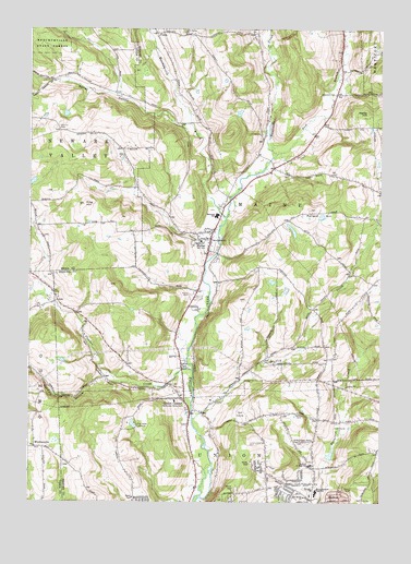
Maine, NY USGS Topographic Map
Click on map above to begin viewing in our Map Viewer.

This topographic map contains these locations and features:
Feature Name Type Latitude Longitude GNIS ID View Map
Allentown CemeteryCemeteryN42.2329°W76.0166°942374View Map
Bailey HollowValleyN42.2248°W76.0702°942789View Map
Berean ChurchChurchN42.1284°W76.0238°943719View Map
Bradley CreekStreamN42.1467°W76.0660°944578View Map
Broas Family CemeteryCemeteryN42.1275°W76.0275°2542964View Map
Chrysler Road CemeteryCemeteryN42.1408°W76.0278°2542963View Map
Cornell HollowValleyN42.1586°W76.0982°947465View Map
Crocker CreekStreamN42.1976°W76.1246°947757View Map
Crocker Creek Buffalo FarmLocaleN42.1781°W76.1206°2516992View Map
East Branch Nanticoke CreekStreamN42.2170°W76.0374°949008View Map
Endwell Fire Department Station 3BuildingN42.1411°W76.0269°2734672View Map
Endwell Greens Golf ClubLocaleN42.1463°W76.0123°2598422View Map
Endwell Junior High SchoolSchoolN42.1351°W76.0246°949659View Map
First Baptist Church of MaineChurchN42.1949°W76.0619°2597313View Map
Hardy HillSummitN42.2279°W76.0052°952222View Map
Hollenbeck CemeteryCemeteryN42.2168°W76.0917°2507609View Map
Holy Rosary ChurchChurchN42.1945°W76.0602°953093View Map
Ingalls SchoolSchoolN42.1940°W76.0635°953714View Map
Ketchumville BranchStreamN42.2004°W76.0552°970263View Map
Ketchumville State ForestForestN42.2476°W76.1191°954562View Map
King HillSummitN42.2037°W76.1055°954633View Map
MainePopulated PlaceN42.1926°W76.0610°956288View Map
Maine CemeteryCemeteryN42.1797°W76.0670°956289View Map
Maine Emergency SquadBuildingN42.1986°W76.0575°2720079View Map
Maine Federated ChurchChurchN42.1960°W76.0607°2597339View Map
Maine Fire CompanyBuildingN42.1971°W76.0620°2734690View Map
Maine Mobile ParkPopulated PlaceN42.1606°W76.0694°2490779View Map
Maine Post OfficePost OfficeN42.1948°W76.0608°2598380View Map
Maine Town HallBuildingN42.1966°W76.0610°2599614View Map
Maine-Endwell High SchoolSchoolN42.1279°W76.0224°956290View Map
Memorial SchoolSchoolN42.2006°W76.0583°2542990View Map
Molyneaux PlantationLocaleN42.1761°W76.0914°2517015View Map
Nanticoke Valley CemeteryCemeteryN42.1506°W76.0690°958249View Map
Northminster Presbyterian ChurchChurchN42.1270°W76.0246°2597345View Map
Oak Hill CemeteryCemeteryN42.1620°W76.0200°2542962View Map
Oakwoods Mobile Home CourtPopulated PlaceN42.1889°W76.0583°2490757View Map
Our Savior ChurchChurchN42.1265°W76.0266°959645View Map
Pine Valley CampsiteLocaleN42.1451°W76.0860°960561View Map
Pine Valley Recreational Vehicle Park and CampgroundLocaleN42.1458°W76.0889°2598415View Map
Pollard HillSummitN42.2026°W76.0252°960865View Map
Quick Mobile Home ParkPopulated PlaceN42.1981°W76.0864°2490786View Map
TionaPopulated PlaceN42.2486°W76.0800°2542989View Map
Tiona CemeteryCemeteryN42.2491°W76.0708°2542988View Map
Town of MaineCivilN42.2000°W76.0314°979184View Map
Town of UnionCivilN42.1258°W76.0330°979572View Map
Twining Trailer ParkPopulated PlaceN42.1789°W76.0650°2490783View Map
Union CenterPopulated PlaceN42.1515°W76.0691°968176View Map
Union Center Christian ChurchChurchN42.1514°W76.0730°2597361View Map
Union Center Fire Company Station 1BuildingN42.1463°W76.0683°2718696View Map
Union Center Fire Company Station 2BuildingN42.1419°W76.0422°2718697View Map
Union Center United Methodist ChurchChurchN42.1533°W76.0705°2597362View Map
WhittemorePopulated PlaceN42.1395°W76.1227°973267View Map
Whittemore Hill Methodist ChurchChurchN42.1397°W76.1228°2504879View Map
Zimmer CemeteryCemeteryN42.2236°W76.1145°971871View Map

Note: Coordinates in the location and feature list above are referenced to NAD83 datum.


Copyright (C) 2008-2024 Ryan Niemi / Sunset Dynamics ... All Rights Reserved