TopoQuest Logo
Do you find TopoQuest useful?
Help keep TopoQuest running and adding new maps/features by donating!
Bitcoin:  19c7KJd3qBynnjoSw5npx9KScwjBe4ifkT
Litecoin:  LXs6TkuXGGXo1vDsWCkWVdjQX94eUKd6ui
Home View Maps Find Maps Find Places Resources & Links


Burnside, Kentucky Topographic Map

USGS Map Title: Burnside, KY
USGS Map MRC: 36084H5
DRG (GeoTIFF) Download: o36084h5.tif


Neighboring USGS Topographic Map Quads:


  Delmer, KY  
37084A6
 

  Somerset, KY  
37084A5
 

  Dykes, KY  
37084A4
 

  Frazer, KY  
36084H6
 

  Burnside, KY  
36084H5
 

  Hail, KY  
36084H4
 

  Coopersville, KY  
36084G6
 

  Nevelsville, KY  
36084G5
 

  Wiborg, KY  
36084G4


Map MRC Location:

N37°
W85°
N37°
W84°
H8 H7 H6 H5 H4 H3 H2 H1
G8 G7 G6 G5 G4 G3 G2 G1
F8 F7 F6 F5 F4 F3 F2 F1
E8 E7 E6 E5 E4 E3 E2 E1
D8 D7 D6 D5 D4 D3 D2 D1
C8 C7 C6 C5 C4 C3 C2 C1
B8 B7 B6 B5 B4 B3 B2 B1
A8 A7 A6 A5 A4 A3 A2 A1
N36°
W85°
N36°
W84°

Burnside, KY USGS 1:24K Topographic Map Preview:
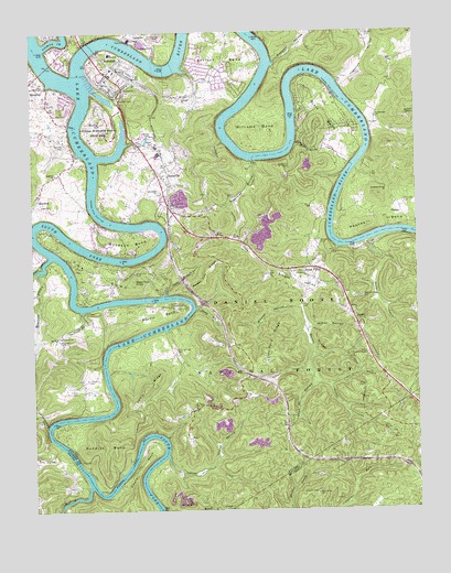
Burnside, KY USGS Topographic Map
Click on map above to begin viewing in our Map Viewer.

This topographic map contains these locations and features:
Feature Name Type Latitude Longitude GNIS ID View Map
AlpinePopulated PlaceN36.9251°W84.5208°510247View Map
Alpine Recreation AreaParkN36.9154°W84.5163°510248View Map
Antioch BendBendN36.9926°W84.5630°510287View Map
Antioch ChurchChurchN36.9829°W84.5749°510290View Map
Baker Spring CreekStreamN36.9706°W84.5391°510364View Map
Big South Fork Cumberland RiverStreamN36.9851°W84.6069°515542View Map
BronstonPopulated PlaceN36.9856°W84.6230°510939View Map
Bronston Fire DepartmentBuildingN36.9651°W84.6137°2637034View Map
Bunker HillSummitN36.9762°W84.6016°511069View Map
BurnsidePopulated PlaceN36.9890°W84.5999°511083View Map
Burnside DivisionCivilN36.9435°W84.5606°1936902View Map
Burnside Fire DepartmentBuildingN36.9900°W84.6016°2636487View Map
Burnside Police DepartmentBuildingN36.9901°W84.6015°2767636View Map
Cain BranchStreamN36.9315°W84.5822°511125View Map
Camp Burnside Historical MarkerParkN36.9909°W84.6066°2744707View Map
Camp Burnside Historical MarkerParkN36.9758°W84.5978°2744708View Map
Cave Springs CemeteryCemeteryN36.9170°W84.5788°511282View Map
Cedar Sinking CreekStreamN36.9412°W84.6188°511301View Map
Cox BendBendN36.9381°W84.6066°511606View Map
Cumberland ChurchChurchN36.9776°W84.5127°511674View Map
Curt Pond RidgeRidgeN36.9195°W84.5466°516636View Map
Dead Ox HollowValleyN36.9084°W84.5335°511754View Map
Deep HollowValleyN36.9277°W84.5714°490759View Map
Dixie BendBendN36.9792°W84.5283°511827View Map
Dixie SchoolSchoolN36.9690°W84.5341°511828View Map
Drippling Spring ChurchChurchN36.9587°W84.5097°511892View Map
Dry ValleyValleyN36.8915°W84.6171°511936View Map
First Boy Scout Troop Historical MarkerParkN36.9893°W84.6002°2744709View Map
Garland BranchStreamN36.9270°W84.6091°512278View Map
Garland SchoolSchoolN36.9195°W84.6158°512279View Map
General Burnside Island State ParkParkN36.9740°W84.6024°512296View Map
Gibson CemeteryCemeteryN36.9062°W84.6105°512304View Map
Gourd CemeteryCemeteryN36.8923°W84.5848°2568816View Map
Gourd NeckCapeN36.8876°W84.5899°512357View Map
Grave Hill CemeteryCemeteryN36.9373°W84.5916°512395View Map
Grave Hill ChurchChurchN36.9581°W84.5827°512396View Map
Gut Lick BranchStreamN36.9076°W84.5291°512486View Map
Hall ChapelChurchN36.9912°W84.5080°512523View Map
Hamilton CemeteryCemeteryN36.9553°W84.5041°512536View Map
Harriet Simpson Arnow Historical MarkerParkN36.9921°W84.6032°2744713View Map
Hayes BranchStreamN36.9826°W84.5977°512605View Map
Haynes BendBendN36.9509°W84.5191°512610View Map
Haynes CemeteryCemeteryN36.9984°W84.5158°512611View Map
Hollers CemeteryCemeteryN36.9092°W84.6072°512748View Map
Indian CreekStreamN36.8892°W84.5813°512898View Map
John Sherman Cooper Power PlantLocaleN36.9981°W84.5927°2725946View Map
Jugornot HollowValleyN36.9867°W84.5246°513090View Map
Keith Post Office (historical)Post OfficeN36.8895°W84.6187°2568838View Map
KenoPopulated PlaceN36.8940°W84.5747°513123View Map
Lewis RidgeRidgeN36.9070°W84.5883°513366View Map
Maces Ferry (historical)CrossingN36.9921°W84.5477°2725688View Map
Martin BendBendN36.9265°W84.5836°513800View Map
Martin CreekStreamN36.9260°W84.5371°513805View Map
Mayfield BranchStreamN36.9376°W84.6222°513836View Map
Mayfield CemeteryCemeteryN36.8813°W84.6141°2568852View Map
McKee HollowValleyN36.9226°W84.5348°513874View Map
Minton HollowValleyN36.9282°W84.5381°514028View Map
Mount Union Baptist Church CemeteryCemeteryN36.9014°W84.5743°2725620View Map
Mount Union SchoolSchoolN36.9017°W84.5724°514112View Map
Neelys CemeteryCemeteryN36.9451°W84.5319°514214View Map
Neelys CreekStreamN36.9345°W84.5136°514215View Map
Neelys Creek ChurchChurchN36.9306°W84.5174°514216View Map
Old Alpine Railroad Station (historical)LocaleN36.9156°W84.5232°2725869View Map
OmegaPopulated PlaceN36.9520°W84.5086°514355View Map
Owens CemeteryCemeteryN36.9959°W84.5844°514394View Map
Piney Grove ChurchChurchN36.9206°W84.6169°514609View Map
Pitman CreekStreamN36.9962°W84.6202°514627View Map
Pumpkin HollowValleyN36.9913°W84.5462°514793View Map
Quinton CemeteryCemeteryN36.9706°W84.6138°514813View Map
Quinton ChurchChurchN36.9629°W84.6169°514814View Map
Roberts BendBendN36.8898°W84.6055°514998View Map
Roberts Mill (historical)LocaleN36.8836°W84.6055°2725879View Map
Seed Tick KnobSummitN36.9351°W84.5919°515320View Map
Sinking CreekStreamN36.8815°W84.6072°515432View Map
Sloans ValleyBasinN36.9317°W84.5358°515493View Map
Sloans ValleyPopulated PlaceN36.9367°W84.5374°515494View Map
Sloans Valley Railroad Station (historical)LocaleN36.9375°W84.5325°2725899View Map
Sugartree HollowValleyN36.9660°W84.5525°515802View Map
Sweet Lily RidgeRidgeN36.9376°W84.5680°515833View Map
TatevillePopulated PlaceN36.9645°W84.5813°515876View Map
Tateville CemeteryCemeteryN36.9607°W84.5798°2725663View Map
Tateville Fire DepartmentBuildingN36.9561°W84.5831°2636315View Map
Tateville Railroad Station (historical)LocaleN36.9607°W84.5804°2725902View Map
Thatch HollowValleyN36.8860°W84.5671°515904View Map
Williams BendBendN36.9729°W84.5513°516379View Map
Woodson BendBendN36.9448°W84.5922°516476View Map
Woodson Bend ResortLocaleN36.9459°W84.6041°1890203View Map
WSEK-FM (Somerset)TowerN36.9612°W84.5686°518024View Map

Note: Coordinates in the location and feature list above are referenced to NAD83 datum.


Copyright (C) 2008-2025 Ryan Niemi / Sunset Dynamics ... All Rights Reserved