TopoQuest Logo
Do you find TopoQuest useful?
Help keep TopoQuest running and adding new maps/features by donating!
Bitcoin:  19c7KJd3qBynnjoSw5npx9KScwjBe4ifkT
Litecoin:  LXs6TkuXGGXo1vDsWCkWVdjQX94eUKd6ui
Home View Maps Find Maps Find Places Resources & Links


Wickiup Creek, Montana Topographic Map

USGS Map Title: Wickiup Creek, MT
USGS Map MRC: 45112F5
DRG (GeoTIFF) Download: o45112f5.tif


Neighboring USGS Topographic Map Quads:


  Tucker Creek, MT  
45112G6
 

  Mount Humbug, MT  
45112G5
 

  Pipestone Pass, MT  
45112G4
 

  Melrose, MT  
45112F6
 

  Wickiup Creek, MT  
45112F5
 

  Table Mountain, MT  
45112F4
 

  Earls Gulch, MT  
45112E6
 

  Nez Perce Hollow, MT  
45112E5
 

  Twin Bridges SW, MT  
45112E4


Map MRC Location:

N46°
W113°
N46°
W112°
H8 H7 H6 H5 H4 H3 H2 H1
G8 G7 G6 G5 G4 G3 G2 G1
F8 F7 F6 F5 F4 F3 F2 F1
E8 E7 E6 E5 E4 E3 E2 E1
D8 D7 D6 D5 D4 D3 D2 D1
C8 C7 C6 C5 C4 C3 C2 C1
B8 B7 B6 B5 B4 B3 B2 B1
A8 A7 A6 A5 A4 A3 A2 A1
N45°
W113°
N45°
W112°

Wickiup Creek, MT USGS 1:24K Topographic Map Preview:
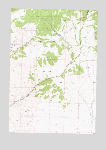
Wickiup Creek, MT USGS Topographic Map
Click on map above to begin viewing in our Map Viewer.

This topographic map contains these locations and features:
Feature Name Type Latitude Longitude GNIS ID View Map
Blacktail CreekStreamN45.7291°W112.5606°780051View Map
Clipper MineMineN45.7249°W112.5606°805187View Map
Columbia MineMineN45.6763°W112.5522°805188View Map
Cow CampLocaleN45.7324°W112.5322°781769View Map
King and Queen HillSummitN45.7013°W112.5706°785738View Map
Little Camp CreekStreamN45.7138°W112.5259°786265View Map
Lizzie Ann MineMineN45.6269°W112.5075°804315View Map
Locust-Assey MineMineN45.6924°W112.6106°805204View Map
Moffet GulchValleyN45.7169°W112.5470°787534View Map
Moffet MountainSummitN45.7171°W112.5870°787535View Map
NE NE Section 20 MineMineN45.6555°W112.6142°804373View Map
NE NE Section 28 MineMineN45.6410°W112.5889°804374View Map
NE NE Section 8 MineMineN45.6827°W112.6125°805243View Map
NE NW Section 11 MineMineN45.6830°W112.5586°805223View Map
NE NW Section 20 MineMineN45.6544°W112.6189°805210View Map
NE SE Section 29 MineMineN45.6327°W112.5959°804368View Map
NE SW Section 21 MineMineN45.6458°W112.6011°804372View Map
NE SW Section 4 MineMineN45.6894°W112.6020°805205View Map
Negro MountainSummitN45.7299°W112.6095°787931View Map
Norwood Post Office (historical)Post OfficeN45.7046°W112.5981°1797829View Map
NW SE Section 28 MineMineN45.6327°W112.5986°804369View Map
NW SW Section 28 MineMineN45.7202°W112.6036°805246View Map
Pandora MountainSummitN45.7121°W112.5764°788609View Map
Pandora/Pilon MineMineN45.7010°W112.6120°805206View Map
Penobscot MineMineN45.6310°W112.5095°804313View Map
Sawmill GulchValleyN45.7219°W112.5253°790075View Map
SE SE Section 17 MineMineN45.6574°W112.6134°805211View Map
SE SW Section 12 MineMineN45.6730°W112.5364°804370View Map
SE SW Section 2 MineMineN45.6880°W112.5570°805222View Map
SE SW Section 29 MineMineN45.7166°W112.6214°805216View Map
SE SW Section 3 MineMineN45.6855°W112.5786°805224View Map
Smith DamDamN45.6516°W112.6209°795364View Map
Spring MineMineN45.6596°W112.6136°805220View Map
Summit/Mount Hecla MineMineN45.7130°W112.6189°805215View Map
SW NE Section 11 MineMineN45.6785°W112.5531°804387View Map
SW NE Section 28 MineMineN45.6355°W112.5953°804375View Map
SW NE Section 32 MineMineN45.7069°W112.6175°805249View Map
SW SE Section 17 MineMineN45.6574°W112.6153°805208View Map
SW SE Section 21 MineMineN45.6430°W112.5986°804367View Map
Wickiup CreekStreamN45.6974°W112.5353°793265View Map
Willow CreekStreamN45.7046°W112.5267°793357View Map
Yellow Metal MineMineN45.6269°W112.5050°804314View Map

Note: Coordinates in the location and feature list above are referenced to NAD83 datum.


Copyright (C) 2008-2025 Ryan Niemi / Sunset Dynamics ... All Rights Reserved