TopoQuest Logo
Do you find TopoQuest useful?
Help keep TopoQuest running and adding new maps/features by donating!
Bitcoin:  19c7KJd3qBynnjoSw5npx9KScwjBe4ifkT
Litecoin:  LXs6TkuXGGXo1vDsWCkWVdjQX94eUKd6ui
Home View Maps Find Maps Find Places Resources & Links


Table Mountain, Montana Topographic Map

USGS Map Title: Table Mountain, MT
USGS Map MRC: 45112F4
DRG (GeoTIFF) Download: o45112f4.tif


Neighboring USGS Topographic Map Quads:


  Mount Humbug, MT  
45112G5
 

  Pipestone Pass, MT  
45112G4
 

  Grace, MT  
45112G3
 

  Wickiup Creek, MT  
45112F5
 

  Table Mountain, MT  
45112F4
 

  Silver Star, MT  
45112F3
 

  Nez Perce Hollow, MT  
45112E5
 

  Twin Bridges SW, MT  
45112E4
 

  Twin Bridges, MT  
45112E3


Map MRC Location:

N46°
W113°
N46°
W112°
H8 H7 H6 H5 H4 H3 H2 H1
G8 G7 G6 G5 G4 G3 G2 G1
F8 F7 F6 F5 F4 F3 F2 F1
E8 E7 E6 E5 E4 E3 E2 E1
D8 D7 D6 D5 D4 D3 D2 D1
C8 C7 C6 C5 C4 C3 C2 C1
B8 B7 B6 B5 B4 B3 B2 B1
A8 A7 A6 A5 A4 A3 A2 A1
N45°
W113°
N45°
W112°

Table Mountain, MT USGS 1:24K Topographic Map Preview:
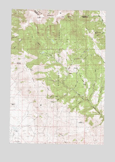
Table Mountain, MT USGS Topographic Map
Click on map above to begin viewing in our Map Viewer.

This topographic map contains these locations and features:
Feature Name Type Latitude Longitude GNIS ID View Map
Big Bonanza MineMineN45.6366°W112.4903°779766View Map
Big MountainSummitN45.6935°W112.4753°779845View Map
Big RidgeRidgeN45.6730°W112.4658°779861View Map
Big Sheep MountainSummitN45.6433°W112.3947°790365View Map
Billy Johns TrailTrailN45.7071°W112.3989°793747View Map
Box CanyonValleyN45.6666°W112.4039°780325View Map
Brazil GulchValleyN45.6683°W112.4336°780375View Map
Brazil Pack TrailTrailN45.6938°W112.4439°780376View Map
Brazil RidgeRidgeN45.6791°W112.4558°780377View Map
Bull PenValleyN45.6763°W112.4183°780576View Map
Bull Pen GulchValleyN45.6702°W112.4081°1930517View Map
Bull Pen SpringSpringN45.6809°W112.4010°780577View Map
Dougherty ButteSummitN45.6624°W112.4983°782507View Map
East Fork Hell CreekStreamN45.6933°W112.4267°782855View Map
East PeakSummitN45.7458°W112.4383°782942View Map
Elgin MineMineN45.6252°W112.4950°771175View Map
Grassy MountainSummitN45.6977°W112.4639°1930516View Map
Hells CanyonValleyN45.6499°W112.3772°784745View Map
Hells Canyon Guard StationLocaleN45.6908°W112.4250°784747View Map
Highland MountainsRangeN45.7260°W112.4789°784869View Map
Julia Lee MineMineN45.6769°W112.3917°785587View Map
Little Cherry Creek SpringsSpringN45.7288°W112.3902°786271View Map
Little Sheep MountainSummitN45.6288°W112.4136°1930515View Map
NE Section 32 MineMineN45.6260°W112.4883°804309View Map
Red MountainSummitN45.7446°W112.4783°789465View Map
Sawmill GulchValleyN45.6760°W112.4170°806256View Map
Second CreekStreamN45.6844°W112.3770°790177View Map
Seidensticker Number Two SpringSpringN45.6988°W112.4878°790206View Map
Silica ButteSummitN45.6952°W112.4178°790489View Map
Steels PassGapN45.6608°W112.4614°791481View Map
Steels Pass CreekStreamN45.6760°W112.4181°791482View Map
SW Section 29 MineMineN45.6305°W112.4981°804317View Map
Table MountainSummitN45.7421°W112.4620°791849View Map
The BarRidgeN45.7216°W112.4253°793745View Map
Third CreekStreamN45.6652°W112.3958°792065View Map
West PeakSummitN45.7335°W112.4841°2486866View Map
White Pine RidgeRidgeN45.7346°W112.4058°793204View Map

Note: Coordinates in the location and feature list above are referenced to NAD83 datum.


Copyright (C) 2008-2025 Ryan Niemi / Sunset Dynamics ... All Rights Reserved