TopoQuest Logo
Do you find TopoQuest useful?
Help keep TopoQuest running and adding new maps/features by donating!
Bitcoin:  19c7KJd3qBynnjoSw5npx9KScwjBe4ifkT
Litecoin:  LXs6TkuXGGXo1vDsWCkWVdjQX94eUKd6ui
Home View Maps Find Maps Find Places Resources & Links


Willamar SW, Texas Topographic Map

USGS Map Title: Willamar SW, TX
USGS Map MRC: 26097C6
DRG (GeoTIFF) Download: o26097c6.tif


Neighboring USGS Topographic Map Quads:


  Raymondville, TX  
26097D7
 

  San Perlita South, TX  
26097D6
 

  Willamar, TX  
26097D5
 

  Santa Rosa, TX  
26097C7
 

  Willamar SW, TX  
26097C6
 

  Paso Real, TX  
26097C5
 

  La Feria, TX  
26097B7
 

  Harlingen, TX  
26097B6
 

  Rio Hondo, TX  
26097B5


Map MRC Location:

N27°
W98°
N27°
W97°
H8 H7 H6 H5 H4 H3 H2 H1
G8 G7 G6 G5 G4 G3 G2 G1
F8 F7 F6 F5 F4 F3 F2 F1
E8 E7 E6 E5 E4 E3 E2 E1
D8 D7 D6 D5 D4 D3 D2 D1
C8 C7 C6 C5 C4 C3 C2 C1
B8 B7 B6 B5 B4 B3 B2 B1
A8 A7 A6 A5 A4 A3 A2 A1
N26°
W98°
N26°
W97°

Willamar SW, TX USGS 1:24K Topographic Map Preview:
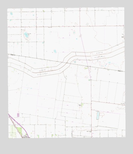
Willamar SW, TX USGS Topographic Map
Click on map above to begin viewing in our Map Viewer.

This topographic map contains these locations and features:
Feature Name Type Latitude Longitude GNIS ID View Map
Aldale RanchLocaleN26.3473°W97.6258°1329335View Map
Bracero CampLocaleN26.3576°W97.7064°1331169View Map
Briggs Colman SchoolSchoolN26.2559°W97.6619°1331269View Map
Dishman Elementary SchoolSchoolN26.2522°W97.7317°1334386View Map
El Graza RanchLocaleN26.2817°W97.6744°1335194View Map
Esperanza Farms LakeReservoirN26.2714°W97.6545°1862245View Map
Esperanza Farms LeveeDamN26.2754°W97.6536°1862244View Map
Hardin RanchLocaleN26.2826°W97.6255°1337338View Map
LasanaPopulated PlaceN26.2506°W97.6972°1852724View Map
Lasana Census Designated PlaceCensusN26.2585°W97.6950°2408583View Map
Lasana ColoniaPopulated PlaceN26.2523°W97.6942°2010283View Map
Noyola CemeteryCemeteryN26.3492°W97.6261°1342909View Map
Pilot ChannelCanalN26.3142°W97.7244°1344013View Map
Santa Rosa LakeLakeN26.3498°W97.7303°1346671View Map
Sebastian DivisionCivilN26.3485°W97.6962°1939181View Map

Note: Coordinates in the location and feature list above are referenced to NAD83 datum.


Copyright (C) 2008-2025 Ryan Niemi / Sunset Dynamics ... All Rights Reserved