TopoQuest Logo
Do you find TopoQuest useful?
Help keep TopoQuest running and adding new maps/features by donating!
Bitcoin:  19c7KJd3qBynnjoSw5npx9KScwjBe4ifkT
Litecoin:  LXs6TkuXGGXo1vDsWCkWVdjQX94eUKd6ui
Home View Maps Find Maps Find Places Resources & Links


Cincinnatus, New York Topographic Map

USGS Map Title: Cincinnatus, NY
USGS Map MRC: 42075E8
DRG (GeoTIFF) Download: o42075e8.tif


Neighboring USGS Topographic Map Quads:


  Truxton, NY  
42076F1
 

  Cuyler, NY  
42075F8
 

  South Otselic, NY  
42075F7
 

  McGraw, NY  
42076E1
 

  Cincinnatus, NY  
42075E8
 

  Pitcher, NY  
42075E7
 

  Marathon, NY  
42076D1
 

  Willet, NY  
42075D8
 

  Smithville Flats, NY  
42075D7


Map MRC Location:

N43°
W76°
N43°
W75°
H8 H7 H6 H5 H4 H3 H2 H1
G8 G7 G6 G5 G4 G3 G2 G1
F8 F7 F6 F5 F4 F3 F2 F1
E8 E7 E6 E5 E4 E3 E2 E1
D8 D7 D6 D5 D4 D3 D2 D1
C8 C7 C6 C5 C4 C3 C2 C1
B8 B7 B6 B5 B4 B3 B2 B1
A8 A7 A6 A5 A4 A3 A2 A1
N42°
W76°
N42°
W75°

Cincinnatus, NY USGS 1:24K Topographic Map Preview:
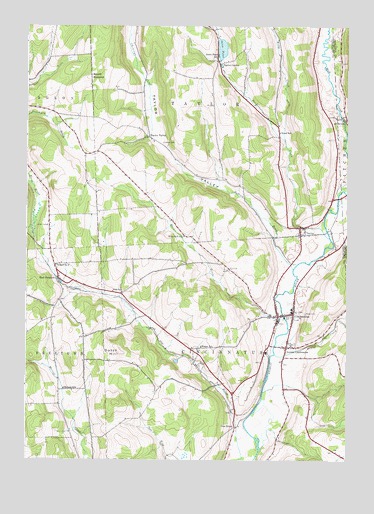
Cincinnatus, NY USGS Topographic Map
Click on map above to begin viewing in our Map Viewer.

This topographic map contains these locations and features:
Feature Name Type Latitude Longitude GNIS ID View Map
Brakel CreekStreamN42.5303°W75.9030°944608View Map
CincinnatusPopulated PlaceN42.5423°W75.8958°946699View Map
Cincinnatus CemeteryCemeteryN42.5455°W75.8971°2541957View Map
Cincinnatus Elementary SchoolSchoolN42.5434°W75.8961°2668827View Map
Cincinnatus High SchoolSchoolN42.5434°W75.8974°2669206View Map
Cincinnatus Middle SchoolSchoolN42.5437°W75.8964°2669151View Map
Cincinnatus Volunteer Fire DepartmentBuildingN42.5416°W75.8985°2734728View Map
Dutch HillSummitN42.5312°W75.9635°948854View Map
East FreetownPopulated PlaceN42.5520°W75.9871°949076View Map
First Baptist ChurchChurchN42.5336°W75.8959°2615945View Map
Fish SchoolSchoolN42.5481°W75.9624°950153View Map
Gee BrookPopulated PlaceN42.5092°W75.9183°972530View Map
Hawley CemeteryCemeteryN42.5914°W75.9469°952417View Map
Holland CemeteryCemeteryN42.5947°W75.9556°2541959View Map
Holmes CemeteryCemeteryN42.5430°W75.9067°2541956View Map
HydevillePopulated PlaceN42.5978°W75.8752°972643View Map
Kellogg Free LibraryBuildingN42.5419°W75.9013°2617323View Map
Knickerbocker Country ClubLocaleN42.5536°W75.9158°2615422View Map
Loope CemeteryCemeteryN42.5674°W75.9919°955987View Map
Lower CincinnatusPopulated PlaceN42.5326°W75.8983°956078View Map
Lower Cincinnatus CemeteryCemeteryN42.5337°W75.8953°2541955View Map
Mallory BrookStreamN42.5551°W75.8958°956306View Map
Mead BrookStreamN42.5406°W75.8988°956855View Map
Minard SchoolSchoolN42.5203°W75.9849°957374View Map
Mount RoderickSummitN42.6103°W75.9752°962796View Map
Mudge SchoolSchoolN42.5326°W75.9316°958124View Map
Our Lady of Perpetual Help ChurchChurchN42.5383°W75.8961°2616195View Map
Pond CreekStreamN42.5642°W75.8819°960888View Map
School Number 2 (historical)SchoolN42.5562°W75.9883°975168View Map
School Number 6 (historical)SchoolN42.5917°W75.9503°2108285View Map
School Number 7 (historical)SchoolN42.5642°W75.8936°2108287View Map
Solon PondLakeN42.6186°W75.9239°965628View Map
Solon Pond SchoolSchoolN42.6165°W75.9255°965629View Map
TaylorPopulated PlaceN42.5670°W75.8933°967076View Map
Taylor CemeteryCemeteryN42.5655°W75.8946°2541958View Map
Taylor CenterPopulated PlaceN42.6140°W75.9249°967084View Map
Taylor ValleyPopulated PlaceN42.5931°W75.9524°973144View Map
Taylor ValleyValleyN42.5570°W75.8983°967103View Map
Taylor Wesleyan ChurchChurchN42.5652°W75.8935°2616307View Map
Town of CincinnatusCivilN42.5257°W75.9208°978827View Map
Town of TaylorCivilN42.6083°W75.9274°979541View Map
United Presbyterian ChurchChurchN42.5448°W75.8992°2617137View Map
Wells CreekStreamN42.5920°W75.8994°969047View Map
West Hill SchoolSchoolN42.5645°W75.9385°969266View Map
Wood SchoolSchoolN42.5942°W75.9013°971605View Map

Note: Coordinates in the location and feature list above are referenced to NAD83 datum.


Copyright (C) 2008-2024 Ryan Niemi / Sunset Dynamics ... All Rights Reserved