TopoQuest Logo
Do you find TopoQuest useful?
Help keep TopoQuest running and adding new maps/features by donating!
Bitcoin:  19c7KJd3qBynnjoSw5npx9KScwjBe4ifkT
Litecoin:  LXs6TkuXGGXo1vDsWCkWVdjQX94eUKd6ui
Home View Maps Find Maps Find Places Resources & Links


Laytonville, California Topographic Map

USGS Map Title: Laytonville, CA
USGS Map MRC: 39123F4
DRG (GeoTIFF) Download: o39123f4.tif


Neighboring USGS Topographic Map Quads:


  Tan Oak Park, CA  
39123G5
 

  Iron Peak, CA  
39123G4
 

  Covelo West, CA  
39123G3
 

  Cahto Peak, CA  
39123F5
 

  Laytonville, CA  
39123F4
 

  Dos Rios, CA  
39123F3
 

  Sherwood Peak, CA  
39123E5
 

  Longvale, CA  
39123E4
 

  Willis Ridge, CA  
39123E3


Map MRC Location:

N40°
W124°
N40°
W123°
H8 H7 H6 H5 H4 H3 H2 H1
G8 G7 G6 G5 G4 G3 G2 G1
F8 F7 F6 F5 F4 F3 F2 F1
E8 E7 E6 E5 E4 E3 E2 E1
D8 D7 D6 D5 D4 D3 D2 D1
C8 C7 C6 C5 C4 C3 C2 C1
B8 B7 B6 B5 B4 B3 B2 B1
A8 A7 A6 A5 A4 A3 A2 A1
N39°
W124°
N39°
W123°

Laytonville, CA USGS 1:24K Topographic Map Preview:
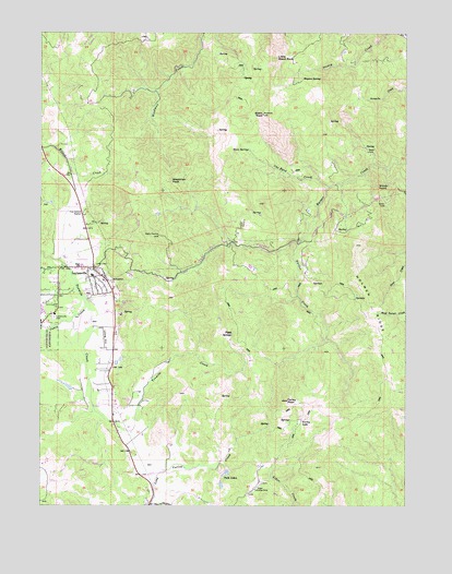
Laytonville, CA USGS Topographic Map
Click on map above to begin viewing in our Map Viewer.

This topographic map contains these locations and features:
Feature Name Type Latitude Longitude GNIS ID View Map
Bear Pen CanyonValleyN39.6949°W123.4131°218865View Map
Black RockSummitN39.7282°W123.4250°219402View Map
Black Rock RanchLocaleN39.6996°W123.4320°1724064View Map
Cahto CreekStreamN39.6802°W123.4867°220369View Map
California Department of Forestry and Fire Protection LaytonvilleBuildingN39.7018°W123.4862°1724100View Map
Farley LakeLakeN39.6477°W123.4117°223396View Map
Farley PeakSummitN39.6527°W123.4164°223397View Map
Hanke RanchLocaleN39.7157°W123.4014°1724092View Map
Holmen RidgeRidgeN39.6788°W123.3886°225463View Map
LaytonvillePopulated PlaceN39.6882°W123.4828°1658951View Map
Laytonville CemeteryCemeteryN39.6746°W123.4964°226974View Map
Laytonville Census Designated PlaceCensusN39.6715°W123.4946°2408589View Map
Laytonville Continuation High SchoolSchoolN39.6894°W123.4892°2516056View Map
Laytonville Elementary - Middle SchoolSchoolN39.6858°W123.4838°1724099View Map
Laytonville High SchoolSchoolN39.6894°W123.4891°1724101View Map
Laytonville Post OfficePost OfficeN39.6857°W123.4821°2760061View Map
Little Black RockSummitN39.7432°W123.4200°227194View Map
Long Valley Volunteer Fire Protection DistrictBuildingN39.6872°W123.4852°2621793View Map
Meyers SpringSpringN39.7374°W123.4118°228562View Map
One Eyed CreekStreamN39.7093°W123.4025°230037View Map
Piggy SpringsSpringN39.6705°W123.4354°230646View Map
Twin LakesLakeN39.6336°W123.4376°236695View Map
Twin SpringsSpringN39.7190°W123.4295°236721View Map
Vinton LakeLakeN39.7231°W123.3755°237102View Map
Windy PointCliffN39.7090°W123.3853°238031View Map
Woodman PeakSummitN39.7113°W123.4564°238140View Map

Note: Coordinates in the location and feature list above are referenced to NAD83 datum.


Copyright (C) 2008-2025 Ryan Niemi / Sunset Dynamics ... All Rights Reserved