TopoQuest Logo
Do you find TopoQuest useful?
Help keep TopoQuest running and adding new maps/features by donating!
Bitcoin:  19c7KJd3qBynnjoSw5npx9KScwjBe4ifkT
Litecoin:  LXs6TkuXGGXo1vDsWCkWVdjQX94eUKd6ui
Home View Maps Find Maps Find Places Resources & Links


Wilson Creek, Louisiana Topographic Map

USGS Map Title: Wilson Creek, LA
USGS Map MRC: 32092D7
DRG (GeoTIFF) Download: o32092d7.tif


Neighboring USGS Topographic Map Quads:


  Arcadia, LA  
32092E8
 

  Simsboro, LA  
32092E7
 

  Ruston West, LA  
32092E6
 

  Bryceland, LA  
32092D8
 

  Wilson Creek, LA  
32092D7
 

  Clay, LA  
32092D6
 

  Bienville, LA  
32092C8
 

  Mount Olive, LA  
32092C7
 

  Jonesboro North, LA  
32092C6


Map MRC Location:

N33°
W93°
N33°
W92°
H8 H7 H6 H5 H4 H3 H2 H1
G8 G7 G6 G5 G4 G3 G2 G1
F8 F7 F6 F5 F4 F3 F2 F1
E8 E7 E6 E5 E4 E3 E2 E1
D8 D7 D6 D5 D4 D3 D2 D1
C8 C7 C6 C5 C4 C3 C2 C1
B8 B7 B6 B5 B4 B3 B2 B1
A8 A7 A6 A5 A4 A3 A2 A1
N32°
W93°
N32°
W92°

Wilson Creek, LA USGS 1:24K Topographic Map Preview:
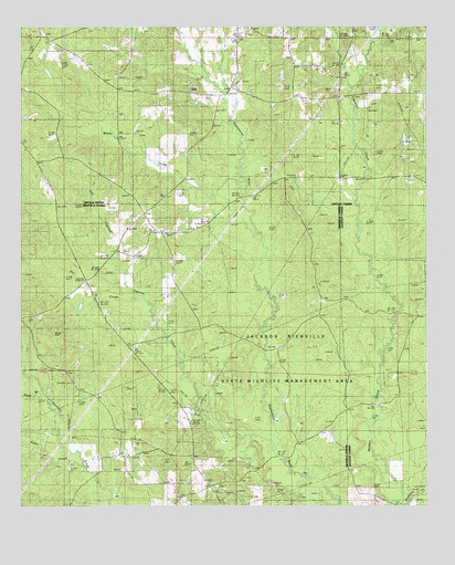
Wilson Creek, LA USGS Topographic Map
Click on map above to begin viewing in our Map Viewer.

This topographic map contains these locations and features:
Feature Name Type Latitude Longitude GNIS ID View Map
Cypress CreekStreamN32.3882°W92.7963°554165View Map
Driscoll Gas FieldOilfieldN32.3877°W92.7988°549076View Map
Dry CreekStreamN32.4293°W92.8385°534613View Map
Fellowship SchoolSchoolN32.4979°W92.8074°534927View Map
Flat Cypress CreekStreamN32.4379°W92.8465°534991View Map
Jackson-Bienville State Wildlife Management AreaParkN32.4002°W92.7668°541276View Map
Mount Temple Church Methodist CemeteryCemeteryN32.3814°W92.8249°2774675View Map
Mount Temple Methodist ChurchChurchN32.3815°W92.8243°555413View Map
North Bienville Fire Protection District Station 3BuildingN32.4339°W92.8546°2673029View Map
Oak GrovePopulated PlaceN32.4965°W92.8660°546615View Map
Oak Grove ChurchChurchN32.4979°W92.8699°537784View Map
Pruitt CemeteryCemeteryN32.4721°W92.8388°538433View Map
Redwine CreekStreamN32.3760°W92.7577°555785View Map
Sand BranchStreamN32.4049°W92.8693°539131View Map
Sardis ChurchChurchN32.4246°W92.8718°539181View Map
Shady Grove ChurchChurchN32.4777°W92.8457°539281View Map
Simsboro Gas FieldOilfieldN32.4918°W92.7552°546640View Map
Springhill Baptist ChurchChurchN32.4752°W92.7765°556121View Map
Sugar CreekStreamN32.3868°W92.8590°539710View Map
Union Baptist ChurchChurchN32.3804°W92.8152°556296View Map
Wilson CreekStreamN32.4585°W92.8063°556450View Map

Note: Coordinates in the location and feature list above are referenced to NAD83 datum.


Copyright (C) 2008-2025 Ryan Niemi / Sunset Dynamics ... All Rights Reserved