TopoQuest Logo
Do you find TopoQuest useful?
Help keep TopoQuest running and adding new maps/features by donating!
Bitcoin:  19c7KJd3qBynnjoSw5npx9KScwjBe4ifkT
Litecoin:  LXs6TkuXGGXo1vDsWCkWVdjQX94eUKd6ui
Home View Maps Find Maps Find Places Resources & Links


Boswell, Pennsylvania Topographic Map

USGS Map Title: Boswell, PA
USGS Map MRC: 40079B1
DRG (GeoTIFF) Download: o40079b1.tif


Neighboring USGS Topographic Map Quads:


  Wilpen, PA  
40079C2
 

  Rachelwood, PA  
40079C1
 

  Johnstown, PA  
40078C8
 

  Ligonier, PA  
40079B2
 

  Boswell, PA  
40079B1
 

  Hooversville, PA  
40078B8
 

  Bakersville, PA  
40079A2
 

  Somerset, PA  
40079A1
 

  Stoystown, PA  
40078A8


Map MRC Location:

N41°
W80°
N41°
W79°
H8 H7 H6 H5 H4 H3 H2 H1
G8 G7 G6 G5 G4 G3 G2 G1
F8 F7 F6 F5 F4 F3 F2 F1
E8 E7 E6 E5 E4 E3 E2 E1
D8 D7 D6 D5 D4 D3 D2 D1
C8 C7 C6 C5 C4 C3 C2 C1
B8 B7 B6 B5 B4 B3 B2 B1
A8 A7 A6 A5 A4 A3 A2 A1
N40°
W80°
N40°
W79°

Boswell, PA USGS 1:24K Topographic Map Preview:
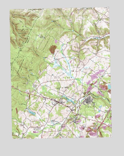
Boswell, PA USGS Topographic Map
Click on map above to begin viewing in our Map Viewer.

This topographic map contains these locations and features:
Feature Name Type Latitude Longitude GNIS ID View Map
AnkenyPopulated PlaceN40.1379°W79.1100°1168316View Map
Beam ChurchChurchN40.1301°W79.1117°1168843View Map
Beam RunStreamN40.1251°W79.1117°1192100View Map
Bearpen HollowValleyN40.2237°W79.1128°1192104View Map
Beaverdam CreekStreamN40.1576°W79.0384°1169058View Map
Beaverdam RunStreamN40.1367°W79.0748°1169066View Map
Beisecker School (historical)SchoolN40.1362°W79.0931°1205240View Map
Beverly LakeReservoirN40.2211°W79.0159°1169463View Map
Borough of BoswellCivilN40.1615°W79.0275°1215583View Map
Borough of JennerstownCivilN40.1636°W79.0611°1215590View Map
BoswellPopulated PlaceN40.1615°W79.0289°1170026View Map
Boswell Borough Police DepartmentBuildingN40.1611°W79.0284°2780521View Map
Boswell Post OfficePost OfficeN40.1612°W79.0333°2779720View Map
Boswell QuarryMineN40.1669°W79.0153°2724971View Map
Boswell ReservoirReservoirN40.2027°W79.0825°1170027View Map
Boswell Volunteer Fire Department - Station 605BuildingN40.1612°W79.0283°2645851View Map
Camp SequanotaLocaleN40.1792°W79.1045°1171087View Map
Card Machine RunStreamN40.1706°W79.0811°1171199View Map
Coal JunctionPopulated PlaceN40.1362°W79.0620°1203292View Map
Coal RunStreamN40.1576°W79.1067°1172071View Map
Conemaugh Township Impounding DamDamN40.2384°W79.0714°1194662View Map
Conemaugh Township ReservoirReservoirN40.2376°W79.0714°1172301View Map
Conner Post Office (historical)Post OfficeN40.1929°W79.0409°1214336View Map
Cooper SchoolSchoolN40.1834°W79.0670°1205241View Map
FerrelltonPopulated PlaceN40.1476°W79.0406°1174709View Map
Flat RunStreamN40.1862°W79.0498°1174889View Map
ForwardstownPopulated PlaceN40.2187°W79.0297°1175028View Map
Gallo DamDamN40.1467°W79.0964°1194581View Map
Gilbert HollowValleyN40.2220°W79.0121°1175602View Map
GlessnerPopulated PlaceN40.1926°W79.0409°1175751View Map
GrayPopulated PlaceN40.1359°W79.0928°1176019View Map
Gray Post OfficePost OfficeN40.1356°W79.0944°2775099View Map
Gum RunStreamN40.1954°W79.0639°1176311View Map
Hare SchoolSchoolN40.1765°W79.0147°1205246View Map
Hoffman RunStreamN40.1317°W79.0639°1177163View Map
Irwin HillSummitN40.2451°W79.0856°1177872View Map
JennersPopulated PlaceN40.1431°W79.0428°1178038View Map
Jenners CrossroadsPopulated PlaceN40.1515°W79.0495°1178039View Map
JennerstownPopulated PlaceN40.1598°W79.0664°1178041View Map
Jennerstown Borough Police DepartmentBuildingN40.1626°W79.0705°2780578View Map
Jennerstown DamDamN40.1851°W79.1114°1194611View Map
Jennerstown Post OfficePost OfficeN40.1604°W79.0675°2779686View Map
Jennerstown ReservoirReservoirN40.1906°W79.1017°1178042View Map
Jennerstown Volunteer Fire Department - Station 606BuildingN40.1614°W79.0700°2645852View Map
Klines MillPopulated PlaceN40.1762°W79.0959°1203953View Map
Lake GloriaReservoirN40.1502°W79.0994°1175755View Map
Laurel HillRangeN40.2279°W79.1006°1192741View Map
Laurel Hill TabernacleChurchN40.1731°W79.0528°1178949View Map
Lohr's Landing Airport (historical)AirportN40.2087°W79.0554°1193860View Map
Maurer SchoolSchoolN40.2151°W79.0531°1205242View Map
MeadowdalePopulated PlaceN40.1259°W79.1131°1180838View Map
Middle HillSummitN40.2029°W79.1211°1181033View Map
Morgans MillsLocaleN40.1581°W79.0006°1206863View Map
Mount Carmel CemeteryCemeteryN40.1554°W79.0532°1181660View Map
Mount Zion ChurchChurchN40.2006°W79.0636°1181919View Map
Muller SchoolSchoolN40.1273°W79.0006°1205247View Map
Mystery HillSummitN40.2245°W79.1045°1182145View Map
North Branch Quemahoning CreekStreamN40.1387°W79.0639°1193037View Map
North Branch South Fork Bens CreekStreamN40.2281°W79.0434°1193041View Map
Oakbrook Golf CourseLocaleN40.1376°W79.0356°1205822View Map
Old Calvary CemeteryCemeteryN40.1951°W79.0311°1182900View Map
Pickings RunStreamN40.1709°W79.0814°1183700View Map
Pikes PeakSummitN40.2101°W79.1139°1183734View Map
PilltownPopulated PlaceN40.1715°W79.0131°1183749View Map
Pine HillSummitN40.2212°W79.1181°1183823View Map
Pine RunStreamN40.1742°W79.0159°1183874View Map
Pine Springs CampLocaleN40.1723°W79.0634°1183908View Map
RandolphPopulated PlaceN40.1506°W79.0022°1184644View Map
Roaring RunStreamN40.1623°W79.0053°1185172View Map
Roaring Run CampLocaleN40.2220°W79.0856°1185186View Map
Rose Bud LakeReservoirN40.1417°W79.0752°1185441View Map
Saint James ChurchChurchN40.1895°W79.0214°1186014View Map
Saint Josephs ChurchChurchN40.1406°W79.0442°1186228View Map
Saint Marys CemeteryCemeteryN40.1527°W79.0399°1186368View Map
Saint Marys ChurchChurchN40.1415°W79.0439°1186408View Map
Saint Stanislaus CemeteryCemeteryN40.1556°W79.0280°1186718View Map
Saints Peter and Paul CemeteryCemeteryN40.1865°W79.0275°1186792View Map
Saylor SchoolSchoolN40.2431°W79.0047°1205245View Map
ShunkSchoolN40.2473°W79.0386°1205243View Map
Spruce RunStreamN40.1309°W79.1059°1188352View Map
State Game Lands Number 42ParkN40.2281°W79.1089°1193452View Map
Stoughton LakeReservoirN40.1616°W79.0522°1188821View Map
Sugar Camp HillSummitN40.2320°W79.1020°1188924View Map
ThomasdalePopulated PlaceN40.2206°W79.0120°1189492View Map
Thomasdale SchoolSchoolN40.2209°W79.0122°1205244View Map
Township of JennerCivilN40.1774°W79.0601°1217051View Map

Note: Coordinates in the location and feature list above are referenced to NAD83 datum.


Copyright (C) 2008-2025 Ryan Niemi / Sunset Dynamics ... All Rights Reserved