TopoQuest Logo
Do you find TopoQuest useful?
Help keep TopoQuest running and adding new maps/features by donating!
Bitcoin:  19c7KJd3qBynnjoSw5npx9KScwjBe4ifkT
Litecoin:  LXs6TkuXGGXo1vDsWCkWVdjQX94eUKd6ui
Home View Maps Find Maps Find Places Resources & Links


Ligonier, Pennsylvania Topographic Map

USGS Map Title: Ligonier, PA
USGS Map MRC: 40079B2
DRG (GeoTIFF) Download: o40079b2.tif


Neighboring USGS Topographic Map Quads:


  Derry, PA  
40079C3
 

  Wilpen, PA  
40079C2
 

  Rachelwood, PA  
40079C1
 

  Stahlstown, PA  
40079B3
 

  Ligonier, PA  
40079B2
 

  Boswell, PA  
40079B1
 

  Seven Springs, PA  
40079A3
 

  Bakersville, PA  
40079A2
 

  Somerset, PA  
40079A1


Map MRC Location:

N41°
W80°
N41°
W79°
H8 H7 H6 H5 H4 H3 H2 H1
G8 G7 G6 G5 G4 G3 G2 G1
F8 F7 F6 F5 F4 F3 F2 F1
E8 E7 E6 E5 E4 E3 E2 E1
D8 D7 D6 D5 D4 D3 D2 D1
C8 C7 C6 C5 C4 C3 C2 C1
B8 B7 B6 B5 B4 B3 B2 B1
A8 A7 A6 A5 A4 A3 A2 A1
N40°
W80°
N40°
W79°

Ligonier, PA USGS 1:24K Topographic Map Preview:
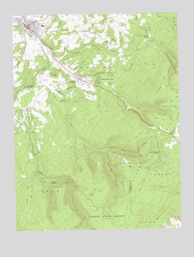
Ligonier, PA USGS Topographic Map
Click on map above to begin viewing in our Map Viewer.

This topographic map contains these locations and features:
Feature Name Type Latitude Longitude GNIS ID View Map
Adams FallsFallsN40.1673°W79.2309°1201462View Map
Airglow ObservatoryLocaleN40.1312°W79.1642°1206534View Map
Beam RocksCliffN40.1306°W79.1586°1201465View Map
Bear CreekStreamN40.1704°W79.1831°1187686View Map
BluestoneLocaleN40.1542°W79.2114°1205238View Map
Bluestone QuarryMineN40.1512°W79.2120°1206292View Map
Borough of Laurel MountainCivilN40.2112°W79.1850°1217442View Map
Borough of LigonierCivilN40.2449°W79.2375°1215706View Map
Boucher School (historical)SchoolN40.2359°W79.2406°1205234View Map
Brant TrailTrailN40.1523°W79.2053°1170175View Map
Byers Station (historical)BuildingN40.1951°W79.2398°1205236View Map
California FurnacePopulated PlaceN40.1917°W79.2081°1203210View Map
Club House HillSummitN40.2070°W79.2078°1172038View Map
Cole CemeteryCemeteryN40.1998°W79.2325°1172169View Map
Darr TrailTrailN40.1542°W79.2086°1172960View Map
Duck PondReservoirN40.2050°W79.2171°1173570View Map
East End TrailTrailN40.1501°W79.1386°1206293View Map
Fish RunStreamN40.1292°W79.1984°1192463View Map
Flat RockBarN40.1734°W79.2356°1201461View Map
Forbes State ForestForestN40.1295°W79.1875°1174949View Map
Fort LigonierLocaleN40.2406°W79.2373°1212235View Map
Furnace RunStreamN40.2154°W79.1836°1175358View Map
Gravel HillSummitN40.2365°W79.1781°1176000View Map
Grove RunStreamN40.1540°W79.2253°1176279View Map
Grove RunLocaleN40.1517°W79.2214°1205239View Map
Grove Run SpringSpringN40.1529°W79.2223°1176282View Map
Heinz HillSummitN40.2106°W79.2403°1176783View Map
Hermitage School (historical)SchoolN40.2356°W79.2064°1205235View Map
Holy Trinity SchoolSchoolN40.2475°W79.2403°2432060View Map
Lake TodReservoirN40.2302°W79.1765°1189616View Map
LaughlintownPopulated PlaceN40.2120°W79.1978°1178918View Map
Laughlintown CemeteryCemeteryN40.2201°W79.1867°1178919View Map
Laughlintown Post OfficePost OfficeN40.2122°W79.1999°2772783View Map
Laughlintown RunStreamN40.2192°W79.2203°1178920View Map
Laurel Hill Fire TowerTowerN40.1826°W79.1517°1206294View Map
Laurel Mountain ParkPopulated PlaceN40.2112°W79.1850°1217431View Map
Laurel Mountain ParkParkN40.2081°W79.1850°1178957View Map
Laurel Mountain Ski ResortLocaleN40.1565°W79.1678°1205830View Map
Laurel Mountain State ParkParkN40.1648°W79.1650°1178958View Map
Laurel Mountain VillagePopulated PlaceN40.1690°W79.1395°1178959View Map
Laurel Valley Golf ClubLocaleN40.2245°W79.2392°1213260View Map
Lebanon ChurchChurchN40.2340°W79.1761°1179100View Map
Left Fork Mill CreekStreamN40.2465°W79.1286°1179143View Map
Lettie Shaffer HollowValleyN40.2236°W79.2165°1179224View Map
LigonierPopulated PlaceN40.2431°W79.2375°1192782View Map
Ligonier DamDamN40.2367°W79.1464°1194657View Map
Ligonier Post OfficePost OfficeN40.2437°W79.2383°2772795View Map
Ligonier ReservoirReservoirN40.2090°W79.1795°1179330View Map
Ligonier Township ReservoirReservoirN40.2365°W79.1459°1179331View Map
Ligonier Valley Ambulance ServiceBuildingN40.2478°W79.2462°2719516View Map
Ligonier Valley LibraryBuildingN40.2433°W79.2380°2430157View Map
Ligonier Valley YMCABuildingN40.2441°W79.2367°2430158View Map
Ligonier Volunteer Hose Company 1BuildingN40.2446°W79.2386°2645128View Map
Linn RunStreamN40.2017°W79.2475°1192789View Map
Linn Run State ParkParkN40.1565°W79.2311°1179434View Map
Marker SchoolSchoolN40.2442°W79.2270°1180418View Map
McCullen RunStreamN40.2151°W79.1834°1180677View Map
MellonsLocaleN40.2179°W79.2220°1205232View Map
Naugle RunStreamN40.2142°W79.2075°1182185View Map
Ninety Foot RocksCliffN40.1617°W79.2239°1201463View Map
Parks HillSummitN40.1454°W79.1909°1183332View Map
Pea Vine HillSummitN40.1806°W79.1520°1183921View Map
Penrod CemeteryCemeteryN40.2251°W79.1614°1183562View Map
Penrod HillSummitN40.2034°W79.1420°1183563View Map
Peyton HillSummitN40.2326°W79.1523°1183647View Map
RectorPopulated PlaceN40.1967°W79.2386°1184747View Map
Rectors MillLocaleN40.1742°W79.2331°1205237View Map
Reed HillSummitN40.1890°W79.1425°1184819View Map
Ridgeview Golf CourseLocaleN40.2492°W79.2023°1205831View Map
Right Fork Mill CreekStreamN40.2462°W79.1286°1185076View Map
Rock RunStreamN40.1590°W79.2320°1185274View Map
Rolling Rock CreekStreamN40.2087°W79.2317°1185409View Map
Rolling Rock Lookout TowerTowerN40.2095°W79.2370°1213348View Map
Scaife HillSummitN40.2020°W79.1959°1187056View Map
Sheep HillSummitN40.1956°W79.1681°1187424View Map
ShirleyPopulated PlaceN40.2306°W79.2284°1201521View Map
Shooters HillSummitN40.2151°W79.2161°1187585View Map
Silver Mine HollowValleyN40.1710°W79.1942°1217405View Map
SpeedwellLocaleN40.2109°W79.2289°1205231View Map
Speedwell School (historical)SchoolN40.2092°W79.2275°1205230View Map
Spruce Run TrailTrailN40.1367°W79.1411°1206694View Map
Thomas CrossroadsPopulated PlaceN40.2404°W79.1973°1204808View Map
Township of LigonierCivilN40.2348°W79.2138°1217240View Map
Ulery HillSummitN40.1612°W79.1609°1190068View Map
Valley CemeteryCemeteryN40.2376°W79.2420°1190285View Map
Valley SchoolSchoolN40.1820°W79.2370°1190311View Map
WJNL-TV (Johnstown)TowerN40.1806°W79.1520°1200532View Map
Wolf RocksCliffN40.1390°W79.1989°1201464View Map
Wolf Rocks TrailTrailN40.1298°W79.1895°1206291View Map
Wrinkle HollowValleyN40.1684°W79.1565°1191816View Map
Zimmerman RunStreamN40.2234°W79.2195°1191957View Map

Note: Coordinates in the location and feature list above are referenced to NAD83 datum.


Copyright (C) 2008-2024 Ryan Niemi / Sunset Dynamics ... All Rights Reserved