TopoQuest Logo
Do you find TopoQuest useful?
Help keep TopoQuest running and adding new maps/features by donating!
Bitcoin:  19c7KJd3qBynnjoSw5npx9KScwjBe4ifkT
Litecoin:  LXs6TkuXGGXo1vDsWCkWVdjQX94eUKd6ui
Home View Maps Find Maps Find Places Resources & Links


Windy Peak, Oregon Topographic Map

USGS Map Title: Windy Peak, OR
USGS Map MRC: 44123B6
DRG (GeoTIFF) Download: o44123b6.tif


Neighboring USGS Topographic Map Quads:


  Five Rivers, OR  
44123C7
 

  Digger Mountain, OR  
44123C6
 

  Prairie Peak, OR  
44123C5
 

  Herman Creek, OR  
44123B7
 

  Windy Peak, OR  
44123B6
 

  Triangle Lake, OR  
44123B5
 

  Mapleton, OR  
44123A7
 

  Greenleaf, OR  
44123A6
 

  Walton, OR  
44123A5


Map MRC Location:

N45°
W124°
N45°
W123°
H8 H7 H6 H5 H4 H3 H2 H1
G8 G7 G6 G5 G4 G3 G2 G1
F8 F7 F6 F5 F4 F3 F2 F1
E8 E7 E6 E5 E4 E3 E2 E1
D8 D7 D6 D5 D4 D3 D2 D1
C8 C7 C6 C5 C4 C3 C2 C1
B8 B7 B6 B5 B4 B3 B2 B1
A8 A7 A6 A5 A4 A3 A2 A1
N44°
W124°
N44°
W123°

Windy Peak, OR USGS 1:24K Topographic Map Preview:
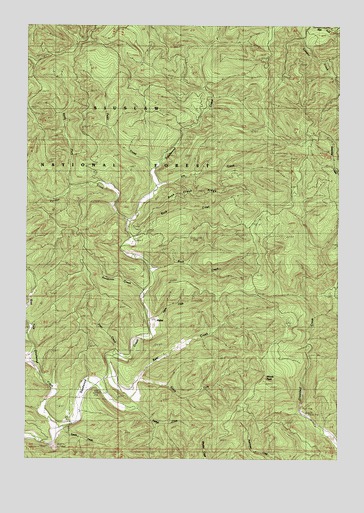
Windy Peak, OR USGS Topographic Map
Click on map above to begin viewing in our Map Viewer.

This topographic map contains these locations and features:
Feature Name Type Latitude Longitude GNIS ID View Map
AlphaPopulated PlaceN44.1643°W123.7007°1137162View Map
Alpha CreekStreamN44.1654°W123.7023°1135315View Map
Alpha Post Office (historical)Post OfficeN44.1643°W123.7007°1164827View Map
Bear CreekStreamN44.1426°W123.7082°1137655View Map
Buck CreekStreamN44.1873°W123.7062°1138759View Map
Buck Creek RidgeRidgeN44.2046°W123.6768°1153544View Map
Deadwood Creek Covered BridgeBridgeN44.1433°W123.7203°2708119View Map
Deadwood Creek Fire ServiceBuildingN44.1390°W123.7295°2577158View Map
Deadwood School (historical)SchoolN44.1404°W123.7276°1140758View Map
Deer CreekStreamN44.1543°W123.7159°1140826View Map
East Fork Lobster CreekStreamN44.2498°W123.6370°1141579View Map
Elk CreekStreamN44.2026°W123.6984°1153545View Map
Fawn CreekStreamN44.2087°W123.7015°1135316View Map
Karlstrom CreekStreamN44.1726°W123.7040°1135314View Map
North Fork Panther CreekStreamN44.2035°W123.7318°1153552View Map
Panther CreekStreamN44.1932°W123.7095°1639323View Map
Raleigh CreekStreamN44.1390°W123.7062°1148186View Map
Rock CreekStreamN44.1787°W123.6993°1148574View Map
South Fork Bear CreekStreamN44.1462°W123.7057°1149928View Map
Swartz CreekStreamN44.1343°W123.7359°1149120View Map
West Fork Deadwood CreekStreamN44.1340°W123.7376°1152065View Map
Wilson RidgeRidgeN44.2457°W123.6946°1156741View Map
Windy PeakSummitN44.1472°W123.6556°1152516View Map

Note: Coordinates in the location and feature list above are referenced to NAD83 datum.


Copyright (C) 2008-2025 Ryan Niemi / Sunset Dynamics ... All Rights Reserved