TopoQuest Logo
Do you find TopoQuest useful?
Help keep TopoQuest running and adding new maps/features by donating!
Bitcoin:  19c7KJd3qBynnjoSw5npx9KScwjBe4ifkT
Litecoin:  LXs6TkuXGGXo1vDsWCkWVdjQX94eUKd6ui
Home View Maps Find Maps Find Places Resources & Links


Digger Mountain, Oregon Topographic Map

USGS Map Title: Digger Mountain, OR
USGS Map MRC: 44123C6
DRG (GeoTIFF) Download: o44123c6.tif


Neighboring USGS Topographic Map Quads:


  Hellion Rapids, OR  
44123D7
 

  Grass Mountain, OR  
44123D6
 

  Alsea, OR  
44123D5
 

  Five Rivers, OR  
44123C7
 

  Digger Mountain, OR  
44123C6
 

  Prairie Peak, OR  
44123C5
 

  Herman Creek, OR  
44123B7
 

  Windy Peak, OR  
44123B6
 

  Triangle Lake, OR  
44123B5


Map MRC Location:

N45°
W124°
N45°
W123°
H8 H7 H6 H5 H4 H3 H2 H1
G8 G7 G6 G5 G4 G3 G2 G1
F8 F7 F6 F5 F4 F3 F2 F1
E8 E7 E6 E5 E4 E3 E2 E1
D8 D7 D6 D5 D4 D3 D2 D1
C8 C7 C6 C5 C4 C3 C2 C1
B8 B7 B6 B5 B4 B3 B2 B1
A8 A7 A6 A5 A4 A3 A2 A1
N44°
W124°
N44°
W123°

Digger Mountain, OR USGS 1:24K Topographic Map Preview:
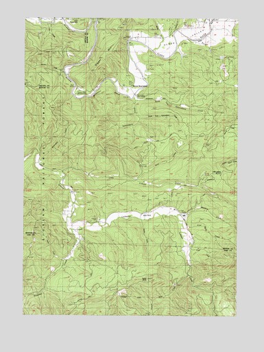
Digger Mountain, OR USGS Topographic Map
Click on map above to begin viewing in our Map Viewer.

This topographic map contains these locations and features:
Feature Name Type Latitude Longitude GNIS ID View Map
Alsea ValleyValleyN44.3493°W123.6926°1155954View Map
Bear CreekStreamN44.2665°W123.6545°1153553View Map
Benner CreekStreamN44.3518°W123.7271°1137921View Map
Bovine CreekStreamN44.3729°W123.7384°1639291View Map
Box (historical)LocaleN44.2873°W123.7234°1153540View Map
Box Post Office (historical)Post OfficeN44.2873°W123.7234°1164946View Map
Briar CreekStreamN44.3068°W123.6862°1138598View Map
Burch CreekStreamN44.3679°W123.6568°1138146View Map
Campbell Boat LandingLocaleN44.3663°W123.6903°2668586View Map
Campbell County ParkParkN44.3657°W123.6896°1135708View Map
Coal Bank CreekStreamN44.2865°W123.6576°1139865View Map
Cook CreekStreamN44.2796°W123.6551°1140053View Map
Digger MountainSummitN44.3573°W123.7048°1141026View Map
Jasper CreekStreamN44.2726°W123.7268°1153539View Map
Little Lobster CreekStreamN44.3098°W123.7276°1145200View Map
Little Lobster SummitGapN44.3096°W123.6359°1135706View Map
Lobster Post Office (historical)Post OfficeN44.2832°W123.7012°1164477View Map
Lobster ValleyValleyN44.3173°W123.7429°1153541View Map
Lone Fir CemeteryCemeteryN44.2899°W123.7078°1145350View Map
Maltby CreekStreamN44.3610°W123.6754°1145779View Map
Martha CreekStreamN44.2904°W123.6832°1153658View Map
Meadow CreekStreamN44.2918°W123.6615°1146054View Map
Missouri BendBendN44.3498°W123.7026°1153543View Map
Missouri Bend Recreation SiteParkN44.3465°W123.7199°1153542View Map
Missouri Bend SchoolLocaleN44.3454°W123.6879°1146364View Map
Narrow CreekStreamN44.3729°W123.6546°1153622View Map
North Fork Salmonberry CreekStreamN44.3398°W123.6854°1147008View Map
Preacher CreekStreamN44.2860°W123.7234°1147991View Map
Salmonberry Boat LandingLocaleN44.3430°W123.6860°2668319View Map
Salmonberry County Park & CampgroundParkN44.3429°W123.6865°1135707View Map
Salmonberry CreekStreamN44.3415°W123.6873°1162597View Map
Schoolhouse CreekStreamN44.3737°W123.6418°1149140View Map
Scoville SpringSpringN44.3698°W123.6873°1153621View Map
South Fork Salmonberry CreekStreamN44.3326°W123.6837°1150025View Map
Taylor ButteSummitN44.2645°W123.6779°1150910View Map
Wilkinson CreekStreamN44.3137°W123.7446°1152376View Map
Yew Wood Camp (historical)LocaleN44.2818°W123.6873°1153630View Map

Note: Coordinates in the location and feature list above are referenced to NAD83 datum.


Copyright (C) 2008-2025 Ryan Niemi / Sunset Dynamics ... All Rights Reserved