TopoQuest Logo
Do you find TopoQuest useful?
Help keep TopoQuest running and adding new maps/features by donating!
Bitcoin:  19c7KJd3qBynnjoSw5npx9KScwjBe4ifkT
Litecoin:  LXs6TkuXGGXo1vDsWCkWVdjQX94eUKd6ui
Home View Maps Find Maps Find Places Resources & Links


Five Rivers, Oregon Topographic Map

USGS Map Title: Five Rivers, OR
USGS Map MRC: 44123C7
DRG (GeoTIFF) Download: o44123c7.tif


Neighboring USGS Topographic Map Quads:


  Tidewater, OR  
44123D8
 

  Hellion Rapids, OR  
44123D7
 

  Grass Mountain, OR  
44123D6
 

  Cannibal Mountain, OR  
44123C8
 

  Five Rivers, OR  
44123C7
 

  Digger Mountain, OR  
44123C6
 

  Cummins Peak, OR  
44123B8
 

  Herman Creek, OR  
44123B7
 

  Windy Peak, OR  
44123B6


Map MRC Location:

N45°
W124°
N45°
W123°
H8 H7 H6 H5 H4 H3 H2 H1
G8 G7 G6 G5 G4 G3 G2 G1
F8 F7 F6 F5 F4 F3 F2 F1
E8 E7 E6 E5 E4 E3 E2 E1
D8 D7 D6 D5 D4 D3 D2 D1
C8 C7 C6 C5 C4 C3 C2 C1
B8 B7 B6 B5 B4 B3 B2 B1
A8 A7 A6 A5 A4 A3 A2 A1
N44°
W124°
N44°
W123°

Five Rivers, OR USGS 1:24K Topographic Map Preview:
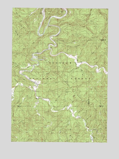
Five Rivers, OR USGS Topographic Map
Click on map above to begin viewing in our Map Viewer.

This topographic map contains these locations and features:
Feature Name Type Latitude Longitude GNIS ID View Map
Alder CreekStreamN44.2851°W123.8251°1137068View Map
Bear CreekStreamN44.3571°W123.8137°1137657View Map
Blackberry Park Boat LaunchLocaleN44.3724°W123.8361°2668337View Map
Blackberry Recreation SiteLocaleN44.3735°W123.8359°1153576View Map
Buck CreekStreamN44.3010°W123.8476°1138775View Map
Camp CreekStreamN44.3162°W123.7634°1139209View Map
Cascade CreekStreamN44.3196°W123.8462°1139417View Map
Cascade FallsFallsN44.3193°W123.8554°1153579View Map
Cedar CreekStreamN44.2701°W123.7793°1139502View Map
Central Oregon Coast Fire and Rescue District 7 Station 7400BuildingN44.3676°W123.8199°2577109View Map
Cherry CreekStreamN44.3037°W123.8412°1139591View Map
Cougar CreekStreamN44.2987°W123.8473°1140208View Map
Crab CreekStreamN44.2929°W123.8440°1140346View Map
Crazy CreekStreamN44.2810°W123.8001°1140418View Map
Crooked CreekStreamN44.3215°W123.7884°1153559View Map
Denzer (historical)Populated PlaceN44.3373°W123.8290°1153577View Map
Denzer BridgeLocaleN44.3360°W123.8279°1140903View Map
Denzer Post Office (historical)Post OfficeN44.3373°W123.8290°1165147View Map
Denzer RidgeRidgeN44.3029°W123.7987°1140904View Map
Elk CreekStreamN44.3440°W123.8215°1141746View Map
Fendall CreekStreamN44.2729°W123.7893°1142061View Map
FisherPopulated PlaceN44.2918°W123.8401°1142172View Map
Fisher Post Office (historical)Post OfficeN44.2918°W123.8401°1165254View Map
Five RiversStreamN44.3585°W123.8271°1142198View Map
Five Rivers County LaunchParkN44.3596°W123.8276°1153578View Map
Five Rivers LaunchLocaleN44.3582°W123.8303°2668223View Map
Fleece RidgeRidgeN44.3373°W123.7904°1142250View Map
George CreekStreamN44.3607°W123.8665°1142613View Map
Green RiverStreamN44.2751°W123.7959°1143056View Map
Hoover CreekStreamN44.3632°W123.8618°1143719View Map
Lake CreekStreamN44.3479°W123.8365°1144767View Map
Launching Forest Camp Boat LaunchLocaleN44.3500°W123.8366°1952951View Map
Lobster CreekStreamN44.3365°W123.8248°1145311View Map
Maples Forest Camp (historical)LocaleN44.3318°W123.8415°1145797View Map
McDonald CreekStreamN44.3043°W123.8668°1145966View Map
McGlynn CreekStreamN44.3212°W123.7884°1145982View Map
Meadow ForkStreamN44.3657°W123.8632°1146059View Map
National Forest Land ParkParkN44.3735°W123.8054°1158678View Map
North Fork Cascade CreekStreamN44.3207°W123.8676°1146921View Map
ParisPopulated PlaceN44.2526°W123.7707°1153560View Map
Paris Post Office (historical)Post OfficeN44.2526°W123.7707°1165761View Map
Phillips CreekStreamN44.3246°W123.7793°1147635View Map
Pitchfork RidgeRidgeN44.3526°W123.8687°1147781View Map
Ryan CreekStreamN44.2665°W123.7996°1148872View Map
Stoney PointCapeN44.3710°W123.8057°1150451View Map
Stoney Point Boat LaunchLocaleN44.3717°W123.8056°2668430View Map
Summers CreekStreamN44.2604°W123.7709°1150600View Map
Swamp CreekStreamN44.3282°W123.8434°1150737View Map
Taylor CreekStreamN44.3279°W123.7934°1150915View Map
Vernon Post Office (historical)Post OfficeN44.3323°W123.8415°1164756View Map

Note: Coordinates in the location and feature list above are referenced to NAD83 datum.


Copyright (C) 2008-2024 Ryan Niemi / Sunset Dynamics ... All Rights Reserved