TopoQuest Logo
Do you find TopoQuest useful?
Help keep TopoQuest running and adding new maps/features by donating!
Bitcoin:  19c7KJd3qBynnjoSw5npx9KScwjBe4ifkT
Litecoin:  LXs6TkuXGGXo1vDsWCkWVdjQX94eUKd6ui
Home View Maps Find Maps Find Places Resources & Links


Winfield, Tennessee Topographic Map

USGS Map Title: Winfield, TN
USGS Map MRC: 36084E4
DRG (GeoTIFF) Download: o36084e4.tif


Neighboring USGS Topographic Map Quads:


  Barthell, KY  
36084F5
 

  Whitley City, KY  
36084F4
 

  Hollyhill, KY  
36084F3
 

  Oneida North, TN  
36084E5
 

  Winfield, TN  
36084E4
 

  Ketchen, TN  
36084E3
 

  Oneida South, TN  
36084D5
 

  Huntsville, TN  
36084D4
 

  Pioneer, TN  
36084D3


Map MRC Location:

N37°
W85°
N37°
W84°
H8 H7 H6 H5 H4 H3 H2 H1
G8 G7 G6 G5 G4 G3 G2 G1
F8 F7 F6 F5 F4 F3 F2 F1
E8 E7 E6 E5 E4 E3 E2 E1
D8 D7 D6 D5 D4 D3 D2 D1
C8 C7 C6 C5 C4 C3 C2 C1
B8 B7 B6 B5 B4 B3 B2 B1
A8 A7 A6 A5 A4 A3 A2 A1
N36°
W85°
N36°
W84°

Winfield, TN USGS 1:24K Topographic Map Preview:
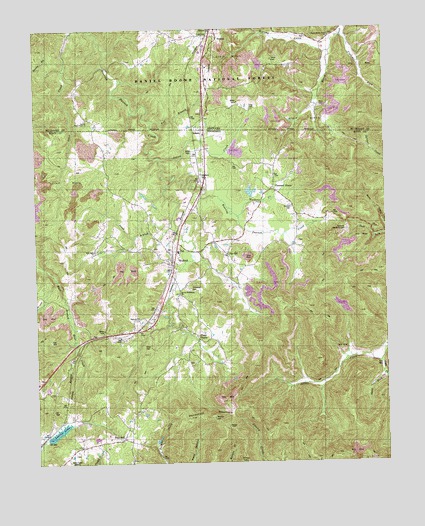
Winfield, TN USGS Topographic Map
Click on map above to begin viewing in our Map Viewer.

This topographic map contains these locations and features:
Feature Name Type Latitude Longitude GNIS ID View Map
Chitwood CemeteryCemeteryN36.5503°W84.4458°1280495View Map
Clay HillPopulated PlaceN36.5598°W84.4313°1311272View Map
Commissioner District 5CivilN36.5332°W84.3902°2464489View Map
Duncan CemeteryCemeteryN36.5734°W84.4083°1283157View Map
Emby King SchoolSchoolN36.6090°W84.4849°512065View Map
Fox BranchStreamN36.5984°W84.4583°516802View Map
Highway ChurchChurchN36.5412°W84.4633°1287771View Map
Honeycutt MountainSummitN36.5131°W84.4452°1288217View Map
IshamPopulated PlaceN36.5976°W84.4388°1289076View Map
Isham CemeteryCemeteryN36.5887°W84.4444°1289079View Map
Isham CreekStreamN36.5876°W84.4549°1311278View Map
Jones BranchStreamN36.5817°W84.4494°1289707View Map
Jones CemeteryCemeteryN36.6162°W84.4144°513063View Map
King CemeteryCemeteryN36.6017°W84.4222°513147View Map
Laxion LakeReservoirN36.5090°W84.4932°1311279View Map
Laxton Lake DamDamN36.5084°W84.4949°1302652View Map
Long ForkStreamN36.5289°W84.3775°1328776View Map
Murphy CreekStreamN36.6187°W84.3941°514167View Map
New Light ChurchChurchN36.5612°W84.4791°1318788View Map
Pine HillPopulated PlaceN36.5065°W84.4710°1297544View Map
Pine Hill Baptist Church (historical)ChurchN36.5073°W84.4691°1318797View Map
Pine Hill Volunteer Fire DepartmentBuildingN36.5068°W84.4695°2654474View Map
Piney GrovePopulated PlaceN36.5356°W84.4422°1311282View Map
Piney Grove ChurchChurchN36.5373°W84.4441°1297638View Map
Pleasant GrovePopulated PlaceN36.5787°W84.4155°1311283View Map
Pleasant Grove ChurchChurchN36.5779°W84.4138°1297833View Map
Privet MountainSummitN36.5001°W84.4266°1298553View Map
Ronald King DamDamN36.5767°W84.4233°1302685View Map
Ronald King LakeReservoirN36.5781°W84.4235°1302684View Map
Ross CemeteryCemeteryN36.5340°W84.4594°1641699View Map
Ross CemeteryCemeteryN36.5337°W84.4597°1318801View Map
Ryan CemeteryCemeteryN36.6031°W84.3977°515154View Map
Second Bethlehem ChurchChurchN36.5492°W84.4483°1301012View Map
Second Bethlehem ChurchChurchN36.5501°W84.4488°1641701View Map
Second Order Creek ChurchChurchN36.5992°W84.4816°515318View Map
Short ForkStreamN36.5248°W84.3760°1270199View Map
Stanley CemeteryCemeteryN36.5129°W84.4369°1271241View Map
State LinePopulated PlaceN36.5904°W84.4388°1311286View Map
Stephens CemeteryCemeteryN36.5828°W84.4402°1271336View Map
StrunkPopulated PlaceN36.6220°W84.4335°515763View Map
Town of WinfieldCivilN36.5645°W84.4460°2406901View Map
Trammel ForkStreamN36.6229°W84.3899°516017View Map
Trammel Memorial CemeteryCemeteryN36.5667°W84.3891°1318817View Map
Upper Marsh Creek ChurchChurchN36.6223°W84.3947°516141View Map
Upper Marsh Creek SchoolSchoolN36.6140°W84.3963°516142View Map
Walkers CreekStreamN36.5709°W84.4277°1311287View Map
WBNTTowerN36.5006°W84.4888°1641695View Map
WBNT-AM (Oneida)TowerN36.5009°W84.4899°1639994View Map
WBNT-FM (Oneida)TowerN36.5009°W84.4899°1640135View Map
WinfieldPopulated PlaceN36.5559°W84.4516°1304634View Map
Winfield Division (historical)CensusN36.5226°W84.4113°1648943View Map
Winfield Elementary SchoolSchoolN36.5606°W84.4491°1318816View Map
Winfield Fire DepartmentBuildingN36.5642°W84.4502°2654497View Map
Winfield Post OfficePost OfficeN36.5587°W84.4497°1651070View Map

Note: Coordinates in the location and feature list above are referenced to NAD83 datum.


Copyright (C) 2008-2024 Ryan Niemi / Sunset Dynamics ... All Rights Reserved