TopoQuest Logo
Do you find TopoQuest useful?
Help keep TopoQuest running and adding new maps/features by donating!
Bitcoin:  19c7KJd3qBynnjoSw5npx9KScwjBe4ifkT
Litecoin:  LXs6TkuXGGXo1vDsWCkWVdjQX94eUKd6ui
Home View Maps Find Maps Find Places Resources & Links


Hamilton West, Missouri Topographic Map

USGS Map Title: Hamilton West, MO
USGS Map MRC: 39094F1
DRG (GeoTIFF) Download: o39094f1.tif


Neighboring USGS Topographic Map Quads:


  Winston, MO  
39094G2
 

  Kidder, MO  
39094G1
 

  Nettleton, MO  
39093G8
 

  Cameron East, MO  
39094F2
 

  Hamilton West, MO  
39094F1
 

  Hamilton East, MO  
39093F8
 

  Elmira, MO  
39094E2
 

  Polo, MO  
39094E1
 

  Cowgill, MO  
39093E8


Map MRC Location:

N40°
W95°
N40°
W94°
H8 H7 H6 H5 H4 H3 H2 H1
G8 G7 G6 G5 G4 G3 G2 G1
F8 F7 F6 F5 F4 F3 F2 F1
E8 E7 E6 E5 E4 E3 E2 E1
D8 D7 D6 D5 D4 D3 D2 D1
C8 C7 C6 C5 C4 C3 C2 C1
B8 B7 B6 B5 B4 B3 B2 B1
A8 A7 A6 A5 A4 A3 A2 A1
N39°
W95°
N39°
W94°

Hamilton West, MO USGS 1:24K Topographic Map Preview:
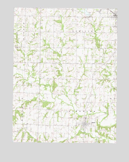
Hamilton West, MO USGS Topographic Map
Click on map above to begin viewing in our Map Viewer.

This topographic map contains these locations and features:
Feature Name Type Latitude Longitude GNIS ID View Map
BarwickPopulated PlaceN39.7136°W94.1233°738426View Map
Barwick School (historical)SchoolN39.7143°W94.1250°713710View Map
Caldwell County Sheriff's OfficeBuildingN39.6433°W94.0375°2752535View Map
Center Prairie School (historical)SchoolN39.6691°W94.0019°715652View Map
City of HamiltonCivilN39.7426°W94.0020°2394277View Map
City of KingstonCivilN39.6425°W94.0383°2395539View Map
Clark LakeReservoirN39.7240°W94.0138°762684View Map
Clark Lake DamDamN39.7250°W94.0136°762683View Map
Corner School (historical)SchoolN39.6986°W94.1122°730074View Map
Dillon School (historical)SchoolN39.6862°W94.0753°716907View Map
Dustin CemeteryCemeteryN39.6664°W94.0085°742935View Map
East Sheep CreekStreamN39.7036°W94.1102°717343View Map
Far West School (historical)SchoolN39.6703°W94.1138°717844View Map
Goose CreekStreamN39.6661°W94.0747°718590View Map
Hamilton City Water Plant DamDamN39.7433°W94.0352°760624View Map
Hamilton ReservoirReservoirN39.7470°W94.0386°760625View Map
Harrison School (historical)SchoolN39.7133°W94.0413°719165View Map
Highland CemeteryCemeteryN39.7475°W94.0216°742936View Map
Houghton School (historical)SchoolN39.6410°W94.0849°719888View Map
Independence School (historical)SchoolN39.7103°W94.0041°720098View Map
Jim CreekStreamN39.6678°W94.0577°720319View Map
Kendall ChurchChurchN39.6984°W94.0473°720532View Map
KingstonPopulated PlaceN39.6442°W94.0386°720629View Map
Kingston CemeteryCemeteryN39.6474°W94.0367°2681366View Map
Kingston Elementary SchoolSchoolN39.6450°W94.0373°2545269View Map
Kingston Fire DepartmentBuildingN39.6425°W94.0395°2621709View Map
Kingston Post OfficePost OfficeN39.6431°W94.0374°2782679View Map
Long CreekStreamN39.6292°W94.0247°721541View Map
Manson School (historical)SchoolN39.7392°W94.1119°721812View Map
Mill CreekStreamN39.6589°W94.0524°722337View Map
Mill Creek School (historical)SchoolN39.7281°W94.0763°722345View Map
Morris CemeteryCemeteryN39.6419°W94.1085°742934View Map
Sheep CreekStreamN39.6881°W94.1022°726298View Map
Township of HamiltonCivilN39.7422°W94.0385°766363View Map
Township of KingstonCivilN39.6553°W94.0386°766365View Map
West Prairie School (historical)SchoolN39.6696°W94.0394°728616View Map
West Sheep CreekStreamN39.7183°W94.1155°728626View Map

Note: Coordinates in the location and feature list above are referenced to NAD83 datum.


Copyright (C) 2008-2025 Ryan Niemi / Sunset Dynamics ... All Rights Reserved