TopoQuest Logo
Do you find TopoQuest useful?
Help keep TopoQuest running and adding new maps/features by donating!
Bitcoin:  19c7KJd3qBynnjoSw5npx9KScwjBe4ifkT
Litecoin:  LXs6TkuXGGXo1vDsWCkWVdjQX94eUKd6ui
Home View Maps Find Maps Find Places Resources & Links


Winter, Wisconsin Topographic Map

USGS Map Title: Winter, WI
USGS Map MRC: 45091G1
DRG (GeoTIFF) Download: o45091g1.tif


Neighboring USGS Topographic Map Quads:


  New Post, WI  
45091H2
 

  Barker Lake, WI  
45091H1
 

  Blaisdell Lake, WI  
45090H8
 

  Radisson, WI  
45091G2
 

  Winter, WI  
45091G1
 

  Lake Winter, WI  
45090G8
 

  Exeland, WI  
45091F2
 

  Hogsback Creek, WI  
45091F1
 

  Ingram NW, WI  
45090F8


Map MRC Location:

N46°
W92°
N46°
W91°
H8 H7 H6 H5 H4 H3 H2 H1
G8 G7 G6 G5 G4 G3 G2 G1
F8 F7 F6 F5 F4 F3 F2 F1
E8 E7 E6 E5 E4 E3 E2 E1
D8 D7 D6 D5 D4 D3 D2 D1
C8 C7 C6 C5 C4 C3 C2 C1
B8 B7 B6 B5 B4 B3 B2 B1
A8 A7 A6 A5 A4 A3 A2 A1
N45°
W92°
N45°
W91°

Winter, WI USGS 1:24K Topographic Map Preview:
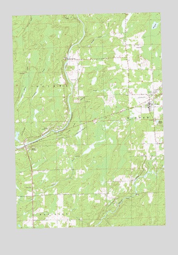
Winter, WI USGS Topographic Map
Click on map above to begin viewing in our Map Viewer.

This topographic map contains these locations and features:
Feature Name Type Latitude Longitude GNIS ID View Map
Bishop BridgeBridgeN45.8486°W91.0785°1561829View Map
Bishop Bridge School (historical)SchoolN45.8483°W91.0754°1833738View Map
Chapple CreekStreamN45.8750°W91.0927°1578978View Map
Crawford CreekStreamN45.8038°W91.1018°1563513View Map
Crazy Horse CreekStreamN45.7983°W91.1204°1563517View Map
Crazy Horse Creek DamDamN45.8016°W91.1218°1792487View Map
Deadman CreekStreamN45.7839°W91.0015°1563779View Map
Doc Smith ParkParkN45.8200°W91.0146°1833748View Map
Evangelical Free ChurchChurchN45.8175°W91.0110°1833750View Map
Knapp Stout CreekStreamN45.8572°W91.0718°1579597View Map
Mud LakeLakeN45.8672°W91.0053°1569971View Map
OjibwaPopulated PlaceN45.7980°W91.1168°1570759View Map
Ojibwa State ParkParkN45.8077°W91.0779°1570760View Map
Phelan CreekStreamN45.8197°W91.0779°1571289View Map
Rainbow AirportAirportN45.8080°W91.0970°1582123View Map
Saint Peter's CemeteryCemeteryN45.8276°W91.0082°1573527View Map
Saint Peters Catholic ChurchChurchN45.8200°W91.0110°1833796View Map
Sawyer County Emergency Ambulance Service Winter StationBuildingN45.8203°W91.0073°2698377View Map
Tice Public LibraryBuildingN45.8214°W91.0124°1833806View Map
Town of OjibwaCivilN45.8315°W91.1129°1583856View Map
Tuscobia Park Falls State TrailTrailN45.8094°W91.0613°1577487View Map
Village of WinterCivilN45.8221°W91.0131°1584459View Map
WinterPopulated PlaceN45.8197°W91.0118°1576887View Map
Winter CemeteryCemeteryN45.8278°W91.0090°1576888View Map
Winter Elementary SchoolSchoolN45.8190°W91.0128°2713214View Map
Winter High SchoolSchoolN45.8190°W91.0129°1833814View Map
Winter Middle SchoolSchoolN45.8190°W91.0129°2713421View Map
Winter Post OfficePost OfficeN45.8208°W91.0110°1833815View Map
Winter Village HallBuildingN45.8214°W91.0124°1833816View Map
Winter Volunteer Fire DepartmentBuildingN45.8203°W91.0073°2696787View Map

Note: Coordinates in the location and feature list above are referenced to NAD83 datum.


Copyright (C) 2008-2025 Ryan Niemi / Sunset Dynamics ... All Rights Reserved