TopoQuest Logo
Do you find TopoQuest useful?
Help keep TopoQuest running and adding new maps/features by donating!
Bitcoin:  19c7KJd3qBynnjoSw5npx9KScwjBe4ifkT
Litecoin:  LXs6TkuXGGXo1vDsWCkWVdjQX94eUKd6ui
Home View Maps Find Maps Find Places Resources & Links


Winter Harbor, Maine Topographic Map

USGS Map Title: Winter Harbor, ME
USGS Map MRC: 44068D1
DRG (GeoTIFF) Download: o44068d1.tif


Neighboring USGS Topographic Map Quads:


  Sullivan, ME  
44068E2
 

  Tunk Lake, ME  
44068E1
 

  Cherryfield, ME  
44067E8
 

  Bar Harbor, ME  
44068D2
 

  Winter Harbor, ME  
44068D1
 

  Petit Manan Point, ME  
44067D8
 

  Seal Harbor, ME  
44068C2
 

  Schoodic Head, ME  
44068C1


Map MRC Location:

N45°
W69°
N45°
W68°
H8 H7 H6 H5 H4 H3 H2 H1
G8 G7 G6 G5 G4 G3 G2 G1
F8 F7 F6 F5 F4 F3 F2 F1
E8 E7 E6 E5 E4 E3 E2 E1
D8 D7 D6 D5 D4 D3 D2 D1
C8 C7 C6 C5 C4 C3 C2 C1
B8 B7 B6 B5 B4 B3 B2 B1
A8 A7 A6 A5 A4 A3 A2 A1
N44°
W69°
N44°
W68°

Winter Harbor, ME USGS 1:24K Topographic Map Preview:
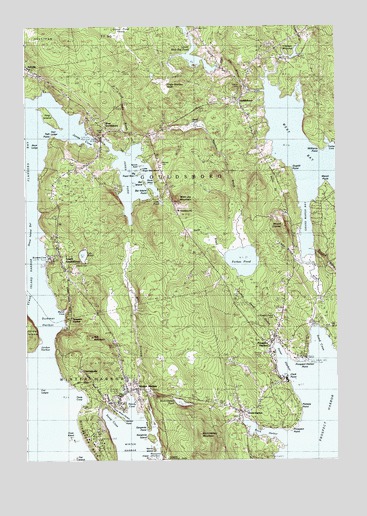
Winter Harbor, ME USGS Topographic Map
Click on map above to begin viewing in our Map Viewer.

This topographic map contains these locations and features:
Feature Name Type Latitude Longitude GNIS ID View Map
Abijah LedgeBarN44.3854°W68.0792°581670View Map
Ash MountainSummitN44.4105°W68.0983°561317View Map
AshvillePopulated PlaceN44.4879°W68.1211°561326View Map
Bar IslandIslandN44.4551°W68.0764°1911375View Map
Bar Island PointCapeN44.4534°W68.0745°1911376View Map
Bartlett Maine Estate WineryLocaleN44.4915°W68.0139°1911381View Map
Big Chief SpringSpringN44.4354°W68.0522°562153View Map
Big Sugar Bear IslandIslandN44.4576°W68.0786°1911411View Map
Birch HarborBayN44.3840°W68.0342°562287View Map
Birch HarborPopulated PlaceN44.3887°W68.0372°562288View Map
Birch Harbor MountainSummitN44.3824°W68.0549°2772243View Map
Birch Harbor PondLakeN44.3917°W68.0626°562289View Map
Birch Harbor Post OfficePost OfficeN44.3890°W68.0402°1911412View Map
Black LedgeBarN44.4651°W68.1181°580032View Map
Bunkers CoveBayN44.4337°W68.1161°579953View Map
Chicken Mill StreamStreamN44.4951°W68.0136°563935View Map
Chicken MillpondLakeN44.4907°W68.0176°563936View Map
Clark PointCapeN44.3970°W68.0192°564045View Map
Cod LedgesBarN44.3956°W68.1197°564144View Map
Crow IslandIslandN44.3817°W68.1058°564607View Map
Deep CoveBayN44.3929°W68.1017°564952View Map
Dike BrookStreamN44.4334°W68.0139°1911526View Map
Dingle Meadow HeathSwampN44.4787°W68.0628°565112View Map
Dorcas LibraryBuildingN44.4085°W68.0258°2738406View Map
Flat IslandIslandN44.3756°W68.1036°579090View Map
Forbes PondLakeN44.4325°W68.0375°566372View Map
Frazer PointCapeN44.3756°W68.0747°581421View Map
Frazer Point Picnic AreaLocaleN44.3759°W68.0750°1911619View Map
GerrishvillePopulated PlaceN44.4015°W68.1014°566763View Map
GouldsboroPopulated PlaceN44.4784°W68.0383°567006View Map
Gouldsboro Fire Department Station 1BuildingN44.4068°W68.0273°2553118View Map
Gouldsboro Fire Department Station 2BuildingN44.4491°W68.1113°2553204View Map
Gouldsboro Fire Department Station 3BuildingN44.4955°W68.0209°2553117View Map
Gouldsboro Grammar SchoolSchoolN44.4467°W68.0633°1911635View Map
Gouldsboro Police DepartmentBuildingN44.4068°W68.0273°2735978View Map
Gouldsboro Post OfficePost OfficeN44.4718°W68.0956°1911638View Map
Gouldsboro United Methodist ChurchChurchN44.4795°W68.0425°1911639View Map
Grand Marsh BayBayN44.4415°W68.0114°567037View Map
Grindstone NeckCapeN44.3826°W68.0958°567340View Map
Grindstone Neck Golf CourseLocaleN44.3895°W68.0958°1911655View Map
Guptill PointCapeN44.4587°W68.0175°567401View Map
Harbor PointCapeN44.3865°W68.0858°1911675View Map
Henry CoveBayN44.3931°W68.0825°581436View Map
Hillcrest CemeteryCemeteryN44.4603°W68.0695°568055View Map
Hillside CemeteryCemeteryN44.4313°W68.1052°568075View Map
Hillside CemeteryCemeteryN44.4824°W68.0380°2736655View Map
Hog IslandIslandN44.4731°W68.1128°568159View Map
Inner HarborBayN44.4029°W68.0208°568646View Map
Inner Winter HarborBayN44.3890°W68.0883°578910View Map
Jones CoveBayN44.4679°W68.1008°568959View Map
Jones PondReservoirN44.4567°W68.0813°568969View Map
Jones Pond DamDamN44.4669°W68.0931°1774685View Map
Jordan HarborBayN44.4090°W68.1156°568986View Map
Lakeview CemeteryCemeteryN44.4647°W68.0916°2736668View Map
Libby BrookStreamN44.4326°W68.0161°1911735View Map
Lily PondLakeN44.4341°W68.1017°569575View Map
Little PondReservoirN44.4492°W68.0702°1911740View Map
Little Sugar Bear IslandIslandN44.4592°W68.0778°1911741View Map
Lower West Bay PondReservoirN44.4934°W68.0570°579987View Map
Lower West Bay Pond DamDamN44.4883°W68.0462°1774683View Map
Marsh PointCapeN44.4540°W68.0031°570816View Map
Mill StreamStreamN44.3895°W68.0745°571354View Map
Mosquito HarborBayN44.3765°W68.0731°1911770View Map
Mount CromerSummitN44.4425°W68.0214°571761View Map
Myrick CoveBayN44.4181°W68.1092°581655View Map
Nahum Jones CemeteryCemeteryN44.4686°W68.0832°2736679View Map
Nails BrookStreamN44.4342°W68.0453°1911794View Map
Norris IslandIslandN44.3784°W68.0731°572236View Map
Peninsula SchoolSchoolN44.4051°W68.0315°2738132View Map
Pettees PointCapeN44.3901°W68.0144°573241View Map
Prospect HarborBayN44.3926°W68.0056°573835View Map
Prospect HarborPopulated PlaceN44.4090°W68.0261°573836View Map
Prospect Harbor Light StationBuildingN44.4034°W68.0131°1911869View Map
Prospect Harbor PointCapeN44.4045°W68.0122°573837View Map
Prospect Harbor Post OfficePost OfficeN44.4112°W68.0244°1911870View Map
Prospect Harbor United Methodist ChurchChurchN44.4076°W68.0272°1911871View Map
Prospect PointCapeN44.3848°W68.0175°573841View Map
Roaring BullBarN44.3815°W68.0186°581878View Map
Sand CoveBayN44.3879°W68.0914°574825View Map
Sand CoveBayN44.4095°W68.0067°574827View Map
Sargents IslandIslandN44.3817°W68.0742°574926View Map
Sargents PointCapeN44.3845°W68.0750°574927View Map
Seal LedgeBarN44.4692°W68.1145°1911922View Map
Seal LedgeBarN44.4612°W68.0011°581891View Map
South GouldsboroPopulated PlaceN44.4298°W68.1075°575845View Map
Spruce PointCapeN44.4623°W68.0786°1911974View Map
Stave Island BarBarN44.4406°W68.1221°576285View Map
Stover IslandIslandN44.4548°W68.0742°581635View Map
Summer HarborPopulated PlaceN44.4156°W68.1058°579753View Map
Summer HarborBayN44.4154°W68.1161°581658View Map
Taft CemeteryCemeteryN44.4609°W68.1067°2736338View Map
Taft PointCapeN44.4676°W68.1125°581498View Map
Timber CoveBayN44.4670°W68.0019°577114View Map
Town of GouldsboroCivilN44.4241°W68.0491°582494View Map
West GouldsboroPopulated PlaceN44.4695°W68.0903°578150View Map
West Gouldsboro Union ChurchChurchN44.4654°W68.0942°1912072View Map
Whitaker CemeteryCemeteryN44.4994°W68.0563°2736343View Map
Willisms PointCapeN44.4662°W68.0056°578530View Map
Winn Joy MountainSummitN44.4506°W68.0628°1912093View Map
Winter HarborPopulated PlaceN44.3954°W68.0831°578605View Map
Winter Harbor Census Designated PlaceCensusN44.3928°W68.0917°2630702View Map
Winter Harbor Fire DepartmentBuildingN44.3940°W68.0860°2552738View Map
Winter Harbor Grammar SchoolSchoolN44.3912°W68.0864°1912094View Map
Winter Harbor Historical Society BuildingBuildingN44.3945°W68.0881°1912095View Map
Winter Harbor MarinaLocaleN44.3917°W68.0811°1912097View Map
Winter Harbor Police DepartmentBuildingN44.3913°W68.0869°2735979View Map
Winter Harbor Post OfficePost OfficeN44.3941°W68.0853°1912098View Map
Winter Harbor Public LibraryBuildingN44.3909°W68.0882°1912099View Map
Winter Harbor Yacht ClubLocaleN44.3834°W68.0920°1912100View Map
Wood CemeteryCemeteryN44.4701°W68.0933°2736346View Map

Note: Coordinates in the location and feature list above are referenced to NAD83 datum.


Copyright (C) 2008-2025 Ryan Niemi / Sunset Dynamics ... All Rights Reserved