TopoQuest Logo
Do you find TopoQuest useful?
Help keep TopoQuest running and adding new maps/features by donating!
Bitcoin:  19c7KJd3qBynnjoSw5npx9KScwjBe4ifkT
Litecoin:  LXs6TkuXGGXo1vDsWCkWVdjQX94eUKd6ui
Home View Maps Find Maps Find Places Resources & Links


Sullivan, Maine Topographic Map

USGS Map Title: Sullivan, ME
USGS Map MRC: 44068E2
DRG (GeoTIFF) Download: o44068e2.tif


Neighboring USGS Topographic Map Quads:


  Eastbrook, ME  
44068F3
 

  Molasses Pond, ME  
44068F2
 

  Tunk Mountain, ME  
44068F1
 

  Hancock, ME  
44068E3
 

  Sullivan, ME  
44068E2
 

  Tunk Lake, ME  
44068E1
 

  Salsbury Cove, ME  
44068D3
 

  Bar Harbor, ME  
44068D2
 

  Winter Harbor, ME  
44068D1


Map MRC Location:

N45°
W69°
N45°
W68°
H8 H7 H6 H5 H4 H3 H2 H1
G8 G7 G6 G5 G4 G3 G2 G1
F8 F7 F6 F5 F4 F3 F2 F1
E8 E7 E6 E5 E4 E3 E2 E1
D8 D7 D6 D5 D4 D3 D2 D1
C8 C7 C6 C5 C4 C3 C2 C1
B8 B7 B6 B5 B4 B3 B2 B1
A8 A7 A6 A5 A4 A3 A2 A1
N44°
W69°
N44°
W68°

Sullivan, ME USGS 1:24K Topographic Map Preview:
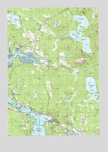
Sullivan, ME USGS Topographic Map
Click on map above to begin viewing in our Map Viewer.

This topographic map contains these locations and features:
Feature Name Type Latitude Longitude GNIS ID View Map
Alder BrookStreamN44.5981°W68.1903°561123View Map
Bailey MountainSummitN44.5971°W68.2390°580128View Map
Baker HillSummitN44.5182°W68.1724°561469View Map
Basin PondLakeN44.5336°W68.1769°561692View Map
Bayview CemeteryCemeteryN44.5923°W68.2156°561754View Map
Bean MeadowSwampN44.5334°W68.1300°1911391View Map
Bear PointCapeN44.6104°W68.1506°580134View Map
Birch Tree CemeteryCemeteryN44.5151°W68.1458°562359View Map
Black BeachBeachN44.5951°W68.1370°580136View Map
Blaisdell CemeteryCemeteryN44.5362°W68.2442°580111View Map
Brown MeadowSwampN44.5417°W68.2117°580110View Map
Buckskin CampLocaleN44.6162°W68.1614°563130View Map
Buckskin IslandIslandN44.5820°W68.2356°580126View Map
Cape RosierCapeN44.5934°W68.1481°580129View Map
Card Mill StreamStreamN44.5709°W68.1945°563505View Map
CatamountSummitN44.5454°W68.1833°580115View Map
Clapham BrookStreamN44.5206°W68.2014°580098View Map
Clark PondLakeN44.5651°W68.2231°564048View Map
Creasy CoveBayN44.5673°W68.2472°1911502View Map
Donnell PondReservoirN44.5995°W68.1490°565206View Map
Donnell Pond DamDamN44.5964°W68.1789°1774695View Map
Doyle CemeteryCemeteryN44.5073°W68.1550°580100View Map
Dry BrookStreamN44.5290°W68.1411°580108View Map
Dry HeathSwampN44.5281°W68.1342°580107View Map
Duck PondLakeN44.6081°W68.1822°565350View Map
Duck Pond HillSummitN44.6054°W68.1740°565363View Map
Dyer CemeteryCemeteryN44.5034°W68.1483°580095View Map
East FranklinPopulated PlaceN44.5681°W68.1947°565609View Map
East Franklin CemeteryCemeteryN44.5723°W68.1956°580122View Map
East SullivanPopulated PlaceN44.5037°W68.1522°565691View Map
Evergreen PointCapeN44.5417°W68.2497°578925View Map
Falls PointCapeN44.5217°W68.2211°566026View Map
Ferry PointCapeN44.5162°W68.2133°566114View Map
Fiery MountainSummitN44.5857°W68.1684°566133View Map
Flanders PondReservoirN44.5467°W68.1350°566279View Map
Flanders StreamStreamN44.5015°W68.1567°566280View Map
FranklinPopulated PlaceN44.5870°W68.2322°566533View Map
Franklin Baptist ChurchChurchN44.5865°W68.2306°1911613View Map
Franklin Historical Society BuildingBuildingN44.5679°W68.1939°1911614View Map
Franklin Post OfficePost OfficeN44.5905°W68.2207°1911615View Map
Franklin United Methodist ChurchChurchN44.5881°W68.2339°1911617View Map
Franklin Volunteer Fire DepartmentBuildingN44.5885°W68.2395°2553213View Map
Frenchman's Bay LibraryBuildingN44.5304°W68.2248°2738395View Map
Georges PondLakeN44.6135°W68.2405°566749View Map
Gill BogSwampN44.6217°W68.1317°566793View Map
Gordon CemeteryCemeteryN44.5323°W68.2383°580112View Map
Grays BrookStreamN44.5279°W68.2203°580103View Map
Hancock-Sullivan BridgeBridgeN44.5279°W68.2325°580102View Map
Hemlock PointCapeN44.6056°W68.1486°567923View Map
Hillcrest CemeteryCemeteryN44.5131°W68.2256°568056View Map
Hog BayBayN44.5773°W68.2239°568151View Map
Jehlickoo IslandIslandN44.5412°W68.1342°580118View Map
Johnnys BrookStreamN44.5640°W68.1847°580119View Map
Julius Darling PointCapeN44.5792°W68.2472°580127View Map
Kelly IslandIslandN44.5434°W68.1356°580117View Map
Little IslandIslandN44.5973°W68.1653°580132View Map
Little PondLakeN44.5763°W68.1709°569977View Map
Littlefield IslandIslandN44.5417°W68.1306°580113View Map
Long CoveBayN44.5151°W68.1943°570194View Map
Long PondReservoirN44.5333°W68.1696°570277View Map
Long Pond BrookStreamN44.5698°W68.1972°580123View Map
Long Pond HillSummitN44.5413°W68.1671°570309View Map
Loon IslandIslandN44.5515°W68.1397°580116View Map
Martin Ridge BrookStreamN44.6167°W68.1600°570857View Map
Martin Ridge CoveBayN44.6126°W68.1511°570858View Map
Mile IslandIslandN44.5990°W68.1578°580131View Map
Mill BrookStreamN44.5220°W68.1953°580104View Map
Mill PondLakeN44.5210°W68.1958°580109View Map
Mountain View SchoolSchoolN44.5558°W68.2027°580121View Map
Mountainview CampgroundLocaleN44.5065°W68.1614°1911788View Map
Mouse IslandIslandN44.5976°W68.1481°1911790View Map
Murch IslandIslandN44.6131°W68.2347°580139View Map
North SullivanPopulated PlaceN44.5406°W68.2431°572413View Map
North Sullivan United Methodist ChurchChurchN44.5376°W68.2403°1911817View Map
Norway PointCapeN44.5992°W68.1556°572513View Map
Otter Bog MountainSummitN44.6197°W68.1431°572798View Map
Pearson IslandIslandN44.5390°W68.1311°580114View Map
Pine KnollSummitN44.6093°W68.2095°573391View Map
Preble CoveBayN44.5256°W68.2178°573770View Map
Redman BrookStreamN44.5948°W68.1383°580893View Map
Rocky BrookStreamN44.5679°W68.2442°580120View Map
Salter CemeteryCemeteryN44.5265°W68.2033°580105View Map
Sand PointCapeN44.5959°W68.1703°580133View Map
SchoodicPopulated PlaceN44.5631°W68.1445°579678View Map
Schoodic BayBayN44.5829°W68.1392°574990View Map
Schoodic BeachBeachN44.5792°W68.1350°580130View Map
Schoodic BogLakeN44.5609°W68.1569°574991View Map
Schoodic BrookStreamN44.5565°W68.1408°580124View Map
Schoodic MountainSummitN44.5734°W68.1468°575000View Map
Schoodic NubbleSummitN44.5731°W68.1567°575002View Map
Shillalah PondLakeN44.6162°W68.1312°575401View Map
Shipyard PointCapeN44.5829°W68.2311°580125View Map
Simpson CemeteryCemeteryN44.5098°W68.1656°580092View Map
Smelt BrookStreamN44.5051°W68.1614°580097View Map
Smelt CoveBayN44.5026°W68.1606°580096View Map
Springer CreekStreamN44.5904°W68.2447°580894View Map
Sprucewood PointCapeN44.5098°W68.2008°580093View Map
SullivanPopulated PlaceN44.5204°W68.1967°576510View Map
Sullivan FallsFallsN44.5206°W68.2208°576511View Map
Sullivan Harbor ChurchChurchN44.5229°W68.2042°1911986View Map
Sullivan Harbor Scenic TurnoutLocaleN44.5154°W68.1864°1911987View Map
Sullivan Harbor SchoolSchoolN44.5226°W68.2042°580106View Map
Sullivan Post OfficePost OfficeN44.5327°W68.2369°1911988View Map
Sullivan SchoolSchoolN44.5265°W68.2153°580101View Map
Sullivan Volunteer Fire Department Barbara Davis StationBuildingN44.5299°W68.2254°2552714View Map
Sullivan Volunteer Fire Department East Sullivan StationBuildingN44.5053°W68.1505°2553161View Map
Sullivan-Sorrento Historical Society BuildingBuildingN44.5459°W68.2220°1911989View Map
Sumner CemeteryCemeteryN44.5099°W68.1658°576523View Map
Sumner Memorial High SchoolSchoolN44.5117°W68.1663°576524View Map
Swan BrookStreamN44.5959°W68.1806°576573View Map
T9 SD BPPCivilN44.6185°W68.1529°2748537View Map
Taunton BayBayN44.5251°W68.2299°576672View Map
The NarrowsChannelN44.6031°W68.1495°580135View Map
Town of FranklinCivilN44.6003°W68.2318°582479View Map
Town of SullivanCivilN44.5350°W68.1572°582754View Map
Tucker MountainSummitN44.5193°W68.1834°577387View Map
Union ChurchChurchN44.5104°W68.1661°577547View Map
Urann CemeteryCemeteryN44.5125°W68.1682°2736342View Map
WaukeagPopulated PlaceN44.5234°W68.2386°577908View Map
West SullivanPopulated PlaceN44.5306°W68.2311°578230View Map
York Hill CemeteryCemeteryN44.5187°W68.1947°578779View Map

Note: Coordinates in the location and feature list above are referenced to NAD83 datum.


Copyright (C) 2008-2024 Ryan Niemi / Sunset Dynamics ... All Rights Reserved