TopoQuest Logo
Do you find TopoQuest useful?
Help keep TopoQuest running and adding new maps/features by donating!
Bitcoin:  19c7KJd3qBynnjoSw5npx9KScwjBe4ifkT
Litecoin:  LXs6TkuXGGXo1vDsWCkWVdjQX94eUKd6ui
Home View Maps Find Maps Find Places Resources & Links


Witham Mountain, Maine Topographic Map

USGS Map Title: Witham Mountain, ME
USGS Map MRC: 45070A1
DRG (GeoTIFF) Download: o45070a1.tif


Neighboring USGS Topographic Map Quads:


  Little Bigelow Mountain, ME  
45070B2
 

  East Carry Pond, ME  
45070B1
 

  Caratunk, ME  
45069B8
 

  Poplar Mountain, ME  
45070A2
 

  Witham Mountain, ME  
45070A1
 

  Bingham, ME  
45069A8
 

  Kingfield, ME  
44070H2
 

  New Portland, ME  
44070H1
 

  Embden Pond, ME  
44069H8


Map MRC Location:

N46°
W71°
N46°
W70°
H8 H7 H6 H5 H4 H3 H2 H1
G8 G7 G6 G5 G4 G3 G2 G1
F8 F7 F6 F5 F4 F3 F2 F1
E8 E7 E6 E5 E4 E3 E2 E1
D8 D7 D6 D5 D4 D3 D2 D1
C8 C7 C6 C5 C4 C3 C2 C1
B8 B7 B6 B5 B4 B3 B2 B1
A8 A7 A6 A5 A4 A3 A2 A1
N45°
W71°
N45°
W70°

Witham Mountain, ME USGS 1:24K Topographic Map Preview:
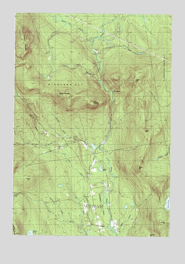
Witham Mountain, ME USGS Topographic Map
Click on map above to begin viewing in our Map Viewer.

This topographic map contains these locations and features:
Feature Name Type Latitude Longitude GNIS ID View Map
Bald MountainSummitN45.0747°W70.0637°561520View Map
Barker BrookStreamN45.1076°W70.0667°561602View Map
Bear BrookStreamN45.0034°W70.0703°561801View Map
Briggs HillSummitN45.0592°W70.0211°562963View Map
Britenell BrookStreamN45.0534°W70.0759°562983View Map
Burnt HillSummitN45.0870°W70.0292°563234View Map
Chandler HillSummitN45.0004°W70.0166°563826View Map
Churchill BrookStreamN45.1003°W70.0603°563987View Map
Highland CemeteryCemeteryN45.0556°W70.0881°2737025View Map
Highland SchoolSchoolN45.0551°W70.0809°568040View Map
Howard HillSummitN45.0332°W70.1136°568383View Map
Hutchins HillSummitN45.0076°W70.0028°568531View Map
Lexington TownshipCivilN45.0069°W70.0579°1987421View Map
Little Michael StreamStreamN45.0509°W70.0937°569906View Map
Michael StreamStreamN45.0259°W70.0498°571199View Map
Moores PondLakeN45.0379°W70.0552°571568View Map
Peaked HillSummitN45.0383°W70.0257°573089View Map
Pease BrookStreamN45.0028°W70.0431°573118View Map
Plantation of HighlandCivilN45.0917°W70.0814°582519View Map
Safford PondLakeN45.0000°W70.1102°574677View Map
Schoolhouse BrookStreamN45.0073°W70.0790°575022View Map
Spruce PondLakeN45.0184°W70.0010°576162View Map
Stewart MountainSummitN45.1130°W70.1192°576340View Map
Stony BrookStreamN45.0867°W70.0581°576397View Map
The LedgesBenchN45.0809°W70.0434°576843View Map
Witham MountainSummitN45.0792°W70.0885°578626View Map

Note: Coordinates in the location and feature list above are referenced to NAD83 datum.


Copyright (C) 2008-2025 Ryan Niemi / Sunset Dynamics ... All Rights Reserved