TopoQuest Logo
Do you find TopoQuest useful?
Help keep TopoQuest running and adding new maps/features by donating!
Bitcoin:  19c7KJd3qBynnjoSw5npx9KScwjBe4ifkT
Litecoin:  LXs6TkuXGGXo1vDsWCkWVdjQX94eUKd6ui
Home View Maps Find Maps Find Places Resources & Links


Woody Creek, Colorado Topographic Map

USGS Map Title: Woody Creek, CO
USGS Map MRC: 39106C8
DRG (GeoTIFF) Download: o39106c8.tif


Neighboring USGS Topographic Map Quads:


  Leon, CO  
39107D1
 

  Toner Reservoir, CO  
39106D8
 

  Red Creek, CO  
39106D7
 

  Basalt, CO  
39107C1
 

  Woody Creek, CO  
39106C8
 

  Ruedi Reservoir, CO  
39106C7
 

  Capitol Peak, CO  
39107B1
 

  Highland Peak, CO  
39106B8
 

  Aspen, CO  
39106B7


Map MRC Location:

N40°
W107°
N40°
W106°
H8 H7 H6 H5 H4 H3 H2 H1
G8 G7 G6 G5 G4 G3 G2 G1
F8 F7 F6 F5 F4 F3 F2 F1
E8 E7 E6 E5 E4 E3 E2 E1
D8 D7 D6 D5 D4 D3 D2 D1
C8 C7 C6 C5 C4 C3 C2 C1
B8 B7 B6 B5 B4 B3 B2 B1
A8 A7 A6 A5 A4 A3 A2 A1
N39°
W107°
N39°
W106°

Woody Creek, CO USGS 1:24K Topographic Map Preview:
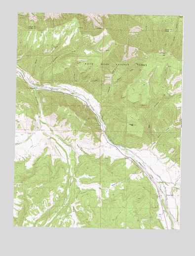
Woody Creek, CO USGS Topographic Map
Click on map above to begin viewing in our Map Viewer.

This topographic map contains these locations and features:
Feature Name Type Latitude Longitude GNIS ID View Map
Arbaney DitchCanalN39.3358°W106.9948°179689View Map
Arbaney GulchValleyN39.3198°W106.9425°179685View Map
Aspen AirportAirportN39.2589°W106.9129°204248View Map
Aspen Fire Protection District SubstationBuildingN39.2733°W106.8865°2667183View Map
Basalt Fire and Rural Fire Protection District Station 44 Old SnowmassBuildingN39.3061°W106.9795°2667092View Map
Besancon GulchValleyN39.2856°W106.9032°179704View Map
Big Buck MineMineN39.3325°W106.9653°1684264View Map
Bionaz GulchValleyN39.3369°W106.9930°179683View Map
Brush CreekStreamN39.2605°W106.8848°179707View Map
Brush Creek DitchCanalN39.2905°W106.9087°179703View Map
Capitol CreekStreamN39.3117°W106.9809°175028View Map
Cerise GulchValleyN39.3315°W106.9547°179711View Map
Dobson GulchValleyN39.3344°W106.9282°179687View Map
Dry Woody CreekStreamN39.2994°W106.8970°179696View Map
Eli Cerise DitchCanalN39.3075°W106.9323°179693View Map
Hemann-Woody Creek QuarryMineN39.2722°W106.8867°1684265View Map
Kester DitchCanalN39.3369°W106.9939°179688View Map
Little Elk CreekStreamN39.3036°W106.9881°175027View Map
Little Woody CreekStreamN39.2747°W106.8806°179708View Map
Panco Manganese DepositsMineN39.3455°W106.9884°1684266View Map
Red CanyonValleyN39.2996°W106.8963°179697View Map
Sloane PeakSummitN39.3525°W106.8909°179686View Map
Smith and Rex DitchCanalN39.2617°W106.8914°179706View Map
SnowmassPopulated PlaceN39.3317°W106.9862°179690View Map
Snowmass CreekStreamN39.3319°W106.9862°175217View Map
Snowmass DitchCanalN39.2714°W106.9453°179700View Map
Snowmass Divide DitchCanalN39.2911°W106.9398°179695View Map
Snowmass Post OfficePost OfficeN39.3302°W106.9832°2734626View Map
T-C Aggregates QuarryMineN39.2705°W106.8848°1684267View Map
Tie Camp DitchCanalN39.3739°W106.8842°202673View Map
Trentaz GulchValleyN39.2548°W106.8807°180035View Map
Triangle PeakSummitN39.3105°W106.9109°196500View Map
Waco DitchCanalN39.2961°W106.9048°179701View Map
Walker Wonder DitchCanalN39.2908°W106.9750°179699View Map
Walthen DitchCanalN39.2842°W106.8909°179705View Map
Watson DivideGapN39.2967°W106.9512°179694View Map
Wheatley CemeteryCemeteryN39.3325°W106.9806°179691View Map
Wheatley GulchValleyN39.3313°W106.9803°179684View Map
Wheatley Western DitchCanalN39.3314°W106.9631°179692View Map
Wildcat CreekStreamN39.2797°W106.9556°179702View Map
Williams Ditch Number 2CanalN39.2905°W106.9912°179698View Map
Woody CreekPopulated PlaceN39.2703°W106.8862°179709View Map
Woody CreekStreamN39.2769°W106.8914°179712View Map
Woody Creek Census Designated PlaceCensusN39.2709°W106.8883°2583319View Map
Woody Creek Post OfficePost OfficeN39.2726°W106.8864°2734584View Map

Note: Coordinates in the location and feature list above are referenced to NAD83 datum.


Copyright (C) 2008-2024 Ryan Niemi / Sunset Dynamics ... All Rights Reserved