TopoQuest Logo
Do you find TopoQuest useful?
Help keep TopoQuest running and adding new maps/features by donating!
Bitcoin:  19c7KJd3qBynnjoSw5npx9KScwjBe4ifkT
Litecoin:  LXs6TkuXGGXo1vDsWCkWVdjQX94eUKd6ui
Home View Maps Find Maps Find Places Resources & Links


Wren, Oregon Topographic Map

USGS Map Title: Wren, OR
USGS Map MRC: 44123E4
DRG (GeoTIFF) Download: o44123e4.tif


Neighboring USGS Topographic Map Quads:


  Summit, OR  
44123F5
 

  Kings Valley, OR  
44123F4
 

  Airlie South, OR  
44123F3
 

  Marys Peak, OR  
44123E5
 

  Wren, OR  
44123E4
 

  Corvallis, OR  
44123E3
 

  Alsea, OR  
44123D5
 

  Flat Mountain, OR  
44123D4
 

  Greenberry, OR  
44123D3


Map MRC Location:

N45°
W124°
N45°
W123°
H8 H7 H6 H5 H4 H3 H2 H1
G8 G7 G6 G5 G4 G3 G2 G1
F8 F7 F6 F5 F4 F3 F2 F1
E8 E7 E6 E5 E4 E3 E2 E1
D8 D7 D6 D5 D4 D3 D2 D1
C8 C7 C6 C5 C4 C3 C2 C1
B8 B7 B6 B5 B4 B3 B2 B1
A8 A7 A6 A5 A4 A3 A2 A1
N44°
W124°
N44°
W123°

Wren, OR USGS 1:24K Topographic Map Preview:
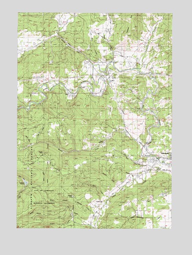
Wren, OR USGS Topographic Map
Click on map above to begin viewing in our Map Viewer.

This topographic map contains these locations and features:
Feature Name Type Latitude Longitude GNIS ID View Map
Blair CreekStreamN44.5362°W123.3907°1138240View Map
Blakesley CreekStreamN44.5923°W123.4048°1138247View Map
Blodgett CemeteryCemeteryN44.6002°W123.4973°1153664View Map
Bounds CreekStreamN44.5276°W123.4040°1130692View Map
Connection CreekStreamN44.5207°W123.4987°1134817View Map
Corvallis Rock Creek Water Treatment PlantLocaleN44.5080°W123.4564°2660758View Map
Enos CreekStreamN44.5490°W123.4857°1134814View Map
FlynnPopulated PlaceN44.5410°W123.3868°1142279View Map
Garrow (historical)LocaleN44.5712°W123.4976°1166530View Map
Gellatly CreekStreamN44.5229°W123.4182°1142604View Map
Gellatly CreekStreamN44.5951°W123.4404°1142605View Map
Gray CreekStreamN44.5179°W123.4273°1143000View Map
Greasy CreekStreamN44.5387°W123.3868°1143017View Map
Griffith CreekStreamN44.5076°W123.4548°1143087View Map
HarrisPopulated PlaceN44.5782°W123.4601°1143328View Map
Harris Post Office (historical)Post OfficeN44.5782°W123.4601°1165374View Map
Jones CreekStreamN44.5262°W123.4707°1130694View Map
Knight ReservoirReservoirN44.5515°W123.4070°1153494View Map
La Bare CreekStreamN44.5957°W123.4298°1144726View Map
Marys River GrangeBuildingN44.5343°W123.3859°1639228View Map
Middle Fork Rock CreekStreamN44.5137°W123.4609°1146157View Map
Miller CreekStreamN44.5804°W123.4429°1153496View Map
NoonPopulated PlaceN44.5454°W123.3982°1146871View Map
North Fork DamDamN44.5262°W123.4943°1155626View Map
North Fork ReservoirReservoirN44.5265°W123.4944°1153495View Map
North Fork Rock CreekStreamN44.5248°W123.4929°1155498View Map
Philomath Fire and Rescue Station 202BuildingN44.5867°W123.4263°2576689View Map
Pioneer ButteSummitN44.5426°W123.4809°1147755View Map
Pleasant Valley CemeteryCemeteryN44.5159°W123.4313°1147802View Map
Read CreekStreamN44.5968°W123.4259°1148260View Map
Rock CreekStreamN44.5012°W123.4368°1148595View Map
Rock Creek City ParkParkN44.5010°W123.4432°1987631View Map
Russell (historical)LocaleN44.5804°W123.4401°1166749View Map
South Fork Rock CreekStreamN44.5248°W123.4929°1150003View Map
Stilson CreekStreamN44.5237°W123.4843°1150435View Map
Tatum CreekStreamN44.5476°W123.4893°1134816View Map
Watkins CreekStreamN44.5101°W123.4329°1151961View Map
Watkins PondReservoirN44.5182°W123.4558°1134815View Map
Woods CreekStreamN44.5476°W123.4004°1152642View Map
WrenPopulated PlaceN44.5876°W123.4284°1166729View Map
Wren CemeteryCemeteryN44.5894°W123.4288°1153497View Map
Wren Forest Service StationLocaleN44.6007°W123.4245°1155955View Map
Wren Guard StationLocaleN44.6018°W123.4265°1152657View Map
Wren Post Office (historical)Post OfficeN44.5876°W123.4284°1166213View Map

Note: Coordinates in the location and feature list above are referenced to NAD83 datum.


Copyright (C) 2008-2025 Ryan Niemi / Sunset Dynamics ... All Rights Reserved