TopoQuest Logo
Do you find TopoQuest useful?
Help keep TopoQuest running and adding new maps/features by donating!
Bitcoin:  19c7KJd3qBynnjoSw5npx9KScwjBe4ifkT
Litecoin:  LXs6TkuXGGXo1vDsWCkWVdjQX94eUKd6ui
Home View Maps Find Maps Find Places Resources & Links


Marys Peak, Oregon Topographic Map

USGS Map Title: Marys Peak, OR
USGS Map MRC: 44123E5
DRG (GeoTIFF) Download: o44123e5.tif


Neighboring USGS Topographic Map Quads:


  Nortons, OR  
44123F6
 

  Summit, OR  
44123F5
 

  Kings Valley, OR  
44123F4
 

  Harlan, OR  
44123E6
 

  Marys Peak, OR  
44123E5
 

  Wren, OR  
44123E4
 

  Grass Mountain, OR  
44123D6
 

  Alsea, OR  
44123D5
 

  Flat Mountain, OR  
44123D4


Map MRC Location:

N45°
W124°
N45°
W123°
H8 H7 H6 H5 H4 H3 H2 H1
G8 G7 G6 G5 G4 G3 G2 G1
F8 F7 F6 F5 F4 F3 F2 F1
E8 E7 E6 E5 E4 E3 E2 E1
D8 D7 D6 D5 D4 D3 D2 D1
C8 C7 C6 C5 C4 C3 C2 C1
B8 B7 B6 B5 B4 B3 B2 B1
A8 A7 A6 A5 A4 A3 A2 A1
N44°
W124°
N44°
W123°

Marys Peak, OR USGS 1:24K Topographic Map Preview:
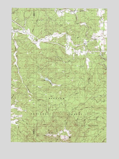
Marys Peak, OR USGS Topographic Map
Click on map above to begin viewing in our Map Viewer.

This topographic map contains these locations and features:
Feature Name Type Latitude Longitude GNIS ID View Map
AlderPopulated PlaceN44.5823°W123.5090°1137055View Map
Bark CreekStreamN44.5935°W123.5890°1137513View Map
BlodgettPopulated PlaceN44.5971°W123.5195°1138266View Map
Blodgett - Summit Rural Fire Protection District Station 1BuildingN44.5959°W123.5208°2577108View Map
Blodgett Census Designated PlaceCensusN44.5970°W123.5210°2584408View Map
Blodgett Elementary SchoolSchoolN44.5912°W123.5289°1138269View Map
Blodgett Post OfficePost OfficeN44.5969°W123.5193°1164928View Map
Burnt WoodsPopulated PlaceN44.6037°W123.6229°1139014View Map
Burnt Woods Post Office (historical)Post OfficeN44.6037°W123.6229°1164988View Map
Burnt Woods State Forest Service Station (historical)LocaleN44.6048°W123.6229°1167137View Map
Butler (historical)LocaleN44.6223°W123.5470°1166526View Map
Cain (historical)LocaleN44.6235°W123.5637°1166528View Map
Chintimini CreekStreamN44.5298°W123.5334°1139700View Map
Clark CreekStreamN44.6187°W123.5448°1153663View Map
Conger (historical)LocaleN44.6101°W123.5373°1153662View Map
Corvallis Watershed Wild Animal RefugeParkN44.5148°W123.5148°1140164View Map
Davidson CemeteryCemeteryN44.5429°W123.5720°1135191View Map
DevittLocaleN44.6226°W123.5473°1166643View Map
Devitt CreekStreamN44.6196°W123.5454°1140984View Map
Devitt Post Office (historical)Post OfficeN44.6226°W123.5473°1165154View Map
Dudlee HillSummitN44.5954°W123.5407°1162278View Map
Hymes CreekStreamN44.5943°W123.5984°1158883View Map
Knights of Pythias CampLocaleN44.5348°W123.5532°1144685View Map
Lasky CreekStreamN44.5818°W123.5457°1144842View Map
Leslie CemeteryCemeteryN44.5690°W123.6168°1135202View Map
Marval (historical)LocaleN44.6229°W123.5629°1145855View Map
Marys PeakSummitN44.5043°W123.5512°1145860View Map
Marys Peak Botanical Special Interest AreaParkN44.5032°W123.5526°1167203View Map
Marys Peak Observation PointLocaleN44.5101°W123.5507°1952952View Map
Marys Peak Recreation SiteLocaleN44.5093°W123.5562°1153667View Map
Meadow Sno-Park (historical)LocaleN44.5090°W123.5623°1952953View Map
Mulkey CemeteryCemeteryN44.5804°W123.6206°1135203View Map
Noble Fir Management Buffer ZoneParkN44.5110°W123.5707°1167138View Map
North Ridge Sno-Park (historical)LocaleN44.5126°W123.5554°1952954View Map
Norton CreekStreamN44.5915°W123.5123°1143824View Map
Peak (historical)Populated PlaceN44.5471°W123.5448°1153666View Map
Peak Post Office (historical)Post OfficeN44.5471°W123.5448°1165771View Map
Scheele CreekStreamN44.5860°W123.5290°1146649View Map
Shotpouch CreekStreamN44.6023°W123.6176°1149446View Map
Shroyer RidgeRidgeN44.6082°W123.5637°1158938View Map
Thompson DamDamN44.5598°W123.5815°1155508View Map
Thompson LakeReservoirN44.5576°W123.5777°1153665View Map
Tumtum RiverStreamN44.5885°W123.5120°1151510View Map
Wesley Post Office (historical)Post OfficeN44.5485°W123.5951°1166147View Map
West RidgeRidgeN44.5073°W123.5734°1134818View Map
Westpoint Sno-Park (historical)LocaleN44.5065°W123.5796°1952959View Map

Note: Coordinates in the location and feature list above are referenced to NAD83 datum.


Copyright (C) 2008-2025 Ryan Niemi / Sunset Dynamics ... All Rights Reserved