TopoQuest Logo
Do you find TopoQuest useful?
Help keep TopoQuest running and adding new maps/features by donating!
Bitcoin:  19c7KJd3qBynnjoSw5npx9KScwjBe4ifkT
Litecoin:  LXs6TkuXGGXo1vDsWCkWVdjQX94eUKd6ui
Home View Maps Find Maps Find Places Resources & Links


Kings Valley, Oregon Topographic Map

USGS Map Title: Kings Valley, OR
USGS Map MRC: 44123F4
DRG (GeoTIFF) Download: o44123f4.tif


Neighboring USGS Topographic Map Quads:


  Fanno Ridge, OR  
44123G5
 

  Falls City, OR  
44123G4
 

  Airlie North, OR  
44123G3
 

  Summit, OR  
44123F5
 

  Kings Valley, OR  
44123F4
 

  Airlie South, OR  
44123F3
 

  Marys Peak, OR  
44123E5
 

  Wren, OR  
44123E4
 

  Corvallis, OR  
44123E3


Map MRC Location:

N45°
W124°
N45°
W123°
H8 H7 H6 H5 H4 H3 H2 H1
G8 G7 G6 G5 G4 G3 G2 G1
F8 F7 F6 F5 F4 F3 F2 F1
E8 E7 E6 E5 E4 E3 E2 E1
D8 D7 D6 D5 D4 D3 D2 D1
C8 C7 C6 C5 C4 C3 C2 C1
B8 B7 B6 B5 B4 B3 B2 B1
A8 A7 A6 A5 A4 A3 A2 A1
N44°
W124°
N44°
W123°

Kings Valley, OR USGS 1:24K Topographic Map Preview:
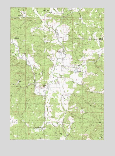
Kings Valley, OR USGS Topographic Map
Click on map above to begin viewing in our Map Viewer.

This topographic map contains these locations and features:
Feature Name Type Latitude Longitude GNIS ID View Map
Alexander CreekStreamN44.6415°W123.4457°1116847View Map
Alexander SchoolLocaleN44.6373°W123.4415°1116849View Map
Beazell Memorial County ForestParkN44.6526°W123.4262°1966190View Map
Bonner CreekStreamN44.6762°W123.4701°1117931View Map
Bonner LakeReservoirN44.6804°W123.4893°1134541View Map
Bonner MountainSummitN44.6832°W123.4957°1158677View Map
Bump CreekStreamN44.7198°W123.4395°1162863View Map
Burgett CreekStreamN44.6443°W123.4526°1162864View Map
Burgett HillSummitN44.6982°W123.4154°1118324View Map
Clayton CreekStreamN44.7423°W123.4665°1162903View Map
Dunn RidgeRidgeN44.6887°W123.4582°1134538View Map
Edwards Pioneer CemeteryCemeteryN44.7469°W123.4539°2575701View Map
Emory Moore DamDamN44.6898°W123.4179°1133524View Map
Emory Moore ReservoirReservoirN44.6899°W123.4141°1130691View Map
Fort Hoskins Historic County ParkParkN44.6754°W123.4543°1966193View Map
Fort Hoskins SpringSpringN44.6751°W123.4576°1134540View Map
Foster CreekStreamN44.7054°W123.4909°1134542View Map
Four PointsLocaleN44.6412°W123.3798°1134148View Map
Grant HillSummitN44.7360°W123.4220°1158266View Map
Hayes HillSummitN44.6310°W123.4329°1134423View Map
HoskinsPopulated PlaceN44.6768°W123.4687°1136399View Map
Hoskins - Kings Valley Rural Fire Protection DistrictBuildingN44.6738°W123.4343°2576731View Map
Hoskins Post Office (historical)Post OfficeN44.6768°W123.4687°1165413View Map
Keas CornerPopulated PlaceN44.7081°W123.3828°2761482View Map
Kings ValleyBasinN44.6862°W123.4407°1122765View Map
Kings ValleyPopulated PlaceN44.7068°W123.4345°1122766View Map
Kings Valley CemeteryCemeteryN44.6782°W123.4398°1122767View Map
Kings Valley Census Designated PlaceCensusN44.6980°W123.4264°2584417View Map
Kings Valley Charter SchoolSchoolN44.6946°W123.4329°1637966View Map
Kings Valley Post Office (historical)Post OfficeN44.7068°W123.4345°1165485View Map
Kinsey CreekStreamN44.7365°W123.4593°1122777View Map
Kopplein (historical)LocaleN44.7165°W123.4987°1136451View Map
Lake of the WindsReservoirN44.6355°W123.4614°1161627View Map
Love CreekStreamN44.7410°W123.4804°1123532View Map
Luckiamute Valley Charter SchoolSchoolN44.7452°W123.4466°2486967View Map
Maxfield CreekStreamN44.6985°W123.4390°1123853View Map
Mitchell ReservoirReservoirN44.6938°W123.4689°1157805View Map
Moody SchoolLocaleN44.7037°W123.4920°1124313View Map
North Benton DivisionCivilN44.6471°W123.4264°1938076View Map
Pedee CemeteryCemeteryN44.7471°W123.4540°1130695View Map
Pedee CreekStreamN44.7404°W123.4348°1125271View Map
Pedee School (historical)SchoolN44.7460°W123.4509°1163199View Map
Plunkett CreekStreamN44.6735°W123.4509°1125492View Map
Price CreekStreamN44.6871°W123.4443°1125661View Map
Price Creek ReservoirReservoirN44.6693°W123.3822°1157806View Map
Ring OrchardLocaleN44.6873°W123.4615°1134539View Map
RitnerLocaleN44.7279°W123.4443°1163225View Map
Ritner CreekStreamN44.7287°W123.4434°1163226View Map
Ritner Creek BridgeBridgeN44.7279°W123.4420°2058223View Map
Ritner Creek County ParkParkN44.7398°W123.4920°2058224View Map
Sheythe CreekStreamN44.7410°W123.4848°1149396View Map
Simpsons CampLocaleN44.7418°W123.4823°1126997View Map
Taylor CemeteryCemeteryN44.7472°W123.4205°1135196View Map
Tiff (historical)LocaleN44.6740°W123.4545°1699628View Map
Vincent CreekStreamN44.6715°W123.4534°1128541View Map
Ward School (historical)SchoolN44.7165°W123.3851°1128636View Map
Watson CreekStreamN44.6679°W123.4345°1130693View Map
Whispering Winds DamDamN44.6348°W123.4595°1131606View Map
Womer CemeteryCemeteryN44.7462°W123.4532°1163362View Map
Woods CreekStreamN44.6854°W123.4348°1129314View Map

Note: Coordinates in the location and feature list above are referenced to NAD83 datum.


Copyright (C) 2008-2025 Ryan Niemi / Sunset Dynamics ... All Rights Reserved