TopoQuest Logo
Do you find TopoQuest useful?
Help keep TopoQuest running and adding new maps/features by donating!
Bitcoin:  19c7KJd3qBynnjoSw5npx9KScwjBe4ifkT
Litecoin:  LXs6TkuXGGXo1vDsWCkWVdjQX94eUKd6ui
Home View Maps Find Maps Find Places Resources & Links


Wupatki SW, Arizona Topographic Map

USGS Map Title: Wupatki SW, AZ
USGS Map MRC: 35111E4
DRG (GeoTIFF) Download: o35111e4.tif


Neighboring USGS Topographic Map Quads:


  Campbell Francis Wash, AZ  
35111F5
 

  Gray Mountain, AZ  
35111F4
 

  Wupatki NE, AZ  
35111F3
 

  East of S P Mountain, AZ  
35111E5
 

  Wupatki SW, AZ  
35111E4
 

  Wupatki SE, AZ  
35111E3
 

  O'Leary Peak, AZ  
35111D5
 

  Strawberry Crater, AZ  
35111D4
 

  Roden Crater, AZ  
35111D3


Map MRC Location:

N36°
W112°
N36°
W111°
H8 H7 H6 H5 H4 H3 H2 H1
G8 G7 G6 G5 G4 G3 G2 G1
F8 F7 F6 F5 F4 F3 F2 F1
E8 E7 E6 E5 E4 E3 E2 E1
D8 D7 D6 D5 D4 D3 D2 D1
C8 C7 C6 C5 C4 C3 C2 C1
B8 B7 B6 B5 B4 B3 B2 B1
A8 A7 A6 A5 A4 A3 A2 A1
N35°
W112°
N35°
W111°

Wupatki SW, AZ USGS 1:24K Topographic Map Preview:
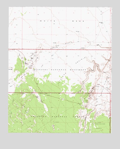
Wupatki SW, AZ USGS Topographic Map
Click on map above to begin viewing in our Map Viewer.

This topographic map contains these locations and features:
Feature Name Type Latitude Longitude GNIS ID View Map
Antelope PrairieFlatN35.5647°W111.4265°25677View Map
Arrowhead SinkBasinN35.5386°W111.4838°25772View Map
Arrowhead TankReservoirN35.5354°W111.4639°25773View Map
Ball Court WashStreamN35.5458°W111.4885°25936View Map
Bar Doney TankReservoirN35.6094°W111.3861°25959View Map
Box CanyonValleyN35.5781°W111.4693°26679View Map
Box Canyon Pueblo (historical)LocaleN35.5783°W111.4696°26684View Map
Cedar CanyonValleyN35.5839°W111.4913°27406View Map
Citadel Pueblo (historical)LocaleN35.5658°W111.4715°27672View Map
Citadel SinkBasinN35.5642°W111.4724°27673View Map
Doney CliffsCliffN35.5706°W111.3807°2025450View Map
Doney MountainSummitN35.5389°W111.3993°28531View Map
East MesaSummitN35.5742°W111.4649°28774View Map
Hulls CanyonValleyN35.5197°W111.4518°30277View Map
Hulls WashStreamN35.5492°W111.4832°30278View Map
Lomaki Pueblo (historical)LocaleN35.5794°W111.4679°31199View Map
Magnetic MesaSummitN35.5686°W111.4782°31446View Map
Mesa WellWellN35.5867°W111.4396°31743View Map
Middle MesaSummitN35.5744°W111.4715°31815View Map
Nalakihu Pueblo (historical)LocaleN35.5661°W111.4707°32241View Map
North MesaSummitN35.5867°W111.4365°32378View Map
Red House BasinBasinN35.5222°W111.4765°33466View Map
South MesaSummitN35.5589°W111.4785°34676View Map
West MesaSummitN35.5625°W111.4971°36006View Map
White MesaSummitN35.6131°W111.4285°36085View Map
Woodhouse MesaSummitN35.5031°W111.3829°36376View Map
Wupatki National MonumentParkN35.5574°W111.3957°38197View Map
Wupatki SpringSpringN35.5219°W111.3760°36411View Map

Note: Coordinates in the location and feature list above are referenced to NAD83 datum.


Copyright (C) 2008-2025 Ryan Niemi / Sunset Dynamics ... All Rights Reserved