TopoQuest Logo
Do you find TopoQuest useful?
Help keep TopoQuest running and adding new maps/features by donating!
Bitcoin:  19c7KJd3qBynnjoSw5npx9KScwjBe4ifkT
Litecoin:  LXs6TkuXGGXo1vDsWCkWVdjQX94eUKd6ui
Home View Maps Find Maps Find Places Resources & Links


East of S P Mountain, Arizona Topographic Map

USGS Map Title: East of S P Mountain, AZ
USGS Map MRC: 35111E5
DRG (GeoTIFF) Download: o35111e5.tif


Neighboring USGS Topographic Map Quads:


  Additional Hill, AZ  
35111F6
 

  Campbell Francis Wash, AZ  
35111F5
 

  Gray Mountain, AZ  
35111F4
 

  S P Mountain, AZ  
35111E6
 

  East of S P Mountain, AZ  
35111E5
 

  Wupatki SW, AZ  
35111E4
 

  White Horse Hills, AZ  
35111D6
 

  O'Leary Peak, AZ  
35111D5
 

  Strawberry Crater, AZ  
35111D4


Map MRC Location:

N36°
W112°
N36°
W111°
H8 H7 H6 H5 H4 H3 H2 H1
G8 G7 G6 G5 G4 G3 G2 G1
F8 F7 F6 F5 F4 F3 F2 F1
E8 E7 E6 E5 E4 E3 E2 E1
D8 D7 D6 D5 D4 D3 D2 D1
C8 C7 C6 C5 C4 C3 C2 C1
B8 B7 B6 B5 B4 B3 B2 B1
A8 A7 A6 A5 A4 A3 A2 A1
N35°
W112°
N35°
W111°

East of S P Mountain, AZ USGS 1:24K Topographic Map Preview:
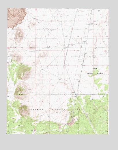
East of S P Mountain, AZ USGS Topographic Map
Click on map above to begin viewing in our Map Viewer.

This topographic map contains these locations and features:
Feature Name Type Latitude Longitude GNIS ID View Map
Black TankReservoirN35.5781°W111.6215°26452View Map
Cinder TankReservoirN35.5372°W111.6246°27663View Map
Deadman FlatFlatN35.5078°W111.5438°2088810View Map
Eightynine TankReservoirN35.5892°W111.5460°28830View Map
Hanks Trading PostLocaleN35.5925°W111.5279°29724View Map
Juniper Trick TankReservoirN35.5194°W111.5229°37866View Map
Lava TankReservoirN35.6150°W111.5921°30908View Map
Lobato TankReservoirN35.5375°W111.6246°31160View Map
Lone Tree TankReservoirN35.6039°W111.5715°31218View Map
Red HillSummitN35.5375°W111.6085°33449View Map
San Francisco Volcanic Field (historical)LavaN35.6200°W111.6224°38053View Map
Slim TankReservoirN35.5719°W111.6207°34538View Map
Tub FiveReservoirN35.5031°W111.5932°35142View Map
Tuba City Road TankReservoirN35.5093°W111.5511°35488View Map

Note: Coordinates in the location and feature list above are referenced to NAD83 datum.


Copyright (C) 2008-2024 Ryan Niemi / Sunset Dynamics ... All Rights Reserved