TopoQuest Logo
Do you find TopoQuest useful?
Help keep TopoQuest running and adding new maps/features by donating!
Bitcoin:  19c7KJd3qBynnjoSw5npx9KScwjBe4ifkT
Litecoin:  LXs6TkuXGGXo1vDsWCkWVdjQX94eUKd6ui
Home View Maps Find Maps Find Places Resources & Links


Bounds Lake, Alabama Topographic Map

USGS Map Title: Bounds Lake, AL
USGS Map MRC: 33086B6
DRG (GeoTIFF) Download: o33086b6.tif


Neighboring USGS Topographic Map Quads:


  Helena, AL  
33086C7
 

  Chelsea, AL  
33086C6
 

  Westover, AL  
33086C5
 

  Alabaster, AL  
33086B7
 

  Bounds Lake, AL  
33086B6
 

  Columbiana, AL  
33086B5
 

  Montevallo, AL  
33086A7
 

  Ozan, AL  
33086A6
 

  Shelby, AL  
33086A5


Map MRC Location:

N34°
W87°
N34°
W86°
H8 H7 H6 H5 H4 H3 H2 H1
G8 G7 G6 G5 G4 G3 G2 G1
F8 F7 F6 F5 F4 F3 F2 F1
E8 E7 E6 E5 E4 E3 E2 E1
D8 D7 D6 D5 D4 D3 D2 D1
C8 C7 C6 C5 C4 C3 C2 C1
B8 B7 B6 B5 B4 B3 B2 B1
A8 A7 A6 A5 A4 A3 A2 A1
N33°
W87°
N33°
W86°

Bounds Lake, AL USGS 1:24K Topographic Map Preview:
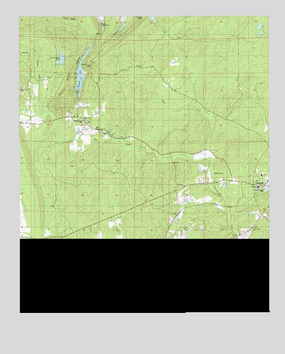
Bounds Lake, AL USGS Topographic Map
Click on map above to begin viewing in our Map Viewer.

This topographic map contains these locations and features:
Feature Name Type Latitude Longitude GNIS ID View Map
Apostolic Truth Center ChurchChurchN33.1609°W86.6336°1805562View Map
Big CreekStreamN33.1915°W86.6567°114258View Map
Blackmon CemeteryCemeteryN33.1837°W86.6475°114445View Map
Bounds LakeReservoirN33.2265°W86.7189°114765View Map
Bowden DamDamN33.2468°W86.6817°131343View Map
Bowden LakeReservoirN33.2490°W86.6828°131342View Map
Butler HollowValleyN33.2098°W86.7250°115316View Map
Dargin Community CenterBuildingN33.1432°W86.7483°146405View Map
Davis School (historical)SchoolN33.2243°W86.6786°146406View Map
Four Wing LakeLakeN33.2324°W86.7288°118547View Map
Four Wing Lake DamDamN33.2301°W86.7267°131329View Map
Green Valley Group DamDamN33.2184°W86.7200°131318View Map
Green Valley LakeReservoirN33.2170°W86.7199°146448View Map
Interchange 231CrossingN33.1423°W86.7497°155595View Map
Jesus Name ChurchChurchN33.1604°W86.6330°120882View Map
JoinertownPopulated PlaceN33.2279°W86.6828°146480View Map
Kimberly-Clark DamDamN33.2468°W86.6967°131344View Map
Kimberly-Clark LakeReservoirN33.2455°W86.6983°131345View Map
Mount Era Methodist ChurchChurchN33.2073°W86.7180°152415View Map
Nazarene Church Camp Lake DamDamN33.1451°W86.7433°131240View Map
Nazarene Church LakeReservoirN33.1445°W86.7433°131241View Map
Nearest Grave CemeteryCemeteryN33.2065°W86.7186°152588View Map
Old Lynch CemeteryCemeteryN33.2029°W86.7111°146630View Map
Pilgrim Rest ChurchChurchN33.2029°W86.7119°124734View Map
Pilgrims Rest Church (historical)ChurchN33.1993°W86.6855°146640View Map
Pinnacle Lookout TowerTowerN33.2298°W86.7164°146643View Map
Pumpkin Swamp Road LakeReservoirN33.2456°W86.6296°131339View Map
Pumpkin Swamp Road Lake DamDamN33.2451°W86.6283°131338View Map
Roach CemeteryCemeteryN33.2348°W86.7453°125676View Map
Rocky Ridge CemeteryCemeteryN33.2215°W86.6294°146551View Map
Rolling Hills CampLocaleN33.1423°W86.7419°153211View Map
Shelby County Area Vocational CenterSchoolN33.1779°W86.6305°146567View Map
Shelby County Sheriff's OfficeBuildingN33.1845°W86.6262°2629394View Map
Shelby County Sheriffs Office - Training CenterBuildingN33.1865°W86.6281°2629400View Map
Shelby SpringsSpringN33.1367°W86.6877°149351View Map
Shelby SpringsPopulated PlaceN33.1351°W86.6867°157046View Map
Shelby Springs Confederate CemeteryCemeteryN33.1307°W86.6811°124253View Map
Stony RidgeRidgeN33.2201°W86.7261°127439View Map
Summer Hill ChurchChurchN33.1532°W86.6547°127534View Map
Summer Hill School (historical)SchoolN33.1521°W86.6542°146587View Map
Summer Hill Volunteer Fire DepartmentBuildingN33.1535°W86.6557°2682791View Map
White LakeReservoirN33.2001°W86.7217°131300View Map
White Lake DamDamN33.2001°W86.7217°131301View Map
Wildwood ChapelChurchN33.2009°W86.7050°153987View Map
Wolf CreekStreamN33.1915°W86.6567°129156View Map
Woodmere Number One LakeReservoirN33.2184°W86.7200°131319View Map
Woodmere Number Two DamDamN33.2184°W86.7200°131316View Map
Woodmere Number Two LakeReservoirN33.2184°W86.7200°131317View Map

Note: Coordinates in the location and feature list above are referenced to NAD83 datum.


Copyright (C) 2008-2025 Ryan Niemi / Sunset Dynamics ... All Rights Reserved