TopoQuest Logo
Do you find TopoQuest useful?
Help keep TopoQuest running and adding new maps/features by donating!
Bitcoin:  19c7KJd3qBynnjoSw5npx9KScwjBe4ifkT
Litecoin:  LXs6TkuXGGXo1vDsWCkWVdjQX94eUKd6ui
Home View Maps Find Maps Find Places Resources & Links


Yatesville, Georgia Topographic Map

USGS Map Title: Yatesville, GA
USGS Map MRC: 32084H2
DRG (GeoTIFF) Download: o32084h2.tif


Neighboring USGS Topographic Map Quads:


  Zebulon, GA  
33084A3
 

  Barnesville, GA  
33084A2
 

  Johnstonville, GA  
33084A1
 

  Thomaston, GA  
32084H3
 

  Yatesville, GA  
32084H2
 

  Strouds, GA  
32084H1
 

  Lincoln Park, GA  
32084G3
 

  Logtown, GA  
32084G2
 

  Culloden, GA  
32084G1


Map MRC Location:

N33°
W85°
N33°
W84°
H8 H7 H6 H5 H4 H3 H2 H1
G8 G7 G6 G5 G4 G3 G2 G1
F8 F7 F6 F5 F4 F3 F2 F1
E8 E7 E6 E5 E4 E3 E2 E1
D8 D7 D6 D5 D4 D3 D2 D1
C8 C7 C6 C5 C4 C3 C2 C1
B8 B7 B6 B5 B4 B3 B2 B1
A8 A7 A6 A5 A4 A3 A2 A1
N32°
W85°
N32°
W84°

Yatesville, GA USGS 1:24K Topographic Map Preview:
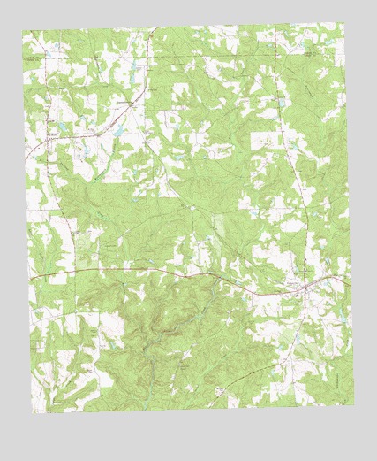
Yatesville, GA USGS Topographic Map
Click on map above to begin viewing in our Map Viewer.

This topographic map contains these locations and features:
Feature Name Type Latitude Longitude GNIS ID View Map
Andrews ChapelChurchN32.9015°W84.2232°310541View Map
Andrews Chapel CemeteryCemeteryN32.9001°W84.2246°346678View Map
Antioch CemeteryCemeteryN32.9754°W84.1524°346679View Map
Antioch ChurchChurchN32.9757°W84.1519°354347View Map
Bethlehem TempleChurchN32.9524°W84.1596°346687View Map
Cheek CemeteryCemeteryN32.9874°W84.2049°312599View Map
Grays ChapelChurchN32.8896°W84.1924°334219View Map
Grays Chapel CemeteryCemeteryN32.8890°W84.1910°314802View Map
Grays School (historical)SchoolN32.8899°W84.1924°334220View Map
Haygood DamDamN32.9551°W84.1399°340373View Map
Haygood LakeReservoirN32.9565°W84.1405°340374View Map
Liberty ChapelChurchN32.9335°W84.2316°316797View Map
Liberty School (historical)SchoolN32.9337°W84.2327°334221View Map
McGehee LakeReservoirN32.9685°W84.2351°338423View Map
McGehee Lake DamDamN32.9685°W84.2366°338422View Map
Middlebrooks (historical)Populated PlaceN32.9932°W84.2013°344054View Map
Mount Olive ChurchChurchN32.9665°W84.2227°318760View Map
Mount Zion ChurchChurchN32.9193°W84.1430°318987View Map
Nash DamDamN32.9651°W84.2133°338424View Map
Nash LakeReservoirN32.9663°W84.2132°338425View Map
New Hope CemeteryCemeteryN32.9118°W84.1524°346731View Map
New Hope ChurchChurchN32.9124°W84.1519°319401View Map
Pine Grove ChurchChurchN32.9185°W84.1466°320574View Map
Rest HavenPopulated PlaceN32.9507°W84.1952°346739View Map
Saint Timothy ChurchChurchN32.9657°W84.2030°322320View Map
Salem CemeteryCemeteryN32.9798°W84.2018°322331View Map
Spring Hill ChurchChurchN32.9704°W84.2413°323432View Map
Stephens CemeteryCemeteryN32.9293°W84.2203°323568View Map
Sullivan CreekStreamN32.8974°W84.2021°323728View Map
The RockPopulated PlaceN32.9640°W84.2410°333213View Map
The Rock CemeteryCemeteryN32.9602°W84.2404°2516645View Map
The Rock Census Designated PlaceCensusN32.9635°W84.2378°2583407View Map
The Rock United Methodist ChurchChurchN32.9596°W84.2405°346753View Map
The Rock-Yatesville DivisionCivilN32.9218°W84.2006°1936582View Map
Thistle Field (historical)AirportN32.9290°W84.1407°351963View Map
Topeka JunctionPopulated PlaceN32.9746°W84.2085°326557View Map
Town of YatesvilleCivilN32.9133°W84.1423°2406924View Map
Trayler CemeteryCemeteryN32.8885°W84.2252°324280View Map
Turner DamDamN32.9018°W84.1282°338418View Map
Turner LakeReservoirN32.9042°W84.1287°338419View Map
Union Hill School (historical)SchoolN32.9682°W84.2160°334223View Map
Upson Camp Ground (historical)LocaleN32.9599°W84.2396°346758View Map
Weatherford BranchStreamN32.9487°W84.2260°324944View Map
White DamDamN32.9568°W84.1899°338406View Map
White LakeReservoirN32.9575°W84.1904°338407View Map
Williams CemeteryCemeteryN32.8812°W84.1744°325335View Map
YatesvillePopulated PlaceN32.9137°W84.1427°325604View Map
Yatesville CemeteryCemeteryN32.9148°W84.1391°346771View Map
Yatesville Fire DepartmentBuildingN32.9118°W84.1455°2604951View Map
Yatesville Methodist ChurchChurchN32.9146°W84.1396°346772View Map

Note: Coordinates in the location and feature list above are referenced to NAD83 datum.


Copyright (C) 2008-2025 Ryan Niemi / Sunset Dynamics ... All Rights Reserved