TopoQuest Logo
Do you find TopoQuest useful?
Help keep TopoQuest running and adding new maps/features by donating!
Bitcoin:  19c7KJd3qBynnjoSw5npx9KScwjBe4ifkT
Litecoin:  LXs6TkuXGGXo1vDsWCkWVdjQX94eUKd6ui
Home View Maps Find Maps Find Places Resources & Links


Logtown, Georgia Topographic Map

USGS Map Title: Logtown, GA
USGS Map MRC: 32084G2
DRG (GeoTIFF) Download: o32084g2.tif


Neighboring USGS Topographic Map Quads:


  Thomaston, GA  
32084H3
 

  Yatesville, GA  
32084H2
 

  Strouds, GA  
32084H1
 

  Lincoln Park, GA  
32084G3
 

  Logtown, GA  
32084G2
 

  Culloden, GA  
32084G1
 

  Prattsburg, GA  
32084F3
 

  Fickling Mill, GA  
32084F2
 

  Roberta, GA  
32084F1


Map MRC Location:

N33°
W85°
N33°
W84°
H8 H7 H6 H5 H4 H3 H2 H1
G8 G7 G6 G5 G4 G3 G2 G1
F8 F7 F6 F5 F4 F3 F2 F1
E8 E7 E6 E5 E4 E3 E2 E1
D8 D7 D6 D5 D4 D3 D2 D1
C8 C7 C6 C5 C4 C3 C2 C1
B8 B7 B6 B5 B4 B3 B2 B1
A8 A7 A6 A5 A4 A3 A2 A1
N32°
W85°
N32°
W84°

Logtown, GA USGS 1:24K Topographic Map Preview:
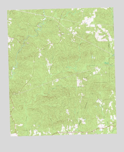
Logtown, GA USGS Topographic Map
Click on map above to begin viewing in our Map Viewer.

This topographic map contains these locations and features:
Feature Name Type Latitude Longitude GNIS ID View Map
Anniebel School (historical)SchoolN32.8587°W84.1452°334218View Map
Arnold CemeteryCemeteryN32.8674°W84.1455°310628View Map
Arnold Methodist Church (historical)ChurchN32.8668°W84.1452°346681View Map
Auchumpkee Creek Covered BridgeBridgeN32.7557°W84.2299°346682View Map
Bentley CemeteryCemeteryN32.7910°W84.1521°311093View Map
Bethel CemeteryCemeteryN32.7590°W84.1291°342912View Map
Bethel ChurchChurchN32.7601°W84.1294°354600View Map
Bethlehem CemeteryCemeteryN32.8579°W84.2135°346686View Map
Bethlehem ChurchChurchN32.8582°W84.2141°354672View Map
Crawford County Fire Department Station 2BuildingN32.7520°W84.1599°2604364View Map
Ebenezer CemeteryCemeteryN32.7860°W84.1802°313813View Map
Gatlin CemeteryCemeteryN32.8471°W84.2446°314533View Map
Hickson CemeteryCemeteryN32.7535°W84.1743°346718View Map
Horseley BranchStreamN32.8090°W84.2005°315708View Map
Israel CreekStreamN32.8685°W84.1938°315965View Map
Kendall BranchStreamN32.8610°W84.2074°316374View Map
Kendall CemeteryCemeteryN32.8582°W84.1905°316375View Map
Kings ChapelChurchN32.8418°W84.2266°316445View Map
Little BranchStreamN32.8157°W84.1721°316958View Map
Little CreekStreamN32.7907°W84.2116°317008View Map
LogtownPopulated PlaceN32.8504°W84.1885°317290View Map
Pleasant Hill CemeteryCemeteryN32.7976°W84.1646°320856View Map
Pleasant Hill ChurchChurchN32.8062°W84.1582°320888View Map
Rocky Mount CemeteryCemeteryN32.8357°W84.2091°321851View Map
SalemPopulated PlaceN32.7587°W84.1877°1852876View Map
Salem CemeteryCemeteryN32.7532°W84.1838°322330View Map
Salem Census Designated PlaceCensusN32.7592°W84.1916°2402817View Map
Salem ChurchChurchN32.7529°W84.1835°346745View Map
Salem DivisionCivilN32.7956°W84.2440°1936291View Map
Salem School (historical)SchoolN32.7521°W84.1755°334222View Map
Salem Volunteer Fire DepartmentBuildingN32.7539°W84.2350°2604111View Map
Sneed CemeteryCemeteryN32.8124°W84.1535°323188View Map
Walker CemeteryCemeteryN32.7643°W84.2455°324770View Map
Watson BranchStreamN32.8207°W84.1382°324915View Map
Wrights Church CreekStreamN32.8260°W84.1296°325579View Map

Note: Coordinates in the location and feature list above are referenced to NAD83 datum.


Copyright (C) 2008-2025 Ryan Niemi / Sunset Dynamics ... All Rights Reserved