TopoQuest Logo
Do you find TopoQuest useful?
Help keep TopoQuest running and adding new maps/features by donating!
Bitcoin:  19c7KJd3qBynnjoSw5npx9KScwjBe4ifkT
Litecoin:  LXs6TkuXGGXo1vDsWCkWVdjQX94eUKd6ui
Home View Maps Find Maps Find Places Resources & Links


Yellow Pine, Idaho Topographic Map

USGS Map Title: Yellow Pine, ID
USGS Map MRC: 44115H4
DRG (GeoTIFF) Download: o44115h4.tif


Neighboring USGS Topographic Map Quads:


  Parks Peak, ID  
45115A5
 

  Profile Gap, ID  
45115A4
 

  Edwardsburg, ID  
45115A3
 

  Caton Lake, ID  
44115H5
 

  Yellow Pine, ID  
44115H4
 

  Stibnite, ID  
44115H3
 

  Log Mountain, ID  
44115G5
 

  Chilcoot Peak, ID  
44115G4
 

  Big Chief Creek, ID  
44115G3


Map MRC Location:

N45°
W116°
N45°
W115°
H8 H7 H6 H5 H4 H3 H2 H1
G8 G7 G6 G5 G4 G3 G2 G1
F8 F7 F6 F5 F4 F3 F2 F1
E8 E7 E6 E5 E4 E3 E2 E1
D8 D7 D6 D5 D4 D3 D2 D1
C8 C7 C6 C5 C4 C3 C2 C1
B8 B7 B6 B5 B4 B3 B2 B1
A8 A7 A6 A5 A4 A3 A2 A1
N44°
W116°
N44°
W115°

Yellow Pine, ID USGS 1:24K Topographic Map Preview:
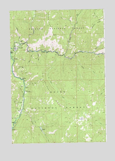
Yellow Pine, ID USGS Topographic Map
Click on map above to begin viewing in our Map Viewer.

This topographic map contains these locations and features:
Feature Name Type Latitude Longitude GNIS ID View Map
Abstein PlacePopulated PlaceN44.9707°W115.4868°397362View Map
Alpine VillageLocaleN44.9671°W115.4862°394374View Map
Antimony CampLocaleN44.9282°W115.4801°376669View Map
Antimony RidgeRidgeN44.9221°W115.4504°376671View Map
Bald HillSummitN44.9766°W115.4434°397399View Map
Bishop CreekStreamN44.9577°W115.4148°377691View Map
Boulder CreekStreamN44.9705°W115.4923°378074View Map
Camp CreekStreamN44.9852°W115.4137°378765View Map
Deadhorse RapidsRapidsN44.8946°W115.4948°380320View Map
Double A CreekStreamN44.9613°W115.4648°380731View Map
Golden Gate CampgroundLocaleN44.9355°W115.4854°382413View Map
Golden Gate HillSummitN44.9469°W115.4829°382414View Map
Hennessey MeadowFlatN44.8874°W115.4596°383100View Map
Hot CreekStreamN44.8988°W115.4937°383438View Map
Ice Hole CampgroundLocaleN44.8880°W115.4996°383594View Map
Johnson Creek AirportAirportN44.9130°W115.4852°400949View Map
Johnson Creek Forest Service StationLocaleN44.9235°W115.4807°383991View Map
No Mans CreekStreamN44.9602°W115.4376°387593View Map
Olson CreekStreamN44.8916°W115.4973°387954View Map
Pioneer CemeteryCemeteryN44.9560°W115.4990°388551View Map
Profile CreekStreamN44.9577°W115.4290°388890View Map
Quartz CreekStreamN44.9705°W115.4787°388967View Map
Riordan CreekStreamN44.9071°W115.4854°389397View Map
Tamarack CreekStreamN44.9596°W115.3898°391830View Map
Vibika CreekStreamN44.9616°W115.4704°392724View Map
Yellow PinePopulated PlaceN44.9649°W115.4937°393748View Map
Yellow Pine CampgroundLocaleN44.9546°W115.4965°393750View Map
Yellow Pine Census Designated PlaceCensusN44.9622°W115.4879°2585596View Map
Yellow Pine Elementary SchoolSchoolN44.9621°W115.4946°399593View Map
Yellow Pine Fire DistrictBuildingN44.9610°W115.4931°2619189View Map
Yellow Pine Post OfficePost OfficeN44.9644°W115.4903°2767295View Map
Yellow Pine Post Office (historical)Post OfficeN44.9649°W115.4937°2027009View Map

Note: Coordinates in the location and feature list above are referenced to NAD83 datum.


Copyright (C) 2008-2025 Ryan Niemi / Sunset Dynamics ... All Rights Reserved