TopoQuest Logo
Do you find TopoQuest useful?
Help keep TopoQuest running and adding new maps/features by donating!
Bitcoin:  19c7KJd3qBynnjoSw5npx9KScwjBe4ifkT
Litecoin:  LXs6TkuXGGXo1vDsWCkWVdjQX94eUKd6ui
Home View Maps Find Maps Find Places Resources & Links


Zachariah, Kentucky Topographic Map

USGS Map Title: Zachariah, KY
USGS Map MRC: 37083F6
DRG (GeoTIFF) Download: o37083f6.tif


Neighboring USGS Topographic Map Quads:


  Stanton, KY  
37083G7
 

  Slade, KY  
37083G6
 

  Pomeroyton, KY  
37083G5
 

  Cobhill, KY  
37083F7
 

  Zachariah, KY  
37083F6
 

  Campton, KY  
37083F5
 

  Heidelberg, KY  
37083E7
 

  Beattyville, KY  
37083E6
 

  Tallega, KY  
37083E5


Map MRC Location:

N38°
W84°
N38°
W83°
H8 H7 H6 H5 H4 H3 H2 H1
G8 G7 G6 G5 G4 G3 G2 G1
F8 F7 F6 F5 F4 F3 F2 F1
E8 E7 E6 E5 E4 E3 E2 E1
D8 D7 D6 D5 D4 D3 D2 D1
C8 C7 C6 C5 C4 C3 C2 C1
B8 B7 B6 B5 B4 B3 B2 B1
A8 A7 A6 A5 A4 A3 A2 A1
N37°
W84°
N37°
W83°

Zachariah, KY USGS 1:24K Topographic Map Preview:
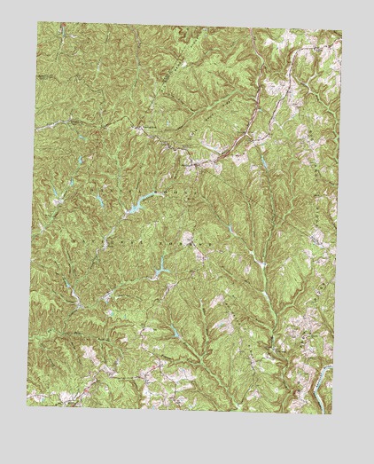
Zachariah, KY USGS Topographic Map
Click on map above to begin viewing in our Map Viewer.

This topographic map contains these locations and features:
Feature Name Type Latitude Longitude GNIS ID View Map
Bald Rock ForkStreamN37.6487°W83.7357°510370View Map
Barker Branch (historical)Populated PlaceN37.7360°W83.7243°2420698View Map
Beattyville DivisionCivilN37.6378°W83.7263°1936868View Map
Beech Stand ForkStreamN37.7215°W83.6841°510528View Map
Bethlehem ChurchChurchN37.6429°W83.6355°510575View Map
Big Andy RidgeRidgeN37.6770°W83.6316°510595View Map
Big Bend RidgeRidgeN37.7409°W83.6882°510598View Map
Boonesboro ForkStreamN37.6637°W83.6538°510851View Map
BoothPopulated PlaceN37.6959°W83.6321°510853View Map
Booth Post Office (historical)Post OfficeN37.6955°W83.6323°2364761View Map
Bowman ForkStreamN37.6406°W83.6785°510878View Map
Buckner BranchStreamN37.6629°W83.7319°511028View Map
Caves ForkStreamN37.6581°W83.7291°511284View Map
Chester CreekStreamN37.7273°W83.6588°511324View Map
Coalbank HollowValleyN37.6666°W83.7308°511441View Map
Cold Oak HollowValleyN37.6581°W83.7299°511456View Map
Cowan ForkStreamN37.6770°W83.6591°511600View Map
Crow Drive CreekStreamN37.7479°W83.7091°511658View Map
El Park (historical)Populated PlaceN37.7161°W83.6643°2364781View Map
FincastlePopulated PlaceN37.6454°W83.6488°512158View Map
Fincastle ChurchChurchN37.6501°W83.6346°512159View Map
FixerPopulated PlaceN37.6781°W83.7182°512178View Map
Flat HollowValleyN37.6467°W83.7203°516658View Map
Harris (historical)Populated PlaceN37.6419°W83.6419°2440456View Map
Hauk BranchStreamN37.6473°W83.7452°512548View Map
Hell for Certain CreekStreamN37.6731°W83.6544°512637View Map
Hog Gap HollowValleyN37.6615°W83.7168°512727View Map
Hopewell ChurchChurchN37.6340°W83.7010°512779View Map
Huff Cave BranchStreamN37.6515°W83.6502°512508View Map
LeecoPopulated PlaceN37.7109°W83.6949°513296View Map
Little Bend RidgeRidgeN37.7229°W83.6752°513450View Map
Miller ForkStreamN37.6426°W83.6788°514008View Map
Moreland HollowValleyN37.6804°W83.7489°514054View Map
Mount Paran SchoolSchoolN37.6868°W83.7410°514104View Map
Naomi Baptist ChurchChurchN37.7444°W83.6365°2364815View Map
Peddler CreekStreamN37.6570°W83.6488°2377189View Map
RogersPopulated PlaceN37.7440°W83.6355°515087View Map
Rogers Baptist ChurchChurchN37.7434°W83.6285°2364827View Map
Rogers Elementary SchoolSchoolN37.7436°W83.6358°2095576View Map
Rogers Post OfficePost OfficeN37.7436°W83.6357°2364828View Map
Shumaker RidgeRidgeN37.6498°W83.6613°515398View Map
Sinking ForkStreamN37.7479°W83.6619°515436View Map
Spring HollowValleyN37.6485°W83.7339°515612View Map
Standing RockPopulated PlaceN37.7165°W83.7063°515657View Map
Thacker CemeteryCemeteryN37.7023°W83.6824°515900View Map
TorrentPopulated PlaceN37.7159°W83.6630°515978View Map
Torrent Church of GodChurchN37.7081°W83.6685°2364851View Map
Torrent CreekStreamN37.7164°W83.6633°2364852View Map
Torrent Post Office (historical)Post OfficeN37.7157°W83.6634°2364853View Map
Townsend CemeteryCemeteryN37.7223°W83.6699°515990View Map
Townsend ForkStreamN37.6912°W83.7085°515991View Map
Tri - Community Fire DepartmentBuildingN37.6813°W83.6842°2637237View Map
Whisman CemeteryCemeteryN37.6931°W83.6349°516294View Map
ZachariahPopulated PlaceN37.7051°W83.6835°516523View Map
Zachariah ForkStreamN37.6881°W83.7110°516524View Map
Zachariah Post Office (historical)Post OfficeN37.7049°W83.6840°2364864View Map
ZoePopulated PlaceN37.6804°W83.6841°516536View Map

Note: Coordinates in the location and feature list above are referenced to NAD83 datum.


Copyright (C) 2008-2025 Ryan Niemi / Sunset Dynamics ... All Rights Reserved