TopoQuest Logo
Do you find TopoQuest useful?
Help keep TopoQuest running and adding new maps/features by donating!
Bitcoin:  19c7KJd3qBynnjoSw5npx9KScwjBe4ifkT
Litecoin:  LXs6TkuXGGXo1vDsWCkWVdjQX94eUKd6ui
Home View Maps Find Maps Find Places Resources & Links


Cobhill, Kentucky Topographic Map

USGS Map Title: Cobhill, KY
USGS Map MRC: 37083F7
DRG (GeoTIFF) Download: o37083f7.tif


Neighboring USGS Topographic Map Quads:


  Clay City, KY  
37083G8
 

  Stanton, KY  
37083G7
 

  Slade, KY  
37083G6
 

  Irvine, KY  
37083F8
 

  Cobhill, KY  
37083F7
 

  Zachariah, KY  
37083F6
 

  Leighton, KY  
37083E8
 

  Heidelberg, KY  
37083E7
 

  Beattyville, KY  
37083E6


Map MRC Location:

N38°
W84°
N38°
W83°
H8 H7 H6 H5 H4 H3 H2 H1
G8 G7 G6 G5 G4 G3 G2 G1
F8 F7 F6 F5 F4 F3 F2 F1
E8 E7 E6 E5 E4 E3 E2 E1
D8 D7 D6 D5 D4 D3 D2 D1
C8 C7 C6 C5 C4 C3 C2 C1
B8 B7 B6 B5 B4 B3 B2 B1
A8 A7 A6 A5 A4 A3 A2 A1
N37°
W84°
N37°
W83°

Cobhill, KY USGS 1:24K Topographic Map Preview:
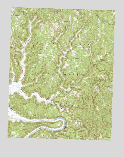
Cobhill, KY USGS Topographic Map
Click on map above to begin viewing in our Map Viewer.

This topographic map contains these locations and features:
Feature Name Type Latitude Longitude GNIS ID View Map
Aldersgate Camp and Retreat CenterParkN37.7298°W83.8480°2440445View Map
Armine BranchStreamN37.6440°W83.7905°510298View Map
Arthur CemeteryCemeteryN37.7156°W83.8546°510304View Map
Bear Track Lookout TowerTowerN37.6254°W83.7721°517095View Map
Beech Grove School (historical)SchoolN37.7095°W83.7534°2440521View Map
Big Sinking CreekStreamN37.6618°W83.8288°510697View Map
Billey ForkStreamN37.6618°W83.8288°510719View Map
Buck CreekStreamN37.6442°W83.8725°511004View Map
Cane Springs (historical)Populated PlaceN37.6292°W83.8483°2440451View Map
Cave HollowValleyN37.6469°W83.7762°511273View Map
Cedar Grove Post Office (historical)Post OfficeN37.6525°W83.8712°2440474View Map
Coal CemeteryCemeteryN37.6636°W83.8255°2440554View Map
Cob Hill Volunteer Fire DepartmentBuildingN37.7213°W83.8351°2637099View Map
Cobb HillSummitN37.7129°W83.8270°2440530View Map
Cobb Hill Post Office (historical)Post OfficeN37.7138°W83.8246°2440475View Map
CobhillPopulated PlaceN37.7151°W83.8285°511446View Map
Crowe CemeteryCemeteryN37.7284°W83.8707°511660View Map
Crowe HollowValleyN37.7151°W83.8584°511661View Map
CrystalPopulated PlaceN37.6634°W83.8255°511668View Map
Dickerson CemeteryCemeteryN37.6929°W83.8457°511805View Map
Dripping Spring SchoolSchoolN37.7020°W83.7971°511890View Map
Durbin SchoolSchoolN37.6698°W83.8413°511963View Map
Eager ChurchChurchN37.6554°W83.8119°511974View Map
Evans ForkStreamN37.6965°W83.7758°512098View Map
FitchburgPopulated PlaceN37.7326°W83.8519°512177View Map
Fitchburg Furnace RuinsLocaleN37.7332°W83.8502°2440436View Map
Fitchburg Post Office (historical)Post OfficeN37.7323°W83.8512°2440480View Map
Fitchburg School (historical)SchoolN37.7318°W83.8518°2440523View Map
Furnace ForkStreamN37.6751°W83.8702°512268View Map
GreeleyPopulated PlaceN37.6765°W83.7530°512427View Map
Gross CemeteryCemeteryN37.7004°W83.8066°512468View Map
Gum Springs ChurchChurchN37.7436°W83.8715°2440424View Map
Gum Springs SchoolSchoolN37.7420°W83.8699°512484View Map
Hall SchoolSchoolN37.7493°W83.7519°512525View Map
Hatton HollowValleyN37.6391°W83.7843°512592View Map
Horn CemeteryCemeteryN37.6387°W83.7930°512786View Map
Howell CemeteryCemeteryN37.7412°W83.8441°512822View Map
Little Sinking CreekStreamN37.6493°W83.7596°513525View Map
Long BranchStreamN37.6787°W83.8694°513608View Map
Macedonia (historical)Populated PlaceN37.6274°W83.8690°2440459View Map
Macedonia ChurchChurchN37.6270°W83.8685°513751View Map
Mackey CemeteryCemeteryN37.7067°W83.8552°497429View Map
Mount Sinai CemeteryCemeteryN37.6674°W83.8549°2440412View Map
Mount Sinai Christian ChurchChurchN37.6687°W83.8560°514111View Map
Mountain ChapelChurchN37.7390°W83.7619°514124View Map
Mountain Spring (historical)Populated PlaceN37.7379°W83.8053°2508709View Map
Mountain Spring Post Office (historical)Post OfficeN37.7384°W83.8065°2440490View Map
Mountain Spring SchoolSchoolN37.7384°W83.8049°514126View Map
Needmore HollowValleyN37.7363°W83.8513°514213View Map
Odas Railroad Station (historical)LocaleN37.6648°W83.8242°2440441View Map
Old LandingPopulated PlaceN37.6365°W83.8069°514328View Map
Old Landing RidgeRidgeN37.6393°W83.8319°513198View Map
PatseyPopulated PlaceN37.7118°W83.7977°514449View Map
Patsey Post Office (historical)Post OfficeN37.7104°W83.7925°2440495View Map
Peach Tree HollowValleyN37.6678°W83.7560°514470View Map
PilotPopulated PlaceN37.7493°W83.7796°514563View Map
Pilot Post Office (historical)Post OfficeN37.7495°W83.7800°2440496View Map
Pinnacle SchoolSchoolN37.6251°W83.8160°514618View Map
PrysePopulated PlaceN37.6539°W83.8725°514787View Map
Pryse SchoolSchoolN37.6456°W83.8560°516659View Map
Radical Post Office (historical)Post OfficeN37.7095°W83.7540°2440501View Map
Ravenna DivisionCivilN37.7034°W83.8375°1937217View Map
Red River Iron Works Historical MarkerParkN37.6887°W83.8588°2744287View Map
Reynolds ForkStreamN37.6629°W83.7596°514898View Map
Sandfield SchoolSchoolN37.6370°W83.7833°515234View Map
ShadePopulated PlaceN37.6418°W83.8646°515332View Map
Shade Post Office (historical)Post OfficeN37.6418°W83.8370°2440550View Map
Shuler CemeteryCemeteryN37.7404°W83.8535°516660View Map
Shuler HollowValleyN37.7061°W83.8558°515397View Map
Smyth CemeteryCemeteryN37.7051°W83.7560°515520View Map
Sparks (historical)Populated PlaceN37.7201°W83.7716°2508710View Map
Sparks SchoolSchoolN37.7201°W83.7716°515574View Map
Stewart ForkStreamN37.7076°W83.8083°515699View Map
Stewart HollowValleyN37.7086°W83.8600°515700View Map
Sudders ForkStreamN37.6748°W83.8613°515773View Map
TexolaPopulated PlaceN37.6537°W83.8713°515898View Map
Thacker CemeteryCemeteryN37.6717°W83.8027°515899View Map
Tipton (historical)Populated PlaceN37.6789°W83.8647°2440468View Map
Tipton SchoolSchoolN37.6787°W83.8646°515959View Map
Town HollowValleyN37.6469°W83.7508°515986View Map
Vanderpool CemeteryCemeteryN37.7273°W83.7781°2440418View Map
Watson (historical)Populated PlaceN37.7353°W83.8330°2440469View Map
Watson RidgeRidgeN37.7405°W83.8330°2440519View Map
Watson SchoolSchoolN37.7351°W83.8335°516248View Map
White HollowValleyN37.6596°W83.7602°516306View Map
Wild Flower RidgeRidgeN37.7279°W83.8627°2440553View Map
Wodward CreekStreamN37.6706°W83.8074°516426View Map
Woodward RidgeRidgeN37.7418°W83.8107°2440520View Map

Note: Coordinates in the location and feature list above are referenced to NAD83 datum.


Copyright (C) 2008-2024 Ryan Niemi / Sunset Dynamics ... All Rights Reserved