TopoQuest Logo
Do you find TopoQuest useful?
Help keep TopoQuest running and adding new maps/features by donating!
Bitcoin:  19c7KJd3qBynnjoSw5npx9KScwjBe4ifkT
Litecoin:  LXs6TkuXGGXo1vDsWCkWVdjQX94eUKd6ui
Home View Maps Find Maps Find Places Resources & Links


Zimmerdale, Kansas Topographic Map

USGS Map Title: Zimmerdale, KS
USGS Map MRC: 38097A4
DRG (GeoTIFF) Download: o38097a4.tif


Neighboring USGS Topographic Map Quads:


  Moundridge, KS  
38097B5
 

  Hesston, KS  
38097B4
 

  Goessel, KS  
38097B3
 

  Halstead, KS  
38097A5
 

  Zimmerdale, KS  
38097A4
 

  Newton, KS  
38097A3
 

  Bentley, KS  
37097H5
 

  Sedgwick, KS  
37097H4
 

  Sedgwick NE, KS  
37097H3


Map MRC Location:

N39°
W98°
N39°
W97°
H8 H7 H6 H5 H4 H3 H2 H1
G8 G7 G6 G5 G4 G3 G2 G1
F8 F7 F6 F5 F4 F3 F2 F1
E8 E7 E6 E5 E4 E3 E2 E1
D8 D7 D6 D5 D4 D3 D2 D1
C8 C7 C6 C5 C4 C3 C2 C1
B8 B7 B6 B5 B4 B3 B2 B1
A8 A7 A6 A5 A4 A3 A2 A1
N38°
W98°
N38°
W97°

Zimmerdale, KS USGS 1:24K Topographic Map Preview:
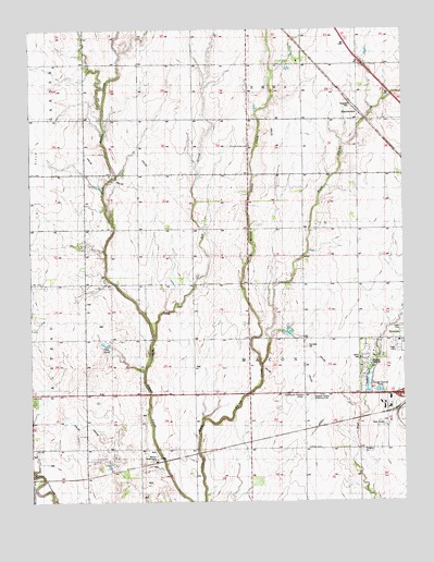
Zimmerdale, KS USGS Topographic Map
Click on map above to begin viewing in our Map Viewer.

This topographic map contains these locations and features:
Feature Name Type Latitude Longitude GNIS ID View Map
Church of God of the First Born CemeteryCemeteryN38.0941°W97.4267°477992View Map
Countryside Christian CenterBuildingN38.0278°W97.4109°484298View Map
Dry CreekStreamN38.0431°W97.4592°477761View Map
Eastlawn CemeteryCemeteryN38.1151°W97.3894°2739702View Map
Garden Valley CemeteryCemeteryN38.1234°W97.4992°2673269View Map
Halstead CemeteryCemeteryN38.0259°W97.4991°477996View Map
Harvey CountyCivilN38.0432°W97.4273°485005View Map
KCFN - FM (Newton)BuildingN38.0199°W97.3846°2625265View Map
KFTI - FM (Newton)BuildingN38.0199°W97.3846°2625275View Map
Middle Emma CreekStreamN38.0358°W97.4231°477345View Map
Newton WaterworksLocaleN38.0106°W97.4587°485406View Map
Pennsylvania Mennonite ChurchChurchN38.1147°W97.3900°477993View Map
Prairie Estates Mobile Home ParkPopulated PlaceN38.0406°W97.3760°2694141View Map
Prouty School (historical)SchoolN38.0647°W97.4275°477995View Map
Restlawn Gardens of Memory CemeteryCemeteryN38.0275°W97.4065°484297View Map
Royer CemeteryCemeteryN38.0142°W97.4073°477997View Map
Township of MaconCivilN38.0438°W97.4285°473695View Map
Weaver Ranch AirportAirportN38.1120°W97.4292°481382View Map
Wedgewood Golf CourseLocaleN38.0410°W97.4754°2694613View Map
ZimmerdalePopulated PlaceN38.1028°W97.3900°477994View Map

Note: Coordinates in the location and feature list above are referenced to NAD83 datum.


Copyright (C) 2008-2024 Ryan Niemi / Sunset Dynamics ... All Rights Reserved